- Geography of the UK

Содержание
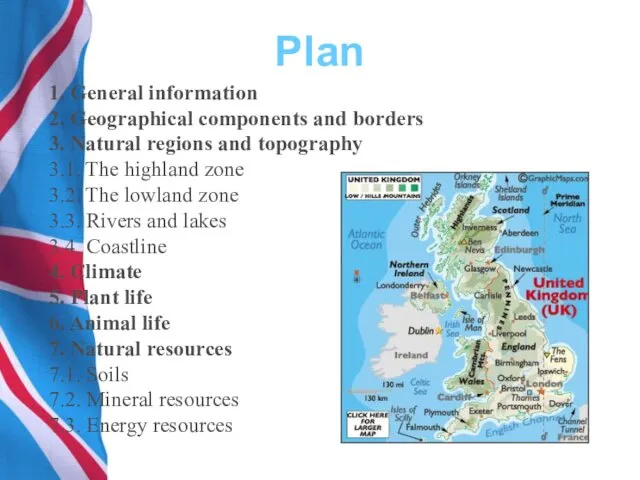
- 2. Plan 1. General information 2. Geographical components and borders 3. Natural regions and topography 3.1. The
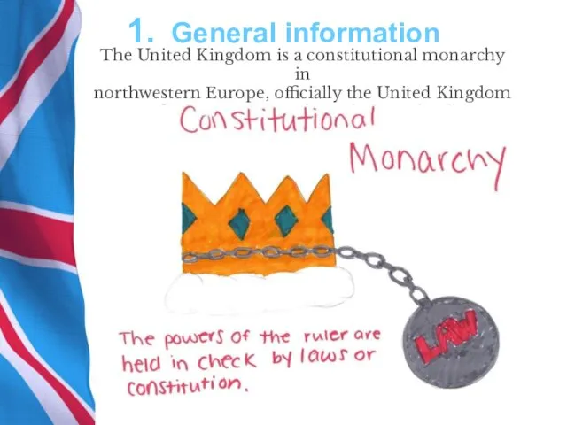
- 3. 1. General information The United Kingdom is a constitutional monarchy in northwestern Europe, officially the United
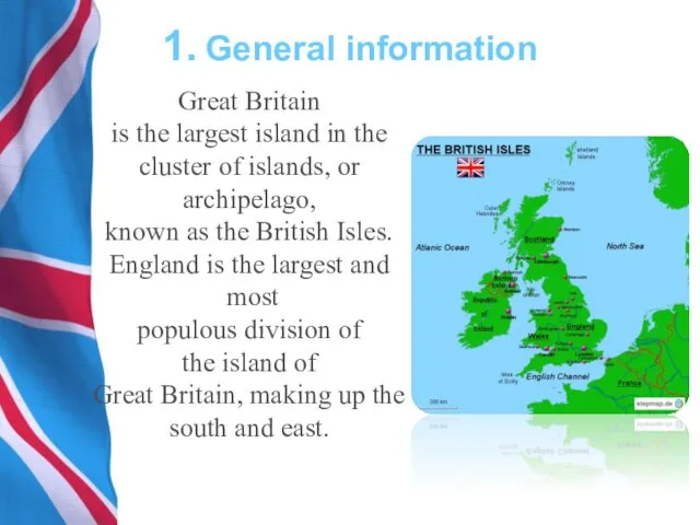
- 4. 1. General information Great Britain is the largest island in the cluster of islands, or archipelago,
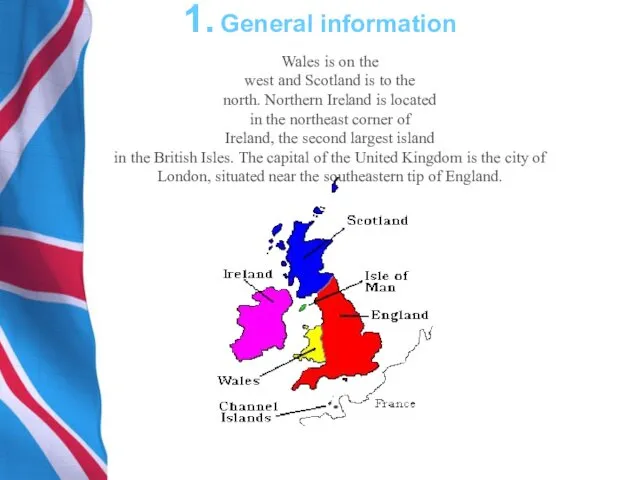
- 5. 1. General information Wales is on the west and Scotland is to the north. Northern Ireland
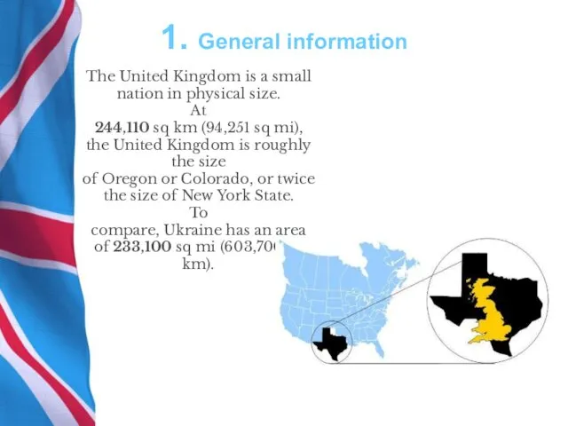
- 6. 1. General information The United Kingdom is a small nation in physical size. At 244,110 sq
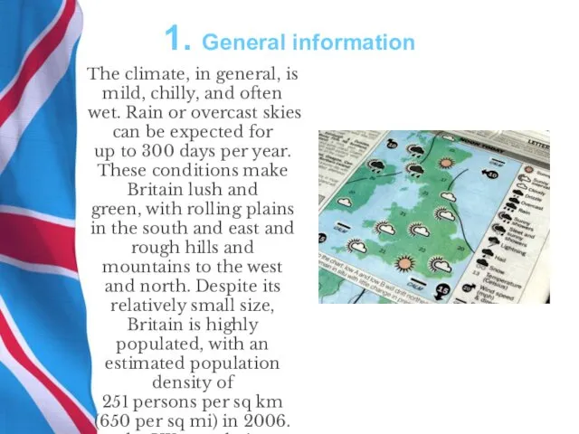
- 7. 1. General information The climate, in general, is mild, chilly, and often wet. Rain or overcast
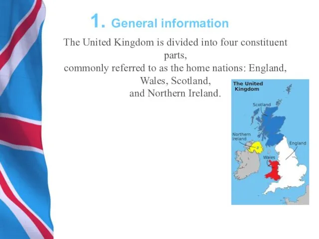
- 8. 1. General information The United Kingdom is divided into four constituent parts, commonly referred to as
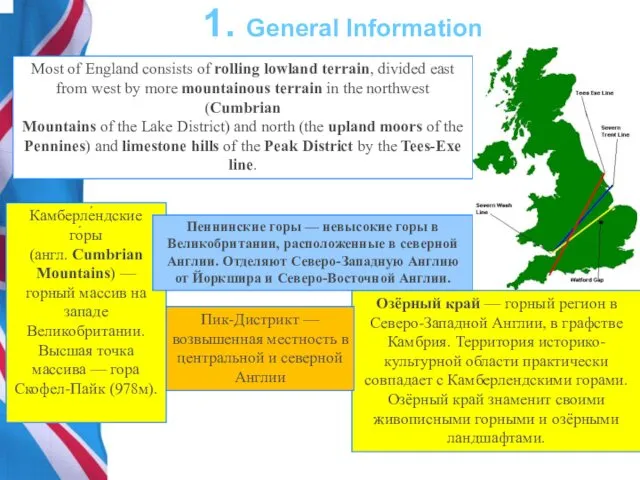
- 9. 1. General Information Камберле́ндские го́ры (англ. Cumbrian Mountains) — горный массив на западе Великобритании. Высшая точка
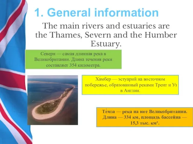
- 10. 1. General information The main rivers and estuaries are the Thames, Severn and the Humber Estuary.
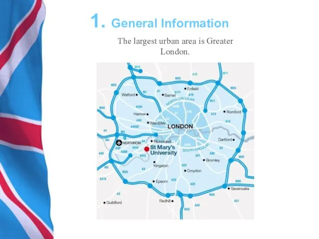
- 11. 1. General Information The largest urban area is Greater London.
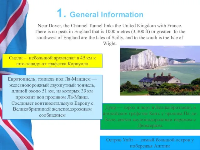
- 12. 1. General Information Near Dover, the Channel Tunnel links the United Kingdom with France. There is
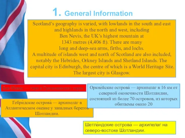
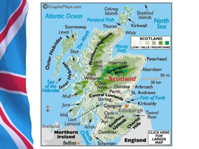
- 14. 1. General Information Scotland’s geography is varied, with lowlands in the south and east and highlands
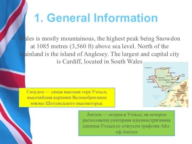
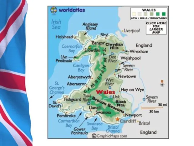
- 16. 1. General Information Wales is mostly mountainous, the highest peak being Snowdon at 1085 metres (3,560
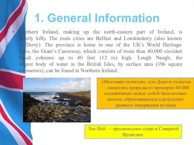
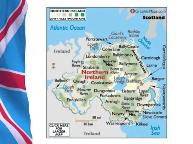
- 18. 1. General Information Northern Ireland, making up the north-eastern part of Ireland, is mostly hilly. The
- 20. 1. General Information In total it is estimated that the UK includes around 1098 small islands,
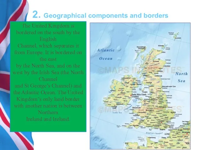
- 21. 2. Geographical components and borders The United Kingdom is bordered on the south by the English
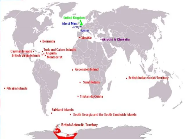
- 22. 2. Geographical components and borders Several dependencies and dependent territories are associated with the United Kingdom.
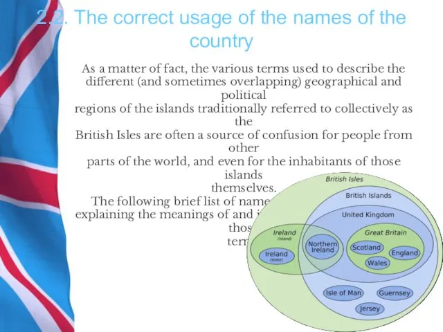
- 24. 2.2. The correct usage of the names of the country As a matter of fact, the
- 25. Britain’s dependent territories are scattered throughout the world and are the remains of the former British
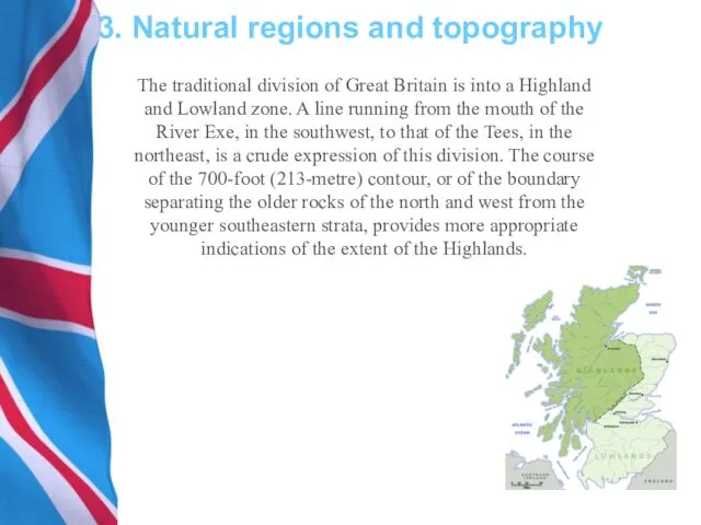
- 26. 3. Natural regions and topography The traditional division of Great Britain is into a Highland and
- 28. Скачать презентацию
Plan
1. General information
2. Geographical components and borders
3. Natural
Plan
1. General information 2. Geographical components and borders 3. Natural
1. General information
The United Kingdom is a constitutional monarchy in
northwestern
1. General information
The United Kingdom is a constitutional monarchy in
northwestern
1. General information
Great Britain
is the largest island in the
cluster
1. General information
Great Britain
is the largest island in the
cluster
1. General information
Wales is on the
west and Scotland is to
1. General information
Wales is on the west and Scotland is to
1. General information
The United Kingdom is a small nation in
1. General information
The United Kingdom is a small nation in
1. General information
The climate, in general, is
mild, chilly, and often wet.
1. General information
The climate, in general, is
mild, chilly, and often wet.
1. General information
The United Kingdom is divided into four constituent parts,
commonly
1. General information
The United Kingdom is divided into four constituent parts, commonly
1. General Information
Камберле́ндские го́ры (англ. Cumbrian Mountains) — горный массив на
1. General Information
Камберле́ндские го́ры (англ. Cumbrian Mountains) — горный массив на
1. General information
The main rivers and estuaries are
the Thames, Severn and
1. General information
The main rivers and estuaries are
the Thames, Severn and
1. General Information
The largest urban area is Greater
London.
1. General Information
The largest urban area is Greater
London.
1. General Information
Near Dover, the Channel Tunnel links the United
1. General Information
Near Dover, the Channel Tunnel links the United
1. General Information
Scotland’s geography is varied, with lowlands in the south
1. General Information
Scotland’s geography is varied, with lowlands in the south
1. General Information
Wales is mostly mountainous, the highest peak being Snowdon
1. General Information
Wales is mostly mountainous, the highest peak being Snowdon
1. General Information
Northern Ireland, making up the north-eastern part of Ireland,
1. General Information
Northern Ireland, making up the north-eastern part of Ireland,
1. General Information
In total it is estimated that the UK includes
1. General Information
In total it is estimated that the UK includes
2. Geographical components and borders
The United Kingdom is bordered on the
2. Geographical components and borders
The United Kingdom is bordered on the
2. Geographical components and borders
Several dependencies and dependent territories are associated
with
2. Geographical components and borders
Several dependencies and dependent territories are associated with
2.2. The correct usage of the names of the country
As a
2.2. The correct usage of the names of the country
As a
Britain’s dependent territories are scattered throughout the
world and are the remains
Britain’s dependent territories are scattered throughout the world and are the remains
3. Natural regions and topography
The traditional division of Great Britain is
3. Natural regions and topography
The traditional division of Great Britain is
 Peters family. Game
 It is... 4 класс
 The law of contract
 Questions-game
 Proper names in translation
 Rheumatic Endocarditis
 Формування іншомовної граматичної компетентності
 Interactive repetition simulator. Grade 2
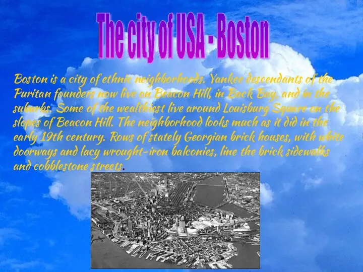 The city of USA - Boston
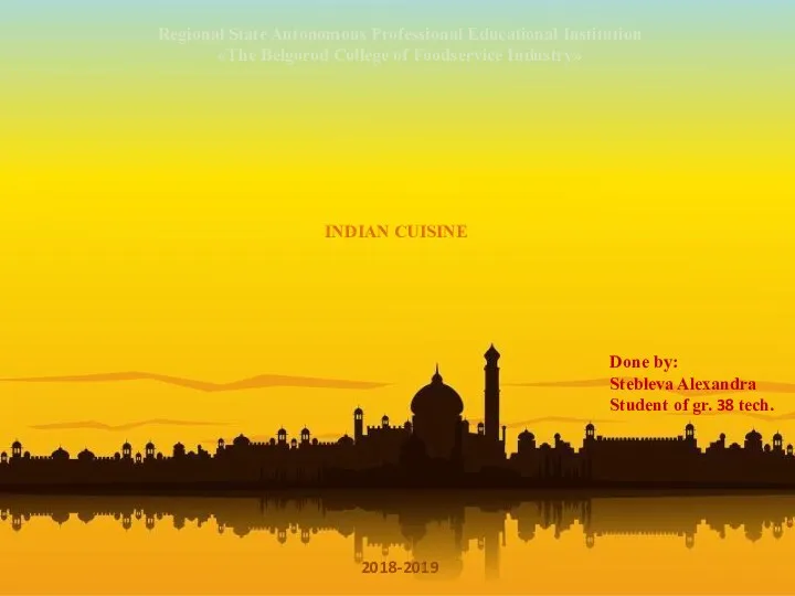 Indian cuisine
 Английский язык на улицах Кемерово
 Begin with an outline or agenda to give a big picture view
 My personal profile, my lifestyle
 Man and nature
 Распространение Американского английского языка
 My house
 Past simple vs past continuous
 My room. A flat
 Summer holidays (1)
 Past Tenses
 Movers Bright Ideas
 The person I admire Steve Jobs
 Welcome to Disneylend
 Ecological city of the future
 Food
Food What does “can” mean
 National Research Tomsk State University
 New York City Attractions Достопримечательности Нью-Йорка