- Bearing capacity of subsea permafrost soils on the Laptev Sea shelf

Содержание
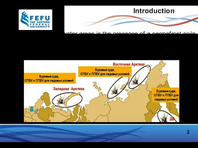
- 2. Introduction A feature of the Arctic water areas is the presence of a permafrost soils on
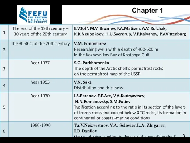
- 3. Chapter 1 3
- 4. Drilling works in the Laptev Sea 4
- 5. Map of distribution and thickness of the permafrost zone in the north of Russia 5
- 6. Methods of research Mathematical model the heat equation and Stefan's condition Initial data changes in air
- 7. 2 Retrospective approach to the study of the shelf cryolithozone Data on the global cyclicity of
- 8. Theoretical model paleogeographic geological-tectonic Researchers A.V. Gavrilov, A.L. Kholodov, A.A. Eliseeva, G.S. Tayenko, N.N. Romanovsky, V.E.
- 9. Geophysical methods of exploration Seismic exploration Electrical Exploration Georadiolocation survey 1-Observation area ; 2-bipole-source V.Ph.Grigorev…,[2013] V.P.
- 10. Mathematical modeling of the stress-strain state of soils 10
- 11. Underwater relict permafrost and the zone of stability of gas hydrants exist in most of the
- 12. Goals and objectives of the research The goal of the work is to sum up the
- 13. Chapter 2 Area of interest -Khatanga Bay 13
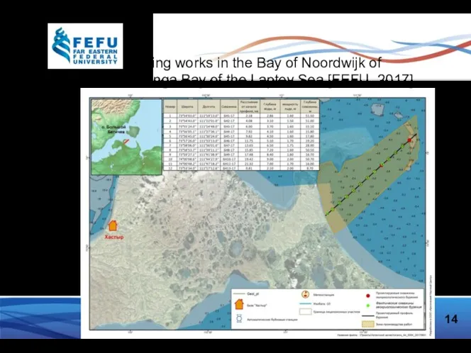
- 14. 14 Drilling works in the Bay of Noordwijk of the Hatanga Bay of the Laptev Sea
- 15. The following results were achived: geocryological and engineering researches were carried out; a description of the
- 16. Geocryological profile of well No.1 16 about 1 km from the coast, depth of water is
- 17. 17 Chapter 3 The problem of determining the settlement is divided into two points: 1. Determination
- 18. Structural model. Temperature distribution 18
- 19. The distribution of the soil temperature from the heating device 19
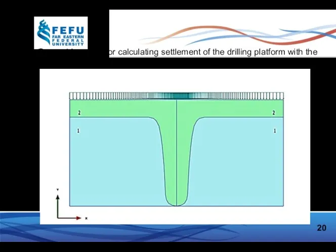
- 20. 20 Geometric model for calculating settlement of the drilling platform with the results of solving the
- 21. 21 Vertical displacement of the lower point of the foundation (10x10m) under load : F=500 kPa
- 22. 22 Vertical displacement of the lower point of the foundation (5x5m) under load : F=500 kPa
- 23. 23 Stress-strain relation (calculated by Plaxis)
- 24. Stress-strain relation (SP 25.13330.2012) 24
- 25. Conclusion 25 A method for predicting the change in temperature fields and thermal settlement of the
- 27. Скачать презентацию
Introduction
A feature of the Arctic water areas is the presence of
Introduction
A feature of the Arctic water areas is the presence of
Chapter 1
3
Chapter 1
3
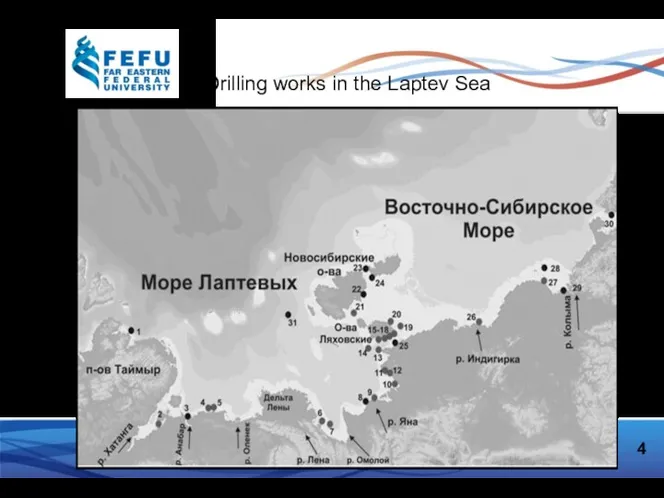
Drilling works in the Laptev Sea
4
Drilling works in the Laptev Sea
4
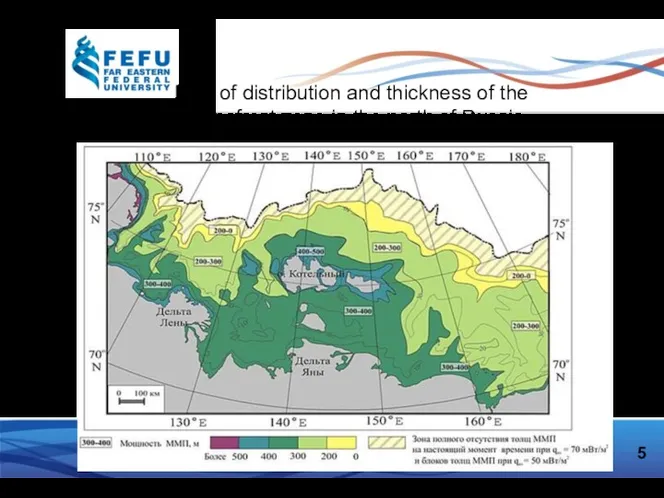
Map of distribution and thickness of the permafrost zone in the
Map of distribution and thickness of the permafrost zone in the
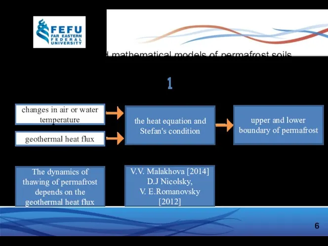
Methods of research
Mathematical model
the heat equation and Stefan's condition
Initial data
changes in
Methods of research
Mathematical model
the heat equation and Stefan's condition
Initial data
changes in
2
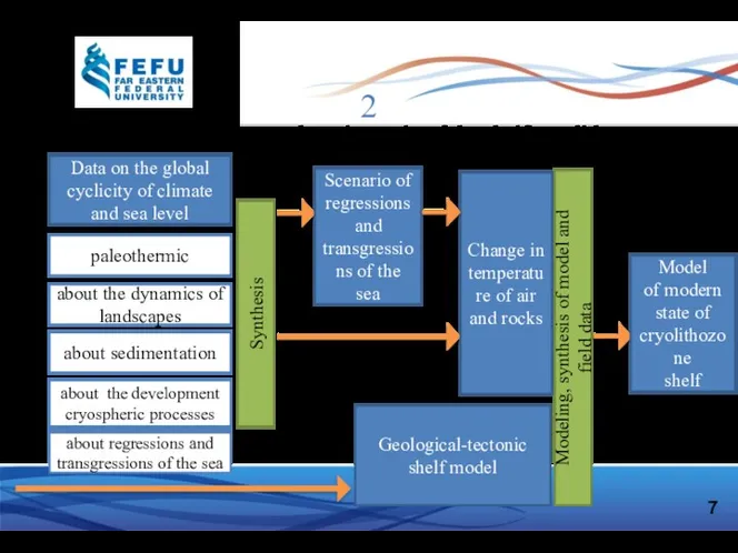
Retrospective approach to the study of the shelf cryolithozone
Data on the
2
Retrospective approach to the study of the shelf cryolithozone
Data on the
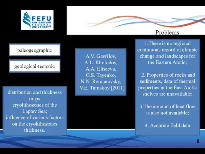
Theoretical model
paleogeographic
geological-tectonic
Researchers
A.V. Gavrilov,
A.L. Kholodov,
A.A. Eliseeva,
G.S. Tayenko,
N.N. Romanovsky,
Theoretical model
paleogeographic
geological-tectonic
Researchers
A.V. Gavrilov,
A.L. Kholodov,
A.A. Eliseeva,
G.S. Tayenko,
N.N. Romanovsky,
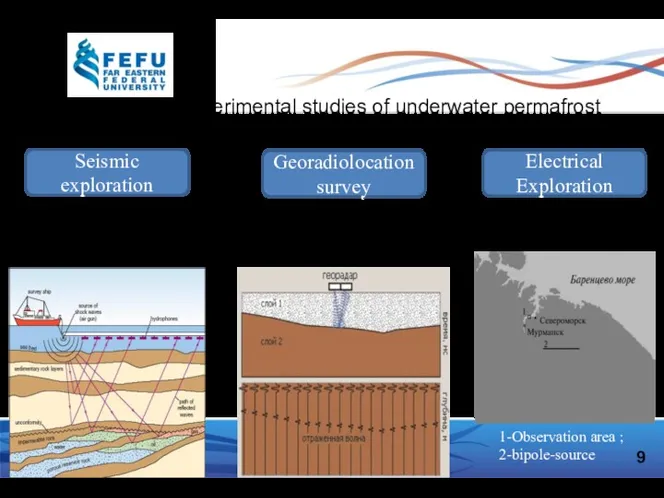
Geophysical methods of exploration
Seismic exploration
Electrical Exploration
Georadiolocation survey
1-Observation area ;
2-bipole-source
V.Ph.Grigorev…,[2013]
V.P. Melnikov…,
Geophysical methods of exploration
Seismic exploration
Electrical Exploration
Georadiolocation survey
1-Observation area ;
2-bipole-source
V.Ph.Grigorev…,[2013]
V.P. Melnikov…,
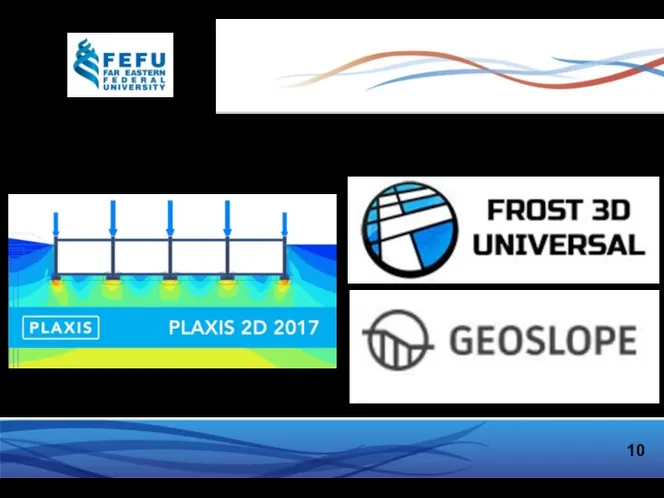
Mathematical modeling of the stress-strain state of soils
10
Mathematical modeling of the stress-strain state of soils
10
Underwater relict permafrost and the zone of stability of gas hydrants
Underwater relict permafrost and the zone of stability of gas hydrants
Goals and objectives of the research
The goal of the work is
Goals and objectives of the research
The goal of the work is
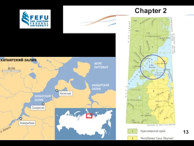
Chapter 2
Area of interest -Khatanga Bay
13
Chapter 2
Area of interest -Khatanga Bay
13
14
Drilling works in the Bay of Noordwijk of
the Hatanga Bay
14
Drilling works in the Bay of Noordwijk of
the Hatanga Bay

The following results were achived:
geocryological and engineering researches were carried out;
a
The following results were achived:
geocryological and engineering researches were carried out;
a
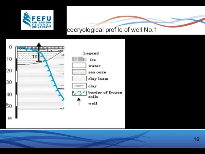
Geocryological profile of well No.1
16
about 1 km from the coast,
depth
Geocryological profile of well No.1
16
about 1 km from the coast,
depth
17
Chapter 3
The problem of determining the settlement is divided into two
17
Chapter 3
The problem of determining the settlement is divided into two
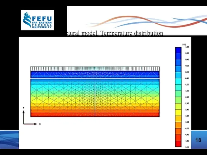
Structural model. Temperature distribution
18
Structural model. Temperature distribution
18
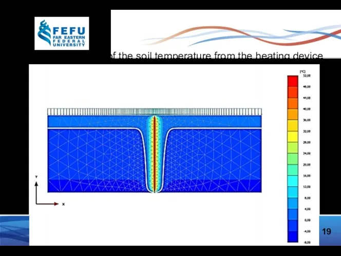
The distribution of the soil temperature from the heating device
19
The distribution of the soil temperature from the heating device
19
20
Geometric model for calculating settlement of the drilling platform with the
20
Geometric model for calculating settlement of the drilling platform with the
21
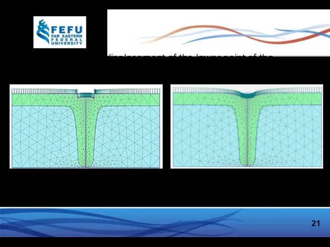
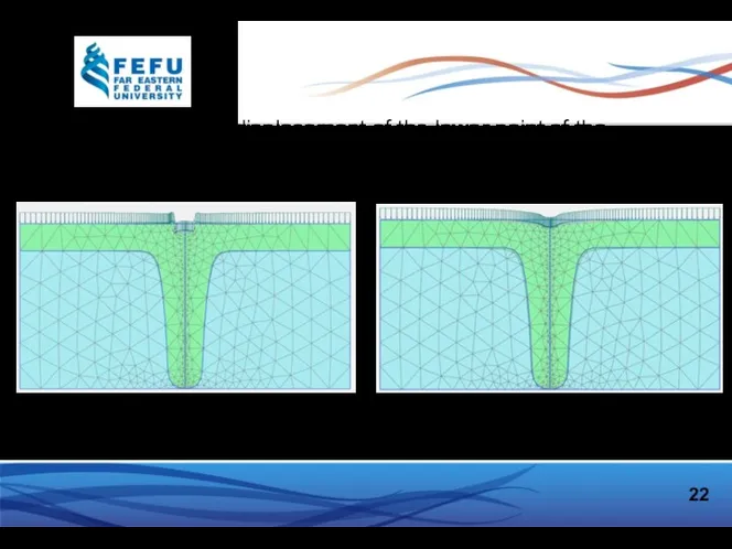
Vertical displacement of the lower point of the foundation (10x10m) under
21
Vertical displacement of the lower point of the foundation (10x10m) under
22
Vertical displacement of the lower point of the foundation (5x5m) under
22
Vertical displacement of the lower point of the foundation (5x5m) under
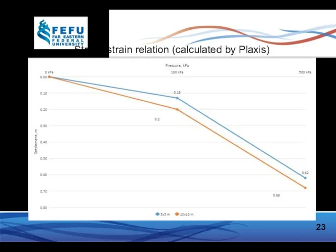
23
Stress-strain relation (calculated by Plaxis)
23
Stress-strain relation (calculated by Plaxis)
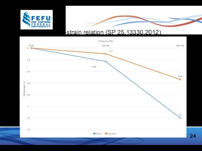
Stress-strain relation (SP 25.13330.2012)
24
Stress-strain relation (SP 25.13330.2012)
24

Conclusion
25
A method for predicting the change in temperature fields and thermal
Conclusion
25
A method for predicting the change in temperature fields and thermal
 Периоды развития знаний о почве
 Тур по Узбекистану
 Германия
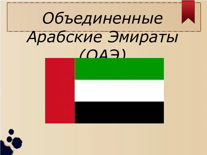 Объединенные Арабские Эмираты
 Les plus beaux biens français inscrits sur la liste du PATRIMOINE MONDIAL
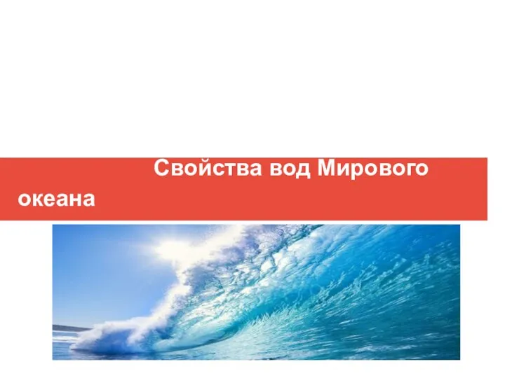 Свойства вод Мирового океана
 Природно-территориальные комплексы Восточно-Европейской равнины
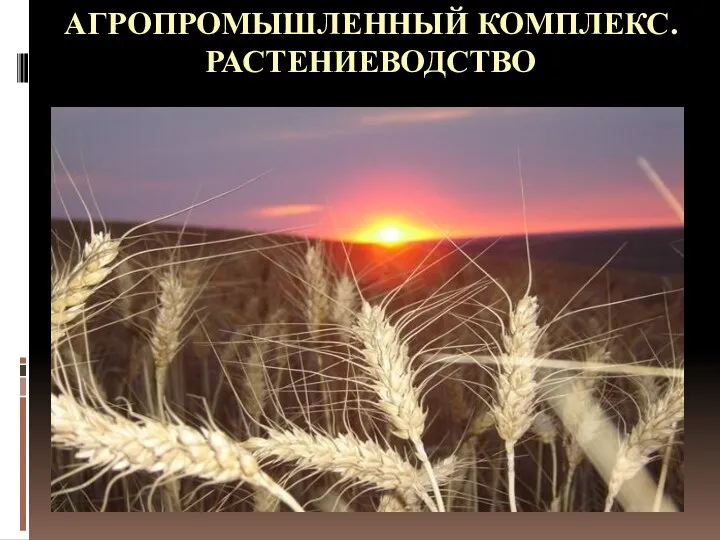 Агропромышленный комплекс. Растениеводство
 Формы поверхности суши
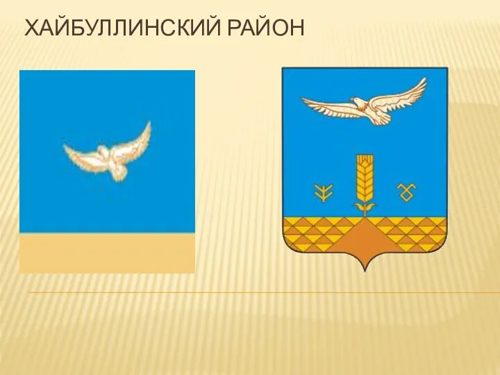 Хайбуллинский Район
 Самые красивые объекты России
 Топливно-энергетический комплекс мира
 Географические карты
 Моя малая родина - Чебоксары
 Страны на политической карте мира
 Определение магнитного азимута
 Дальний Восток
 Добро пожаловать в Грузию
 Еуразия жағалауындағы мұхиттар мен теңіздер. Атлант мұхиты
 Географическая карта и правила работы с ней
 Страна утренней свежести. Южная Корея
 Гидрология рек
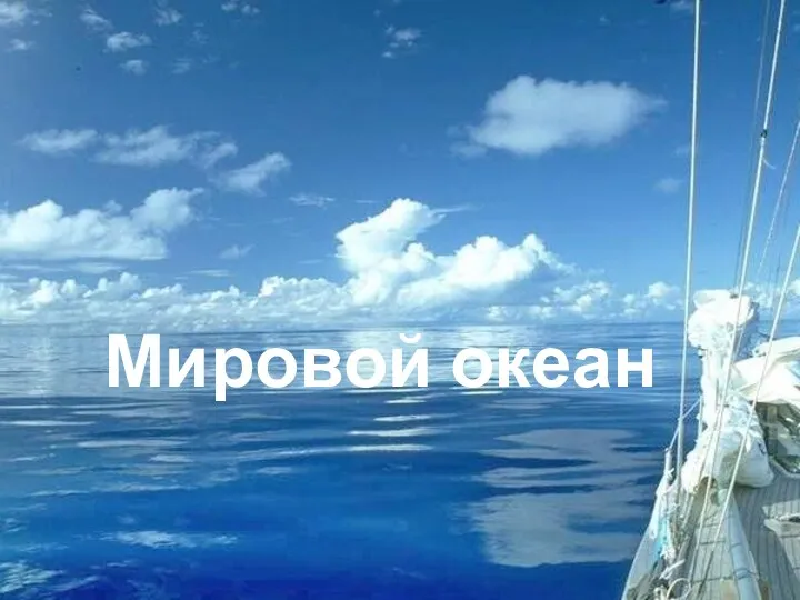 Мировой океан. Части океана. Свойства вод
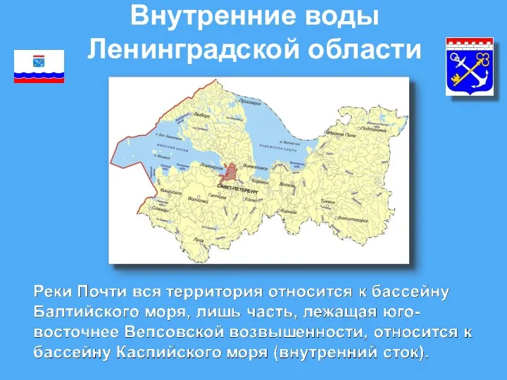 Внутренние воды Ленинградской области
 Путеводитель Карелия неизвестная
 Мировые природные ресурсы
 Африканская саванна
 Эрозия