Слайд 2
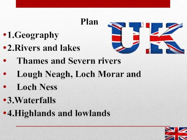
Plan
1.Geography
2.Rivers and lakes
Thames and Severn rivers
Lough Neagh, Loch
Morar and
Loch Ness
3.Waterfalls
4.Highlands and lowlands
Слайд 3
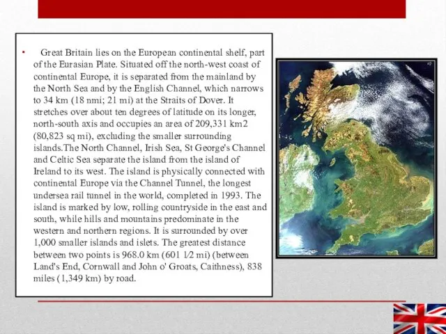
Great Britain lies on the European continental shelf, part of
the Eurasian Plate. Situated off the north-west coast of continental Europe, it is separated from the mainland by the North Sea and by the English Channel, which narrows to 34 km (18 nmi; 21 mi) at the Straits of Dover. It stretches over about ten degrees of latitude on its longer, north-south axis and occupies an area of 209,331 km2 (80,823 sq mi), excluding the smaller surrounding islands.The North Channel, Irish Sea, St George's Channel and Celtic Sea separate the island from the island of Ireland to its west. The island is physically connected with continental Europe via the Channel Tunnel, the longest undersea rail tunnel in the world, completed in 1993. The island is marked by low, rolling countryside in the east and south, while hills and mountains predominate in the western and northern regions. It is surrounded by over 1,000 smaller islands and islets. The greatest distance between two points is 968.0 km (601 1⁄2 mi) (between Land's End, Cornwall and John o' Groats, Caithness), 838 miles (1,349 km) by road.
Слайд 4
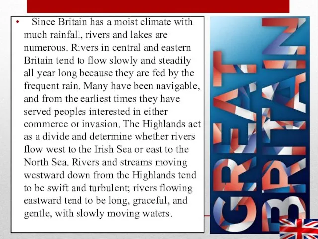
Since Britain has a moist climate with much rainfall, rivers
and lakes are numerous. Rivers in central and eastern Britain tend to flow slowly and steadily all year long because they are fed by the frequent rain. Many have been navigable, and from the earliest times they have served peoples interested in either commerce or invasion. The Highlands act as a divide and determine whether rivers flow west to the Irish Sea or east to the North Sea. Rivers and streams moving westward down from the Highlands tend to be swift and turbulent; rivers flowing eastward tend to be long, graceful, and gentle, with slowly moving waters.
Слайд 5
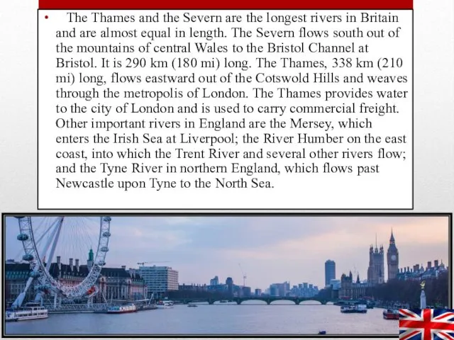
The Thames and the Severn are the longest rivers in
Britain and are almost equal in length. The Severn flows south out of the mountains of central Wales to the Bristol Channel at Bristol. It is 290 km (180 mi) long. The Thames, 338 km (210 mi) long, flows eastward out of the Cotswold Hills and weaves through the metropolis of London. The Thames provides water to the city of London and is used to carry commercial freight. Other important rivers in England are the Mersey, which enters the Irish Sea at Liverpool; the River Humber on the east coast, into which the Trent River and several other rivers flow; and the Tyne River in northern England, which flows past Newcastle upon Tyne to the North Sea.
Слайд 6
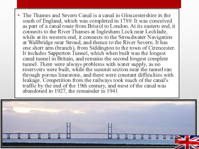
The Thames and Severn Canal is a canal in Gloucestershire in
the south of England, which was completed in 1789. It was conceived as part of a canal route from Bristol to London. At its eastern end, it connects to the River Thames at Inglesham Lock near Lechlade, while at its western end, it connects to the Stroudwater Navigation at Wallbridge near Stroud, and thence to the River Severn. It has one short arm (branch), from Siddington to the town of Cirencester. It includes Sapperton Tunnel, which when built was the longest canal tunnel in Britain, and remains the second longest complete tunnel. There were always problems with water supply, as no reservoirs were built, while the summit section near the tunnel ran through porous limestone, and there were constant difficulties with leakage. Competition from the railways took much of the canal's traffic by the end of the 19th century, and most of the canal was abandoned in 1927, the remainder in 1941
Слайд 7
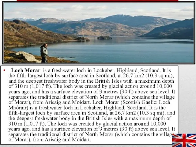
Loch Morar is a freshwater loch in Lochaber, Highland, Scotland.
It is the fifth-largest loch by surface area in Scotland, at 26.7 km2 (10.3 sq mi), and the deepest freshwater body in the British Isles with a maximum depth of 310 m (1,017 ft). The loch was created by glacial action around 10,000 years ago, and has a surface elevation of 9 metres (30 ft) above sea level. It separates the traditional district of North Morar (which contains the village of Morar), from Arisaig and Moidart. Loch Morar (Scottish Gaelic: Loch Mhòrair) is a freshwater loch in Lochaber, Highland, Scotland. It is the fifth-largest loch by surface area in Scotland, at 26.7 km2 (10.3 sq mi), and the deepest freshwater body in the British Isles with a maximum depth of 310 m (1,017 ft). The loch was created by glacial action around 10,000 years ago, and has a surface elevation of 9 metres (30 ft) above sea level. It separates the traditional district of North Morar (which contains the village of Morar), from Arisaig and Moidart.
Слайд 8
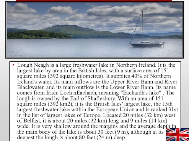
Lough Neagh is a large freshwater lake in Northern Ireland. It
is the largest lake by area in the British Isles, with a surface area of 151 square miles (392 square kilometres). It supplies 40% of Northern Ireland's water. Its main inflows are the Upper River Bann and River Blackwater, and its main outflow is the Lower River Bann. Its name comes from Irish: Loch nEachach, meaning "Eachaidh's lake" . The lough is owned by the Earl of Shaftesbury. With an area of 151 square miles (392 km2), it is the British Isles' largest lake, the 15th largest freshwater lake within the European Union and is ranked 31st in the list of largest lakes of Europe. Located 20 miles (32 km) west of Belfast, it is about 20 miles (32 km) long and 9 miles (14 km) wide. It is very shallow around the margins and the average depth in the main body of the lake is about 30 feet (9 m), although at its deepest the lough is about 80 feet (24 m) deep.
Слайд 9
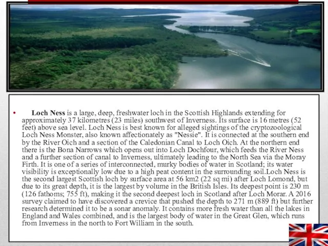
Loch Ness is a large, deep, freshwater loch in the
Scottish Highlands extending for approximately 37 kilometres (23 miles) southwest of Inverness. Its surface is 16 metres (52 feet) above sea level. Loch Ness is best known for alleged sightings of the cryptozoological Loch Ness Monster, also known affectionately as "Nessie". It is connected at the southern end by the River Oich and a section of the Caledonian Canal to Loch Oich. At the northern end there is the Bona Narrows which opens out into Loch Dochfour, which feeds the River Ness and a further section of canal to Inverness, ultimately leading to the North Sea via the Moray Firth. It is one of a series of interconnected, murky bodies of water in Scotland; its water visibility is exceptionally low due to a high peat content in the surrounding soil.Loch Ness is the second largest Scottish loch by surface area at 56 km2 (22 sq mi) after Loch Lomond, but due to its great depth, it is the largest by volume in the British Isles. Its deepest point is 230 m (126 fathoms; 755 ft), making it the second deepest loch in Scotland after Loch Morar. A 2016 survey claimed to have discovered a crevice that pushed the depth to 271 m (889 ft) but further research determined it to be a sonar anomaly. It contains more fresh water than all the lakes in England and Wales combined, and is the largest body of water in the Great Glen, which runs from Inverness in the north to Fort William in the south.
Слайд 10
The list of highest waterfalls is often controversial, due to the
ambiguity of whether to measure the single largest fall or the sum of a series of falls, and many falls make false claims to the record. This table measures above-ground waterfalls by tallest single drop
Слайд 11
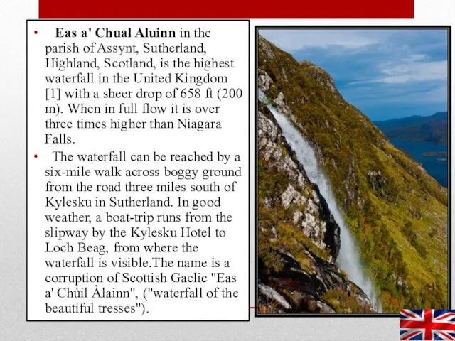
Eas a' Chual Aluinn in the parish of Assynt, Sutherland,
Highland, Scotland, is the highest waterfall in the United Kingdom [1] with a sheer drop of 658 ft (200 m). When in full flow it is over three times higher than Niagara Falls.
The waterfall can be reached by a six-mile walk across boggy ground from the road three miles south of Kylesku in Sutherland. In good weather, a boat-trip runs from the slipway by the Kylesku Hotel to Loch Beag, from where the waterfall is visible.The name is a corruption of Scottish Gaelic "Eas a' Chùil Àlainn", ("waterfall of the beautiful tresses").
Слайд 12
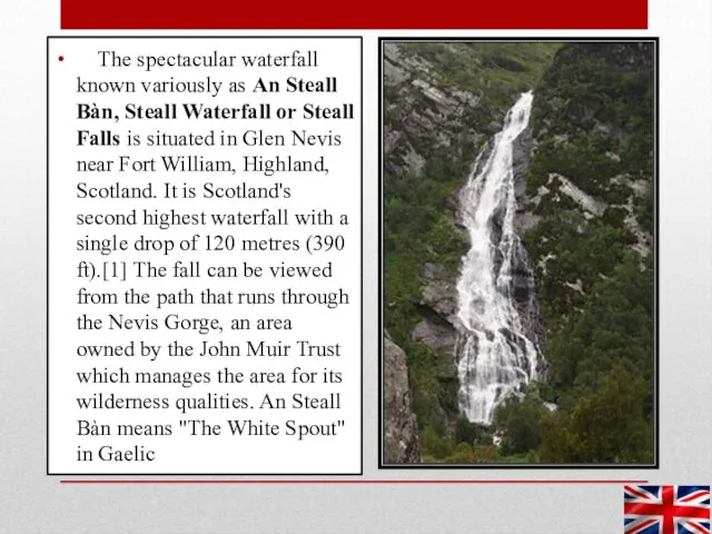
The spectacular waterfall known variously as An Steall Bàn, Steall
Waterfall or Steall Falls is situated in Glen Nevis near Fort William, Highland, Scotland. It is Scotland's second highest waterfall with a single drop of 120 metres (390 ft).[1] The fall can be viewed from the path that runs through the Nevis Gorge, an area owned by the John Muir Trust which manages the area for its wilderness qualities. An Steall Bàn means "The White Spout" in Gaelic
Слайд 13
![The mountains and hills of the British Isles[a] are categorised](/_ipx/f_webp&q_80&fit_contain&s_1440x1080/imagesDir/jpg/18782/slide-12.jpg)
The mountains and hills of the British Isles[a] are categorised
into lists based on elevation (or "height"), prominence (or "relative height", or "drop"), and other criteria (e.g. isolation). These lists are used for peak bagging, whereby hillwalkers attempt to reach all the summits on a list, the oldest and best-known, being the 282 § Munros in Scotland, which amongst other criteria, must be above 3,000 feet (914.4 m). A height above 2,000 ft, or more latterly 600 m, is considered necessary to be a "mountain" in the British Isles, and apart from the Munros (who favour isolation), all lists require a prominence of at least 15 metres (49.21 ft). A prominence of between 15–30 metres (49.21–98.43 ft) (e.g. some § Nuttalls and § Vandeleur-Lynams), does not meet the UIAA definition of an "independent" peak. Most lists consider a prominence between 30–150 metres (98.43–492.1 ft) as a "top", and not a mountain (e.g. many § Hewitts and § Simms). A popular designation are the § Marilyns, with a prominence above 150 metres (492.1 ft). Prominences above 600 metres (1,969 ft), are the § P600 (the "Majors"), the international classification of a "major" mountain.
Слайд 14
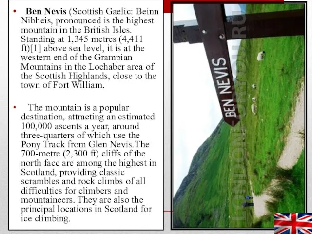
Ben Nevis (Scottish Gaelic: Beinn Nibheis, pronounced is the highest
mountain in the British Isles. Standing at 1,345 metres (4,411 ft)[1] above sea level, it is at the western end of the Grampian Mountains in the Lochaber area of the Scottish Highlands, close to the town of Fort William.
The mountain is a popular destination, attracting an estimated 100,000 ascents a year, around three-quarters of which use the Pony Track from Glen Nevis.The 700-metre (2,300 ft) cliffs of the north face are among the highest in Scotland, providing classic scrambles and rock climbs of all difficulties for climbers and mountaineers. They are also the principal locations in Scotland for ice climbing.
Слайд 15
Recreational caving in the United Kingdom dates back to the
mid nineteenth century. The four major caving areas of the United Kingdom are North Yorkshire, South Wales, Derbyshire, and the Mendips. Minor areas include Devon, North Wales, and Grampian.
Caving grew in popularity in the 1950s and 60s through participation in caving clubs. There are about 4,000 active cavers in the UK and nearly twenty times that number who attend instructor-led courses each year in caves around the country. In addition, many tourists visit show caves such as Wookey Hole Caves.
Cave diving is a niche technical area of caving practiced in the UK since the 1930s. This skill enables cavers to explore water-filled cave passages in Britain, and around the world. In recent years, British cave divers have been called on internationally for cave rescues and recoveries.
Слайд 16
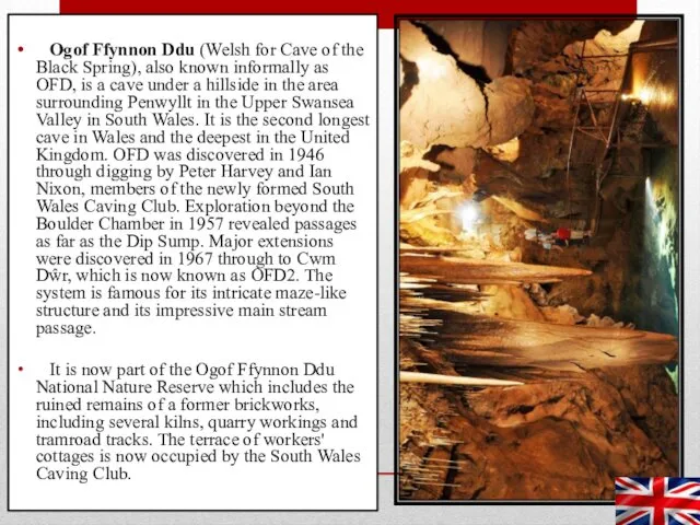
Ogof Ffynnon Ddu (Welsh for Cave of the Black Spring),
also known informally as OFD, is a cave under a hillside in the area surrounding Penwyllt in the Upper Swansea Valley in South Wales. It is the second longest cave in Wales and the deepest in the United Kingdom. OFD was discovered in 1946 through digging by Peter Harvey and Ian Nixon, members of the newly formed South Wales Caving Club. Exploration beyond the Boulder Chamber in 1957 revealed passages as far as the Dip Sump. Major extensions were discovered in 1967 through to Cwm Dŵr, which is now known as OFD2. The system is famous for its intricate maze-like structure and its impressive main stream passage.
It is now part of the Ogof Ffynnon Ddu National Nature Reserve which includes the ruined remains of a former brickworks, including several kilns, quarry workings and tramroad tracks. The terrace of workers' cottages is now occupied by the South Wales Caving Club.
Слайд 17
Interesting facts
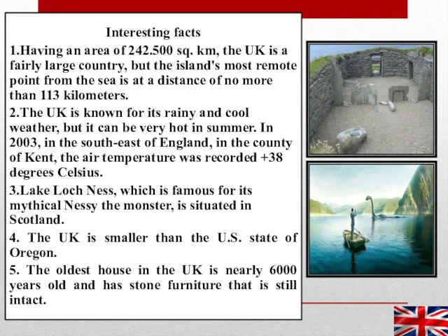
1.Having an area of 242.500 sq. km, the UK is
a fairly large country, but the island's most remote point from the sea is at a distance of no more than 113 kilometers.
2.The UK is known for its rainy and cool weather, but it can be very hot in summer. In 2003, in the south-east of England, in the county of Kent, the air temperature was recorded +38 degrees Celsius.
3.Lake Loch Ness, which is famous for its mythical Nessy the monster, is situated in Scotland.
4. The UK is smaller than the U.S. state of Oregon.
5. The oldest house in the UK is nearly 6000 years old and has stone furniture that is still intact.

 Сибирский федеральный округ
 Мультимедийный тест по географии (11 класс)
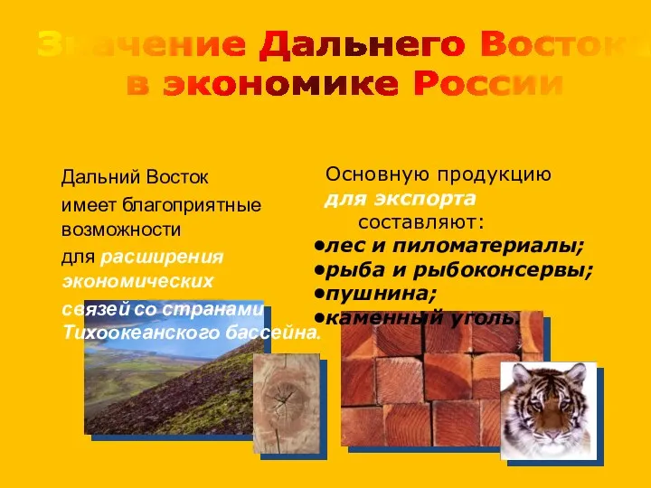 Дальневосточный экономический район (часть 3)
 Путеводитель по Праге или Мечта начинающего туриста
 Роль географічного простору в світосистемі
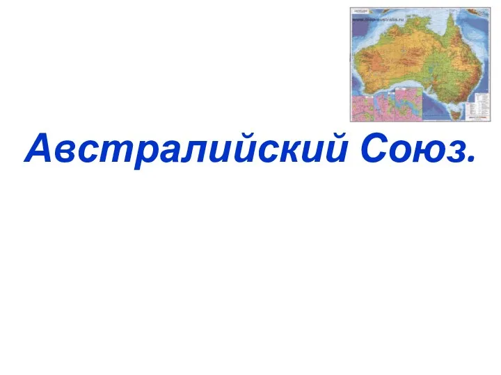 Австралийский Союз (Австралия)
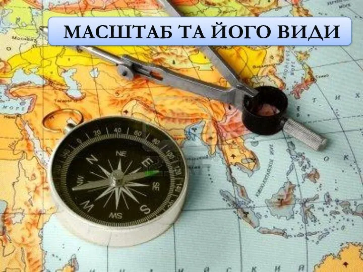 Масштаб та його види
 Великобритания. Окружающий мир 3 класс
 Черное море
 Трудовые ресурсы. Рынок труда
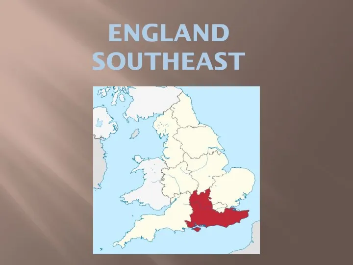 England, Southeast
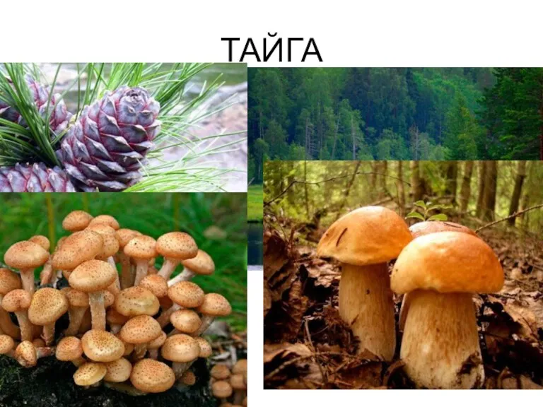 Тайга. Уссурийская тайга
 Природные зоны Южной Америки
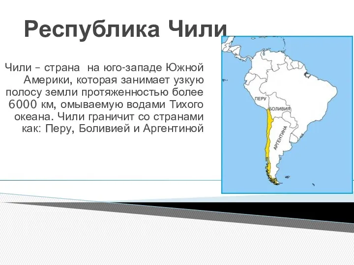 Республика Чили
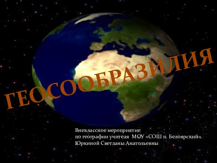 Внеклассное мероприятие Геосообразилия
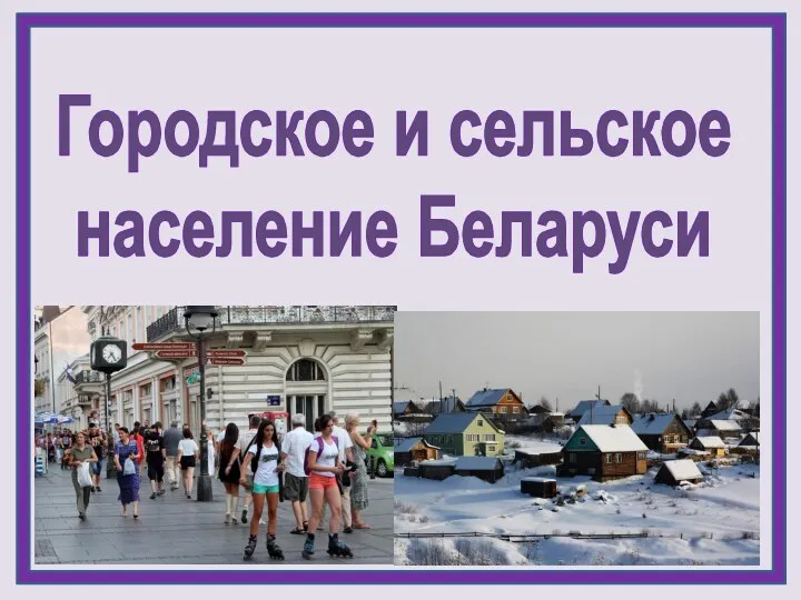 Городское и сельское население Республики Беларусь
 Строение земли. Минеральные ресурсы
 Литосфера. Рельеф Земли. 6 класс
 Жар и дрожь Земли
 Восточная и Северо-Восточная Сибирь
 Геологическая деятельность океанов и морей
 Развитие географических знаний о Земле
 Методы полевых исследований
 Белгород. Достопримечательности
 Тянь-Шань
 Хозяйство Беларуси (инфографика). Показатели направления развития перспективы
 Природа и человек в современном мире
 Требования к геодезическим приборам. Классификация и стандартизация. Лекция № 2