- Navigation

Содержание
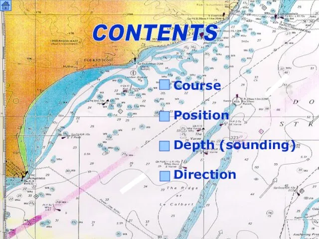
- 2. CONTENTS Course Position Depth (sounding) Direction
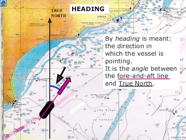
- 3. SOUND HEADING TRUE NORTH By heading is meant: the direction in which the vessel is pointing.
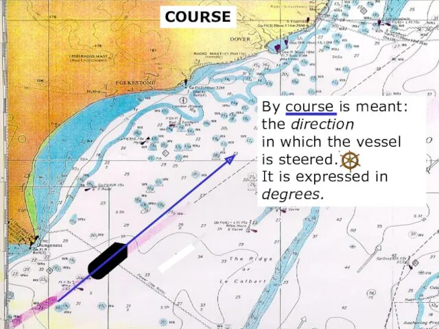
- 4. sound COURSE By course is meant: the direction in which the vessel is steered. It is
- 5. Do not confuse heading and course; HEADING AND COURSE heading constantly changes due to sea- and
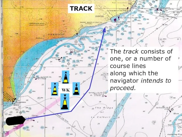
- 6. sound TRACK The track consists of one, or a number of course lines along which the
- 7. GREAT CIRCLE COURSE (TRACK) DEPARTURE DESTINATION A great circle course forms the shortest connection between two
- 8. This implies that in (Mercator) sea charts the earth is not a sphere, but a square.
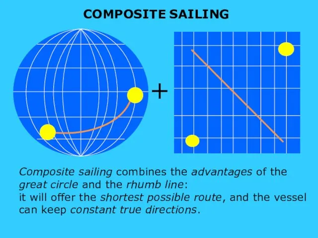
- 9. s sound COMPOSITE SAILING + Composite sailing combines the advantages of the great circle and the
- 10. sound DRIFT AND CURRENT A B Due to theinfluences of wind and current destination B will
- 11. sound A By course made good is understood the course that the ship will follow after
- 12. sound A By course over ground is understood the course that the ship will follow after
- 13. s POSITION
- 14. Pilotage (coastal navigation) Cross bearing The cocked hat A running fix Dead reckoning Astronomical navigation Satellite
- 15. When sailing along the coast, compass- bearings of conspicuous objects are taken at regular intervals.
- 16. A CONSPICUOUS OBJECT (CONSPIC) is an object on land or at sea, which is mentioned and
- 17. Cross bearings form an intersection of two bearing lines that have been taken of two conspicuous
- 18. If a third conspicuous object is available, a third bearing (“check line”) is taken. X X
- 19. X X X As the ship is proceeding, a triangle is formed by the two bearing
- 20. When there is only one conspicuous object, a position fix is made by taking two bearings
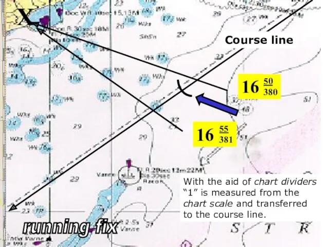
- 21. X Course line 16 50 380 The first bearing is taken at 16.50 hrs; log reading:
- 22. 16 50 380 X 16 55 381 The second bearing is taken at 16.55 hrs; log
- 23. 16 50 380 X With the aid of chart dividers “1” is measured from the chart
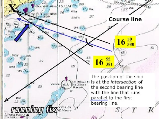
- 24. X 16 50 380 The position of the ship is at the intersection of the second
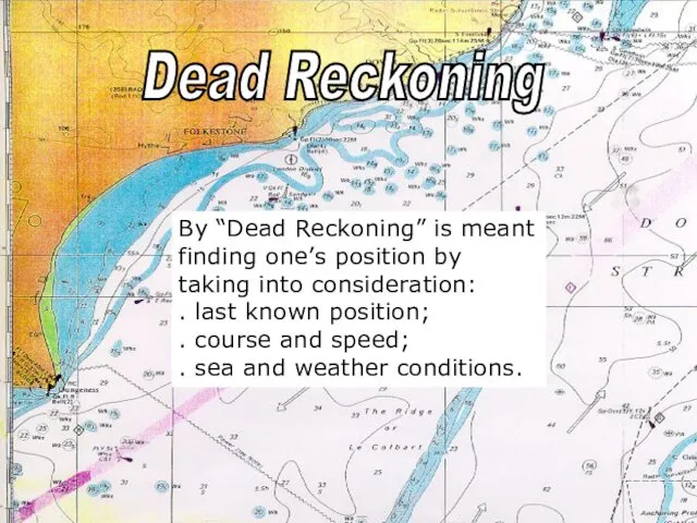
- 25. sound By “Dead Reckoning” is meant finding one’s position by taking into consideration: . last known
- 26. s ASTRONOMICAL NAVIGATION With astronomical navigation(celestial navigation) observations are taken of the sun, the moon or
- 27. SEXTANT-BEARING The angle between a celestial body and the horizon is measured.
- 28. With the aid of the chronometer and the tables in the nautical almanac the ship’s position
- 29. SATELLITE-BEARING When taking a satellite bearing by means of the Global Positioning System a signal is
- 30. sound s Sounding With the aid of the echo sounder the depth of the water can
- 31. TAKING SOUNDINGS A signal is transmitted to the sea bed. This signal “bounces back” and is
- 32. TAKING SOUNDINGS With multi-beam echo sounding 3-D images are made of the seabed to determine charted
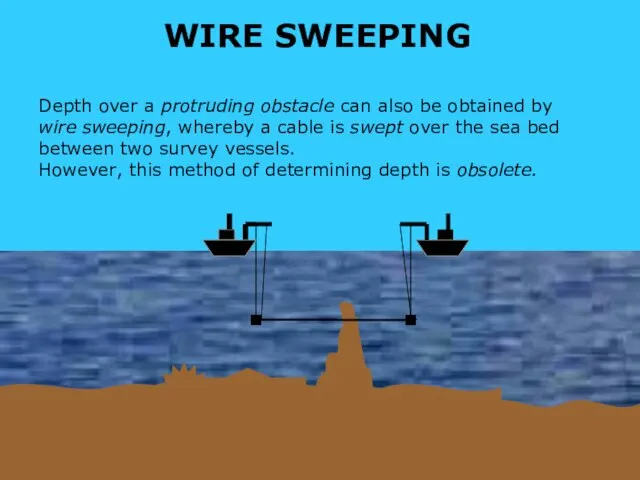
- 33. so WIRE SWEEPING Depth over a protruding obstacle can also be obtained by wire sweeping, whereby
- 34. s Directions
- 35. Ahead Starboard Astern Port
- 36. On the stem On the starboard bow Before the starboard beam On the starboard beam Abaft
- 38. Скачать презентацию
CONTENTS
Course
Position
Depth (sounding)
Direction
CONTENTS
Course
Position
Depth (sounding)
Direction
SOUND
HEADING
TRUE
NORTH
By heading is meant:
the direction in
which the
SOUND
HEADING
TRUE
NORTH
By heading is meant:
the direction in
which the
sound
COURSE
By course is meant:
the direction
in which the vessel
is steered.
It
sound
COURSE
By course is meant:
the direction
in which the vessel
is steered.
It
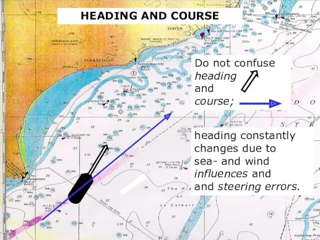
Do not confuse
heading
and
course;
HEADING AND COURSE
heading constantly
changes due to
sea- and
Do not confuse
heading
and
course;
HEADING AND COURSE
heading constantly
changes due to
sea- and
sound
TRACK
The track consists of one, or a number of
course lines
along which
sound
TRACK
The track consists of one, or a number of
course lines
along which
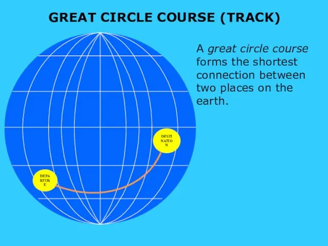
GREAT CIRCLE COURSE (TRACK)
DEPARTURE
DESTINATION
A great circle course forms the shortest connection
GREAT CIRCLE COURSE (TRACK)
DEPARTURE
DESTINATION
A great circle course forms the shortest connection
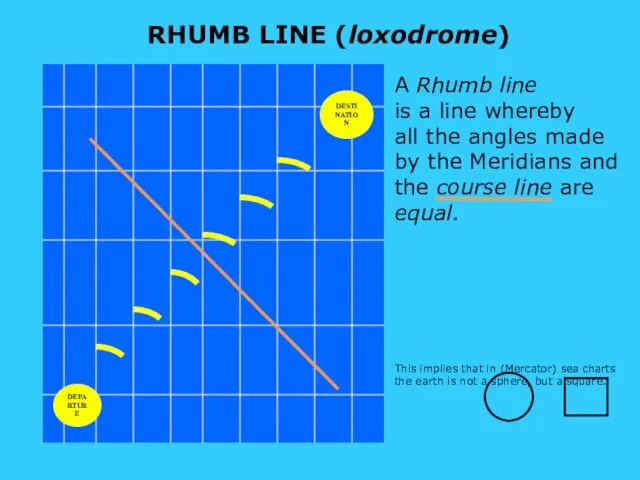
This implies that in (Mercator) sea charts
the earth is
This implies that in (Mercator) sea charts
the earth is
s
sound
COMPOSITE SAILING
+
Composite sailing combines the advantages of the
great circle and
s
sound
COMPOSITE SAILING
+
Composite sailing combines the advantages of the
great circle and
sound
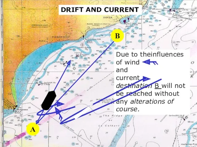
DRIFT AND CURRENT
A
B
Due to theinfluences of wind
and
current
destination B will
sound
DRIFT AND CURRENT
A
B
Due to theinfluences of wind
and
current
destination B will
sound
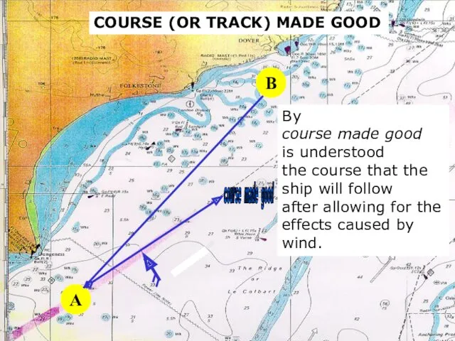
A
By
course made good
is understood
the course that the
ship will
sound
A
By
course made good
is understood
the course that the
ship will
sound
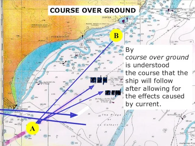
A
By
course over ground
is understood
the course that the
ship will
sound
A
By
course over ground
is understood
the course that the
ship will
s
POSITION
s
POSITION
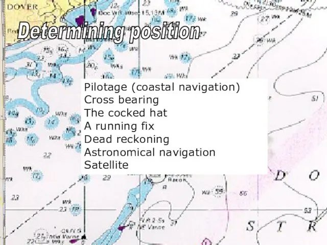
Pilotage (coastal navigation)
Cross bearing
The cocked hat
A running fix
Dead reckoning
Astronomical
Pilotage (coastal navigation)
Cross bearing
The cocked hat
A running fix
Dead reckoning
Astronomical
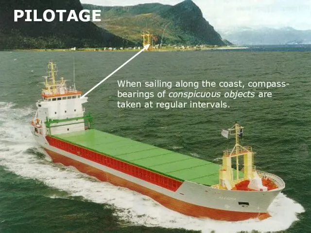
When sailing along the coast, compass- bearings of conspicuous objects are
When sailing along the coast, compass- bearings of conspicuous objects are

A CONSPICUOUS OBJECT (CONSPIC)
is an object on land or at
A CONSPICUOUS OBJECT (CONSPIC)
is an object on land or at
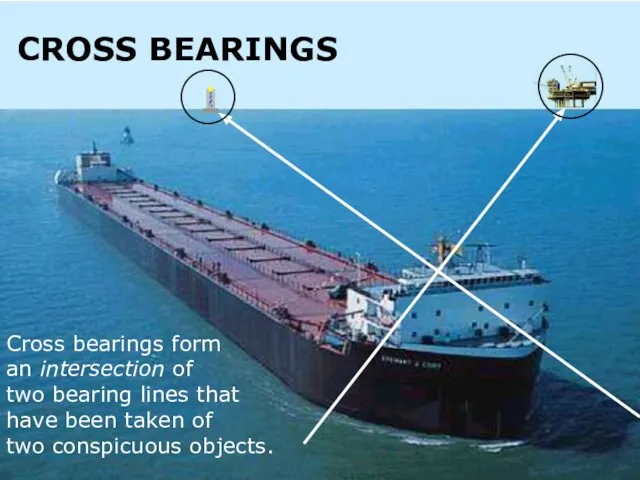
Cross bearings form
an intersection of
two bearing lines that
have been
an intersection of
two bearing lines that
have been
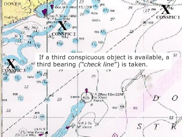
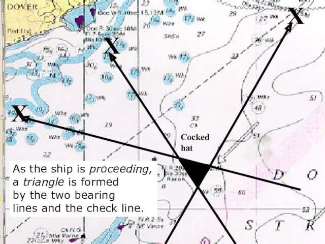
If a third conspicuous object is available, a third bearing
If a third conspicuous object is available, a third bearing
X
X
X
As the ship is proceeding,
a triangle is formed
by the two bearing
X
X
X
As the ship is proceeding,
a triangle is formed
by the two bearing
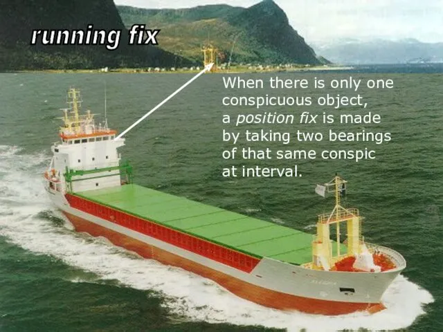
When there is only one
conspicuous object,
a position fix is made
by
When there is only one
conspicuous object,
a position fix is made
by
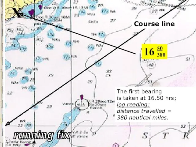
X
Course line
16
50
380
The first bearing
is taken at 16.50 hrs;
log reading:
distance travelled
X
Course line
16
50
380
The first bearing
is taken at 16.50 hrs;
log reading:
distance travelled
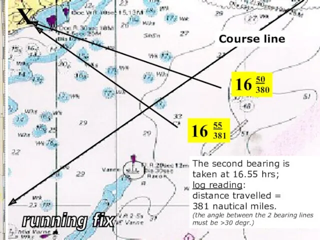
16
50
380
X
16
55
381
The second bearing is
taken at 16.55 hrs;
log reading:
16
50
380
X
16
55
381
The second bearing is
taken at 16.55 hrs;
log reading:
16
50
380
X
With the aid of chart dividers
“1” is measured from the
16
50
380
X
With the aid of chart dividers
“1” is measured from the
X
16
50
380
The position of the ship
is at the intersection of
the
X
16
50
380
The position of the ship
is at the intersection of
the
sound
By “Dead Reckoning” is meant
finding one’s position by
taking into
sound
By “Dead Reckoning” is meant
finding one’s position by
taking into
s
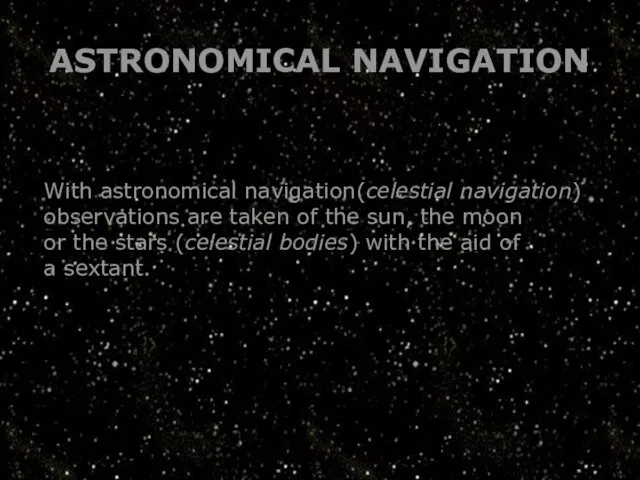
ASTRONOMICAL NAVIGATION
With astronomical navigation(celestial navigation)
observations are taken of the sun,
s
ASTRONOMICAL NAVIGATION
With astronomical navigation(celestial navigation)
observations are taken of the sun,
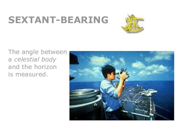
SEXTANT-BEARING
The angle between
a celestial body
and the horizon
is measured.
The angle between
a celestial body
and the horizon
is measured.
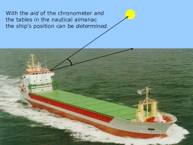
With the aid of the chronometer and
the tables in
With the aid of the chronometer and
the tables in
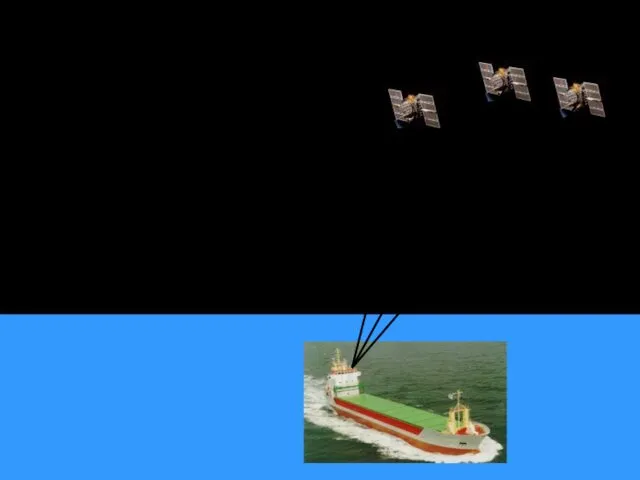
SATELLITE-BEARING
When taking a satellite bearing
by means of the
Global Positioning System
a
SATELLITE-BEARING
When taking a satellite bearing
by means of the
Global Positioning System
a
sound
s
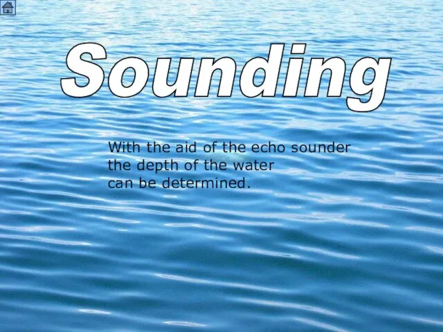
Sounding
With the aid of the echo sounder
the depth of the
sound
s
Sounding
With the aid of the echo sounder
the depth of the
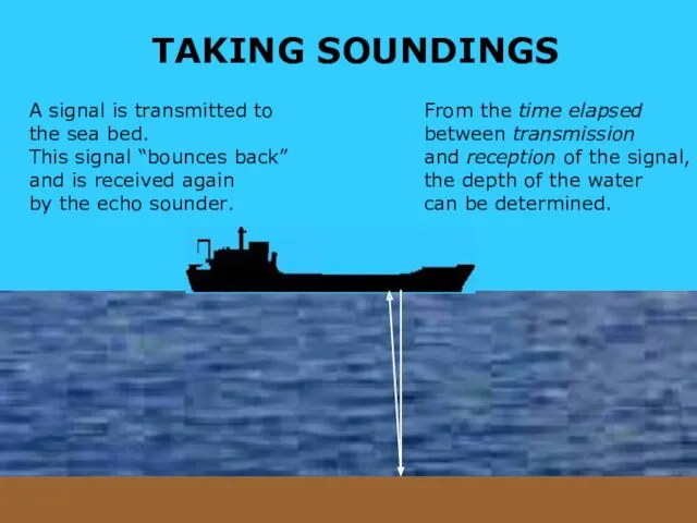
TAKING SOUNDINGS
A signal is transmitted to
the sea bed.
This signal “bounces
TAKING SOUNDINGS
A signal is transmitted to
the sea bed.
This signal “bounces
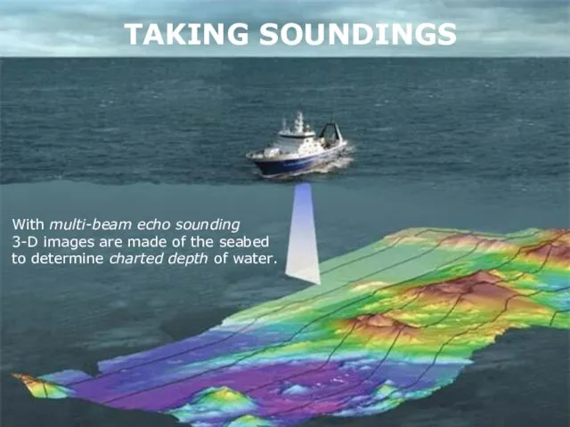
TAKING SOUNDINGS
With multi-beam echo sounding
3-D images are made of the
TAKING SOUNDINGS
With multi-beam echo sounding
3-D images are made of the
so
WIRE SWEEPING
Depth over a protruding obstacle can also be obtained
so
WIRE SWEEPING
Depth over a protruding obstacle can also be obtained
s
Directions
s
Directions
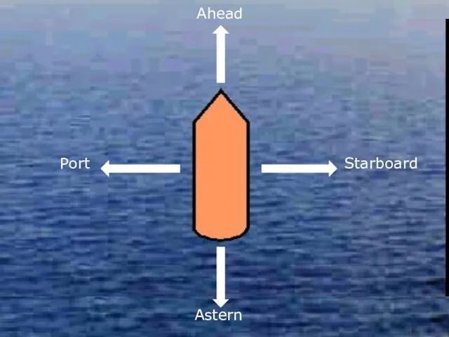
Ahead
Starboard
Astern
Port
Ahead
Starboard
Astern
Port
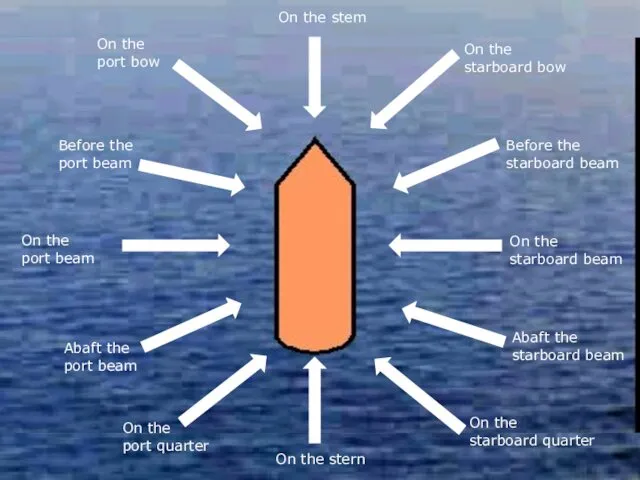
On the stem
On the
starboard bow
Before the
starboard beam
On the
starboard
On the stem
On the
starboard bow
Before the
starboard beam
On the
starboard
 Еуразия жағалауындағы мұхиттар мен теңіздер. Атлант мұхиты
 Водоемы. Интерактивный кроссворд
 Природная зональность. (2 класс)
 The socio-economic, political and cultural achievements of the Republic of Kazakhstan and their role in the world community
 Урал. Освоение и хозяйство. 2 часть. 9 класс
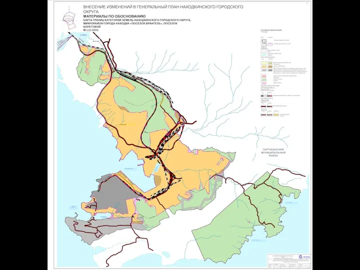 Внесение изменений в генеральный план Находкинского городского округа
 Нововаршавский район
 Классификация полезных ископаемых
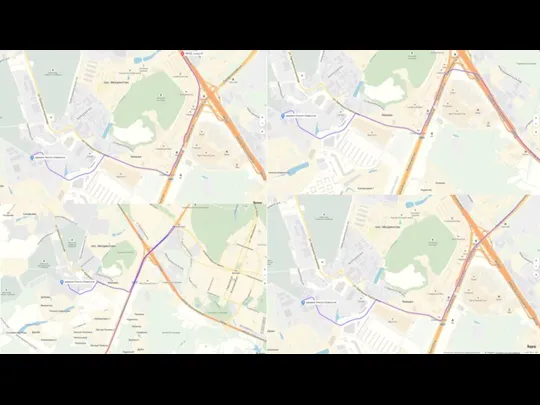 Схема проезда
 Объединенные Арабские Эмираты
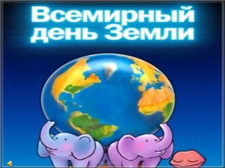 Всемирный День Земли
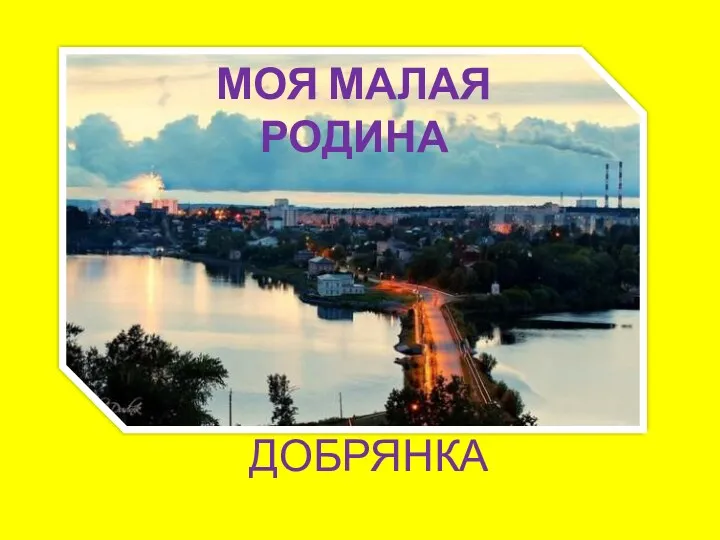 Моя малая Родина. Город Добрянка
 Озера Кольского края
 Географические открытия
 Современная политическая карта мира
 Восточная Сибирь. Величие и суровость природы
 20230321_22.02.2023_g_master_klass
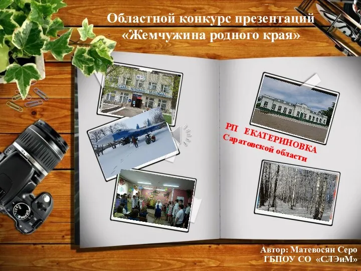 Поселок Екатериновка Саратовской области
 Хозяйство Северо-Западного экономического района РФ
 Изображение на плане неровностей земной поверхности
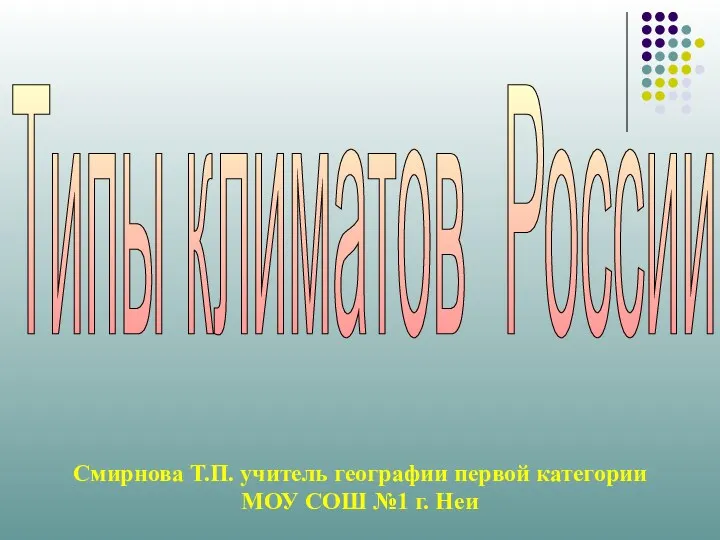 Типы климата на территории России
 Открытия русских путешественников
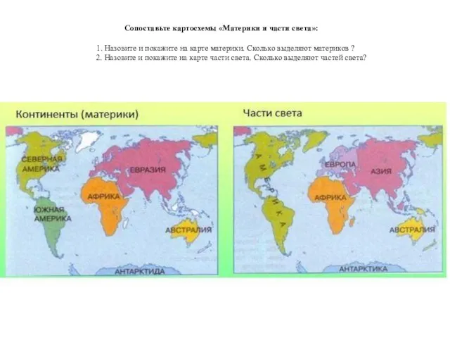 Сопоставьте картосхемы Материки и части света
 Природно-хозяйственные зоны России
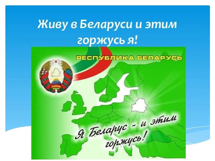 Живу в Беларуси и этим горжусь я
 Дендрологічний парк Софіївка
 Основные течения Мирового океана
 Україна і світ