- The Lands of the Russian Empire, Soviet Union, and Independent States (“Eurasia”)

Содержание
- 2. Introduction Last time – we discussed “what is environmental history?” Today, two parts: 1. Lecture on
- 3. SIZE Russian Empire at start C20 and Soviet Union covered about 1/6th land surface of the
- 4. NORTHERLINESS Much of Eurasia is in north of northern hemisphere Global comparisons: Only Nordic countries (Scandinavia)
- 5. Northern hemisphere
- 6. CONTINENTALITY Russia has coasts on Baltic and Black Seas in NW and SW, White Sea and
- 7. TOPOGRAPHY Much of Eurasia, especially parts where most of population live - flat plains under 400
- 8. CLIMATE Northerliness + continentality + topography = severe continental climate: long, cold winters; short, warm or
- 9. PRECIPITATION (RAIN + SNOW) highest in mountain regions along the periphery otherwise decreases from NW to
- 10. VEGETATION Climate (heat and moisture) -> vegetation zones from N to S: Tundra Forest (taiga in
- 11. Soils = (parent rock + organic matter [plants, animals] + climate + topography) x time Tundra
- 12. NATURAL RESOURCES I The lands of Eurasia have provided resources for people Timber for construction (housing,
- 13. NATURAL RESOURCES II Fossil fuels and minerals Large reserves of coal in Kazakhstan around Karaganda; Kuzbass,
- 14. POPULATION DENSITY (late Soviet period)
- 15. SETTLEMENT Map of population density shows distribution of population in late Soviet period, but also how
- 16. HUMAN SOCIETIES AND ENVIRONMENT IN EURASIA Reciprocal influences? (Environmental history) Or environmental determinism? Low productivity of
- 18. Скачать презентацию
Introduction
Last time – we discussed “what is environmental history?”
Today, two parts:
1.
Introduction
Last time – we discussed “what is environmental history?”
Today, two parts:
1.
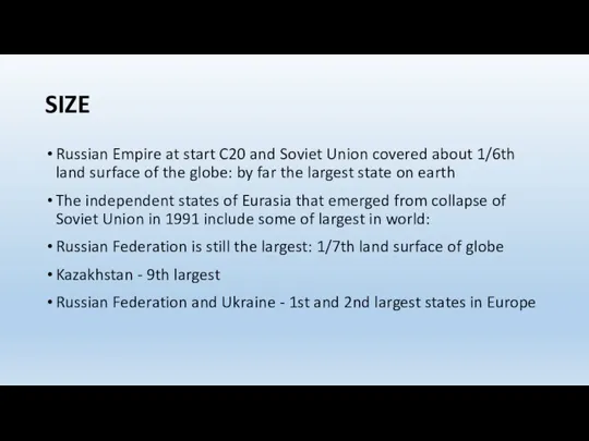
SIZE
Russian Empire at start C20 and Soviet Union covered about 1/6th
SIZE
Russian Empire at start C20 and Soviet Union covered about 1/6th
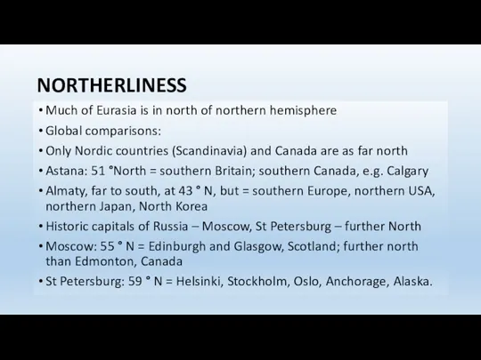
NORTHERLINESS
Much of Eurasia is in north of northern hemisphere
Global comparisons:
Only
NORTHERLINESS
Much of Eurasia is in north of northern hemisphere
Global comparisons:
Only
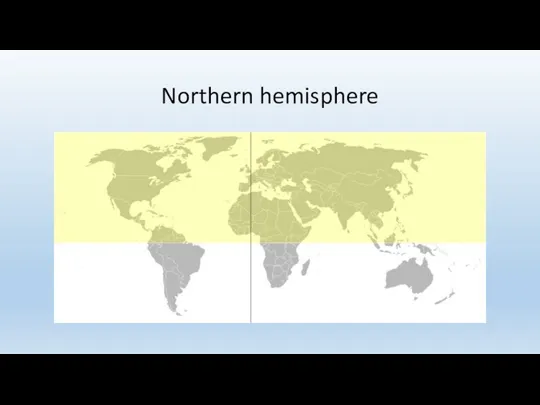
Northern hemisphere
Northern hemisphere
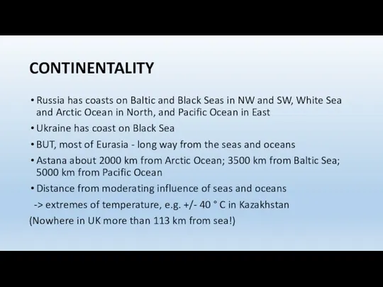
CONTINENTALITY
Russia has coasts on Baltic and Black Seas in NW and
CONTINENTALITY
Russia has coasts on Baltic and Black Seas in NW and
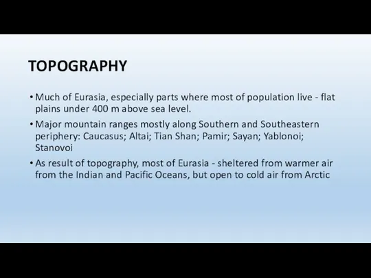
TOPOGRAPHY
Much of Eurasia, especially parts where most of population live -
TOPOGRAPHY
Much of Eurasia, especially parts where most of population live -
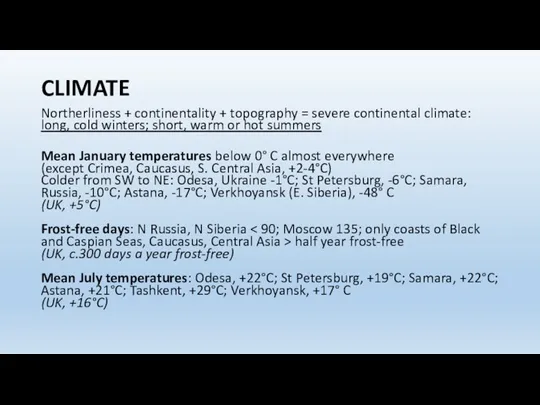
CLIMATE
Northerliness + continentality + topography = severe continental climate: long, cold
CLIMATE
Northerliness + continentality + topography = severe continental climate: long, cold
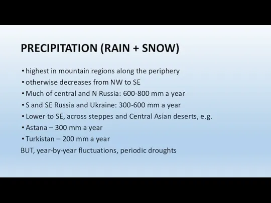
PRECIPITATION (RAIN + SNOW)
highest in mountain regions along the periphery
otherwise decreases
PRECIPITATION (RAIN + SNOW)
highest in mountain regions along the periphery
otherwise decreases
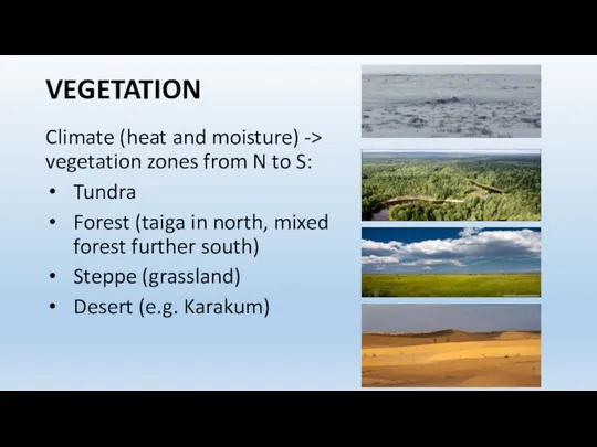
VEGETATION
Climate (heat and moisture) -> vegetation zones from N to
VEGETATION
Climate (heat and moisture) -> vegetation zones from N to
![Soils = (parent rock + organic matter [plants, animals] +](/_ipx/f_webp&q_80&fit_contain&s_1440x1080/imagesDir/jpg/247830/slide-10.jpg)
Soils = (parent rock + organic matter [plants, animals] + climate
Soils = (parent rock + organic matter [plants, animals] + climate

NATURAL RESOURCES I
The lands of Eurasia have provided resources for people
Timber
NATURAL RESOURCES I
The lands of Eurasia have provided resources for people
Timber
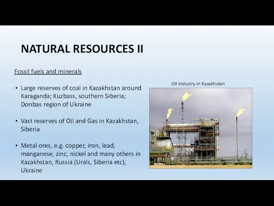
NATURAL RESOURCES II
Fossil fuels and minerals
Large reserves of coal in
NATURAL RESOURCES II
Fossil fuels and minerals
Large reserves of coal in
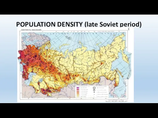
POPULATION DENSITY (late Soviet period)
POPULATION DENSITY (late Soviet period)
SETTLEMENT
Map of population density shows distribution of population in late Soviet
SETTLEMENT
Map of population density shows distribution of population in late Soviet
HUMAN SOCIETIES AND ENVIRONMENT IN EURASIA
Reciprocal influences? (Environmental history)
Or environmental determinism?
Low
HUMAN SOCIETIES AND ENVIRONMENT IN EURASIA
Reciprocal influences? (Environmental history)
Or environmental determinism?
Low
 Природные комплексы Северного Кавказа
 Новосибирская область. Викторина
 География в загадках
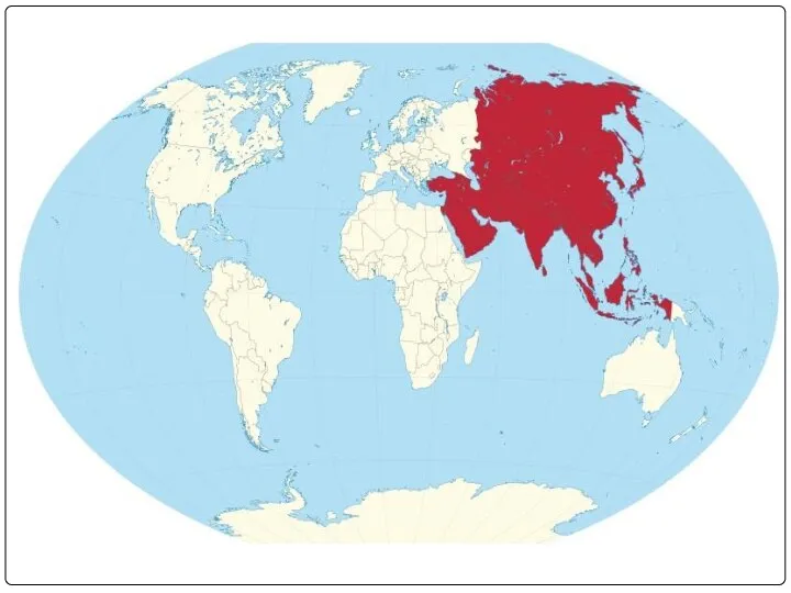 Регион Азия
 Достопримечательности Карелии
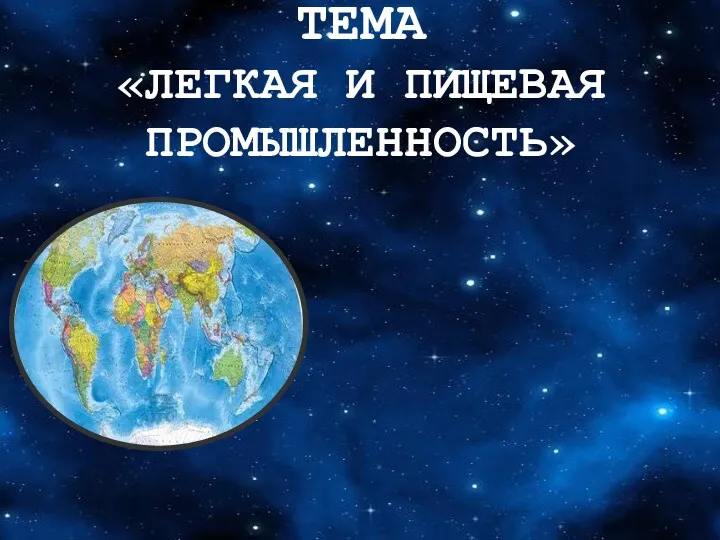 Лёгкая и пищевая промышленность. Состав, особенности, продукция
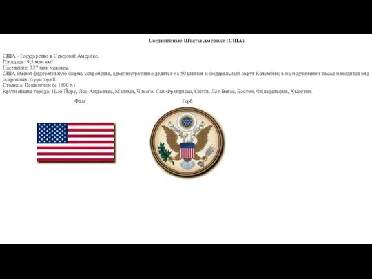 Соединённые Штаты Америки
 Фото на конкурс экологической фотографии №1
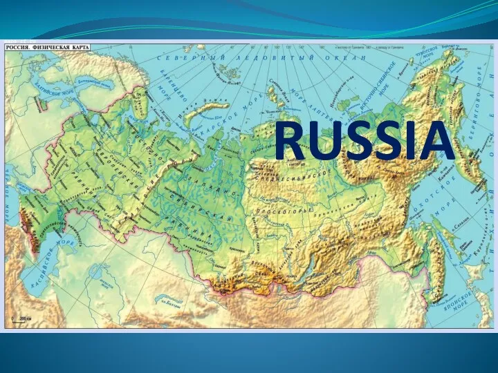 Russia
 Что такое заливы
 Основные понятия в ландшафтоведении
 Грузия. Административный состав объектов
 Почвы. Образование почв и разнообразие
 Государственная территория России. Типы российских границ
 Туристические объекты национального парка “Русский Север”
 Путешествие в удивительную Германию
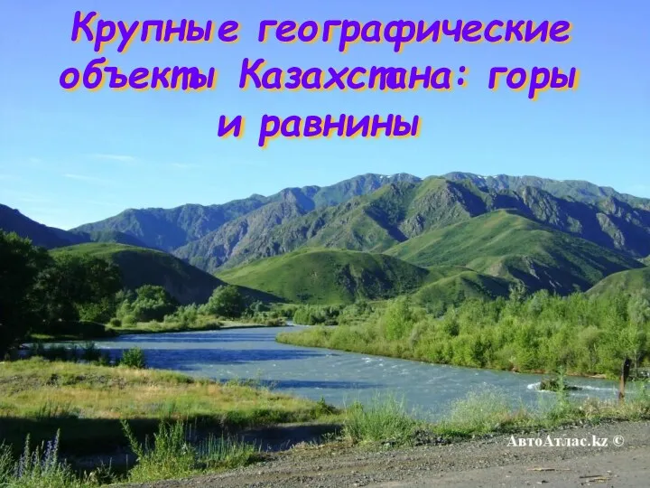 Крупные географические объекты Казахстана: горы и равнины
 Ќойгелді орта мектебі
 Canada
 Жердің пішіндері және қозғалысы
 я гражданин
 Водная оболочка Земли - гидросфера
 Германия
 Воздушные массы и типы климата
 Предмет и задачи геологии. Связь с другими науками. Лекция 0 -Введение
 Топырақты эрозиядан (су, жел). Қорғау мәселелрі
 Полезные ископаемые Калининградской области
 10 пам’яток Херсонської області