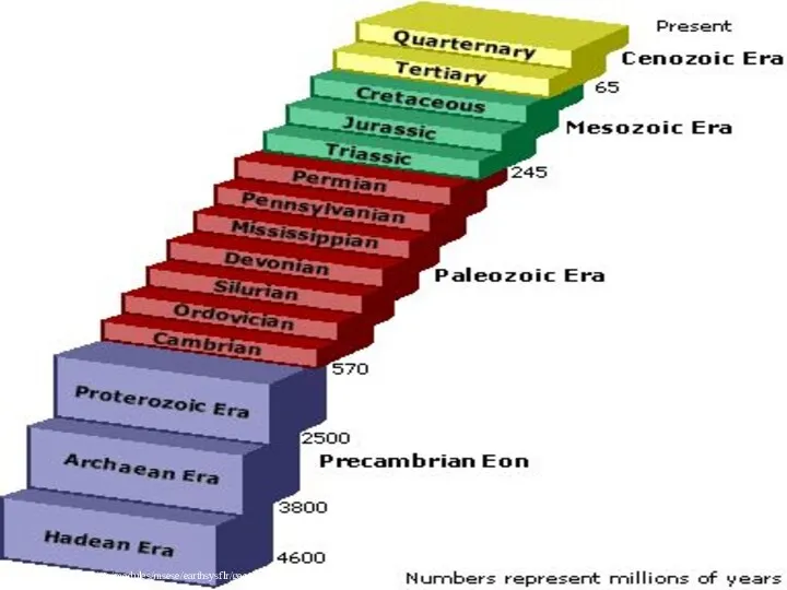
- The Phanerozoic оf Egypt

Содержание
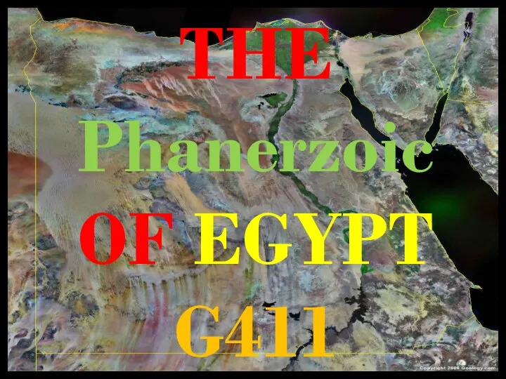
- 2. THE Phanerzoic OF EGYPT G411
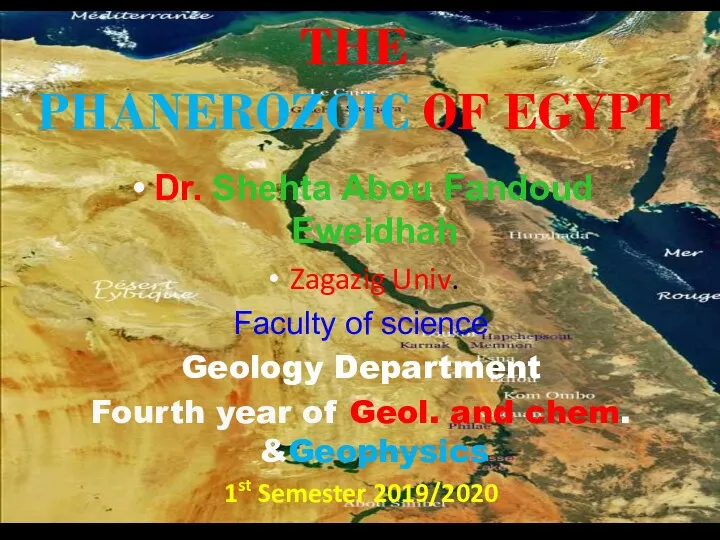
- 3. THE PHANEROZOIC OF EGYPT Dr. Shehta Abou Fandoud Eweidhah Zagazig Univ. Faculty of science Geology Department
- 4. 10/1/2019 Course Grading ACTIVITIES PERCENTAGES Class Exercises 10 % Lab exam 10 % Midterm exam 10
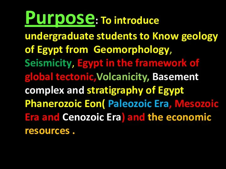
- 5. Purpose: To introduce undergraduate students to Know geology of Egypt from Geomorphology, Seismicity, Egypt in the
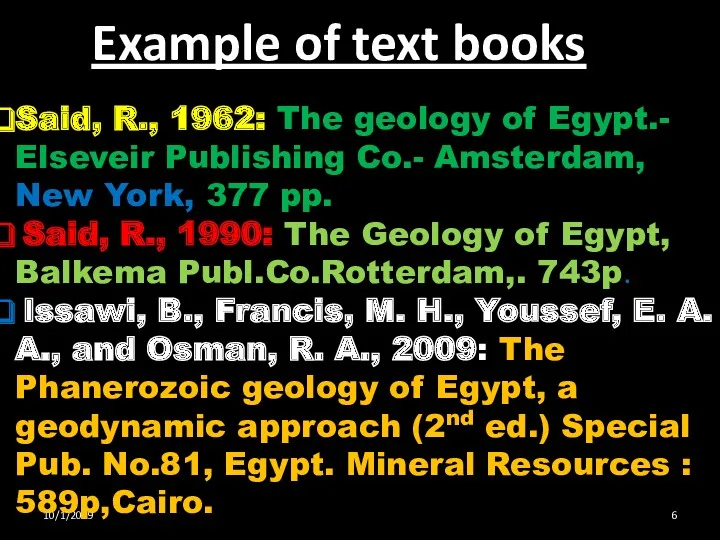
- 6. 10/1/2019 Example of text books Said, R., 1962: The geology of Egypt.- Elseveir Publishing Co.- Amsterdam,
- 7. http://www.cotf.edu/ete/modules/msese/earthsysflr/geotime.html
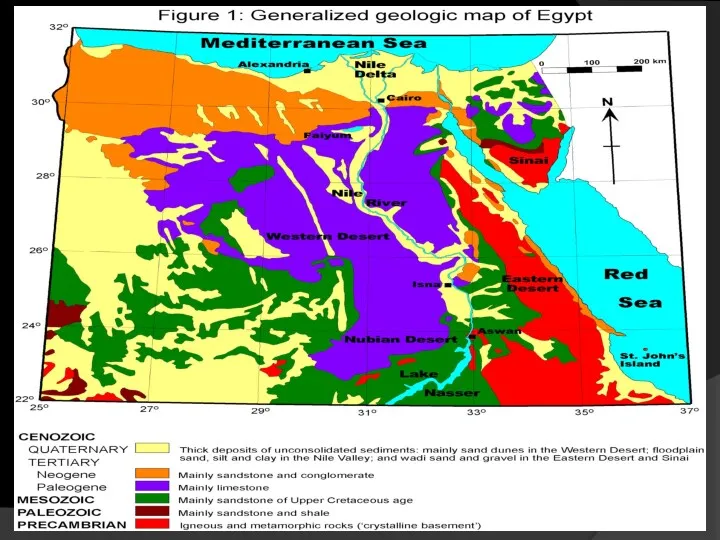
- 8. Introduction The present work presents the framework on the Phanerozoic of Egypt; its stratigraphy & structural
- 9. GEOMORPHOLOGY OF EGYPT G 411 Lecture Topics 1st semester 2019 Egypt in the framework of global
- 10. Course Introduction
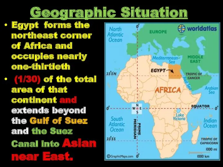
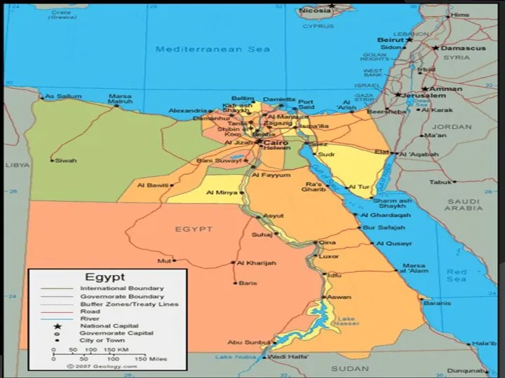
- 11. Geographic Situation Egypt forms the northeast corner of Africa and occupies nearly one-thirtieth (1/30) of the
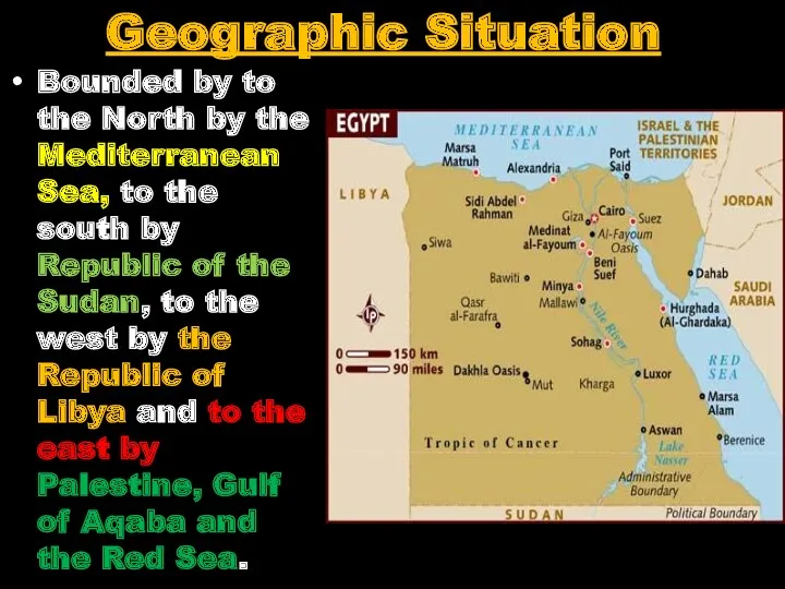
- 12. Geographic Situation Bounded by to the North by the Mediterranean Sea, to the south by Republic
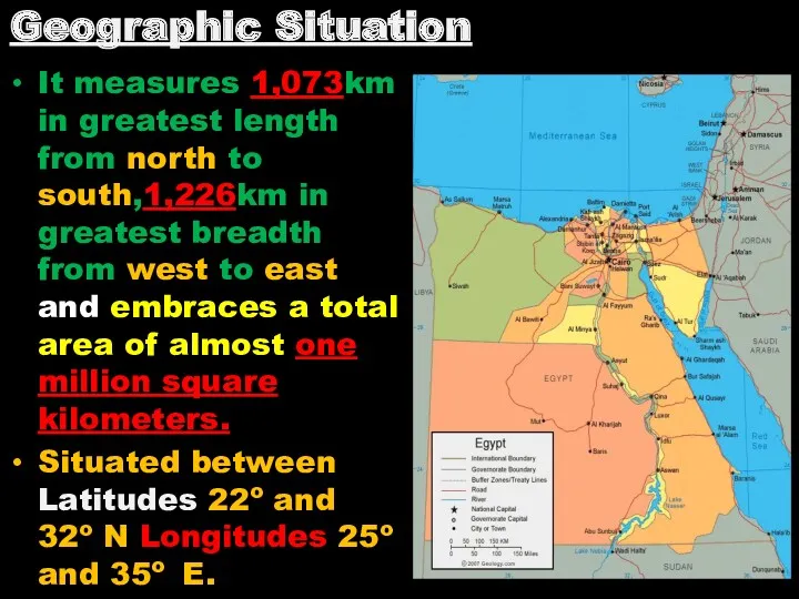
- 13. It measures 1,073km in greatest length from north to south,1,226km in greatest breadth from west to
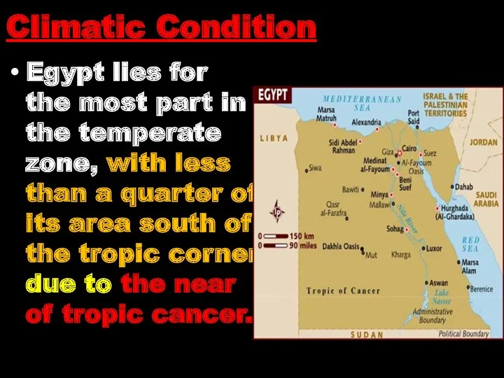
- 14. Egypt lies for the most part in the temperate zone, with less than a quarter of
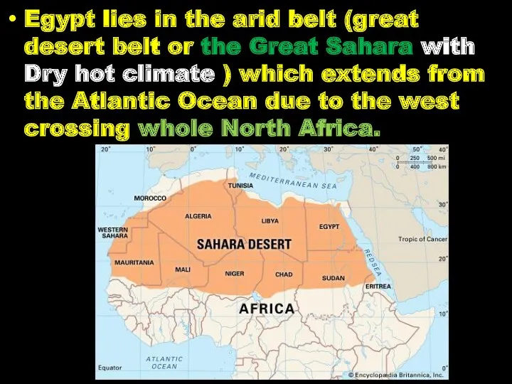
- 15. Egypt lies in the arid belt (great desert belt or the Great Sahara with Dry hot
- 16. Morocco, Algeria, Tunis, Lybia and Egypt and further to the east ,Saudi Arabia, Arab Gulf ,
- 17. The climate is characterized by a warm and almost rainless climate. The air temperature in Egypt
- 18. The average rainfall over the country of winter only about 1 cm a year . Even
- 19. Its only through the River Nile that a regular and voluminous supply of water ,coming from
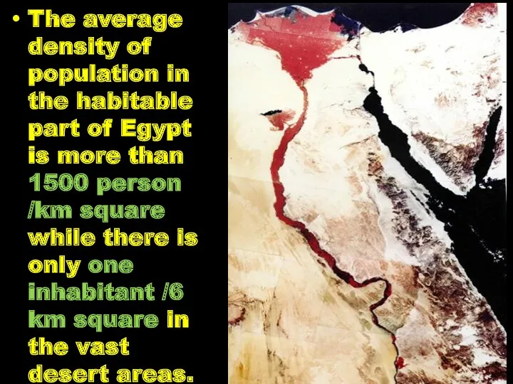
- 20. The average density of population in the habitable part of Egypt is more than 1500 person
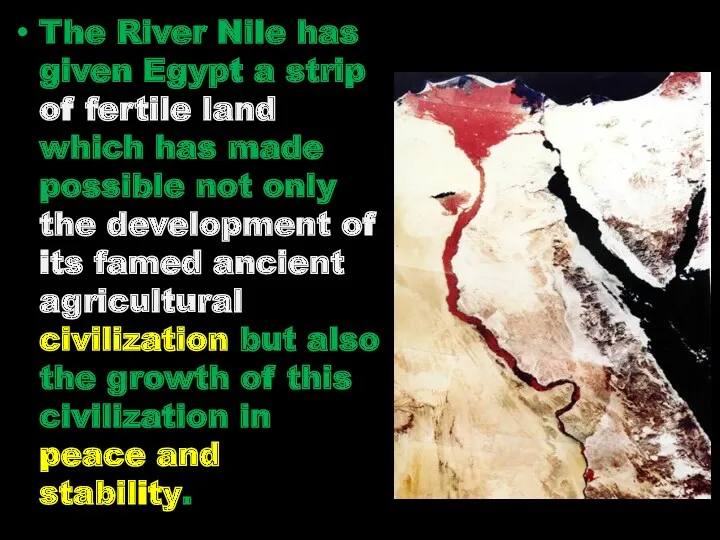
- 21. The River Nile has given Egypt a strip of fertile land which has made possible not
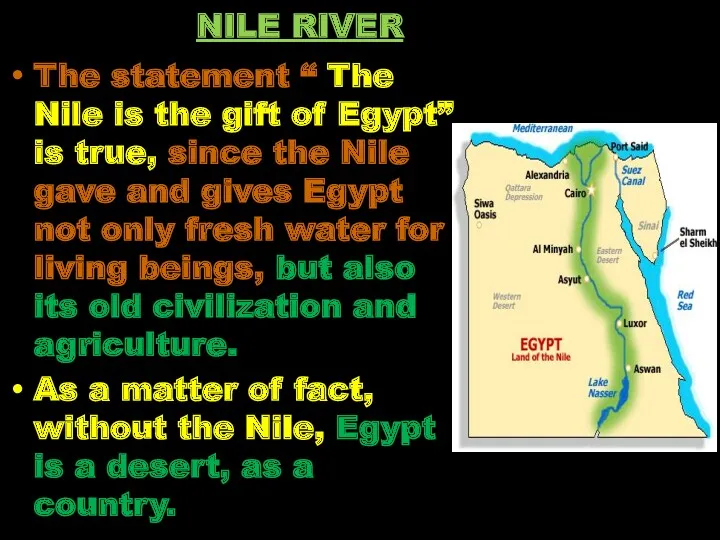
- 22. The statement “ The Nile is the gift of Egypt” is true, since the Nile gave
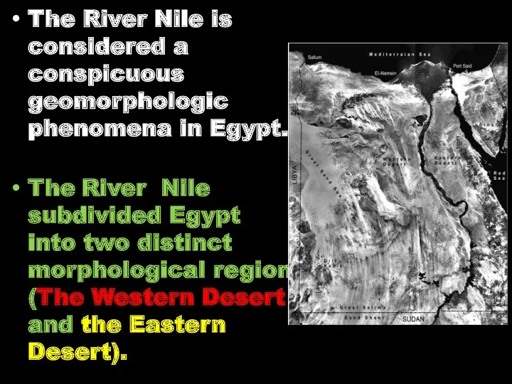
- 23. The River Nile is considered a conspicuous geomorphologic phenomena in Egypt. The River Nile subdivided Egypt
- 24. The region to the east consists of a dissected plateau draining to the Nile river or
- 25. While the region to the west consists of a series of unconnected depressions with wide and
- 26. The table - land between kharga Oasis and the Nile is in continuation with Maasa plateau
- 27. Review Egypt forms the northeastern corner of Africa and occupies nearly 1/30th of the total area
- 28. Review Max. Summer temp. over 40ºC and min. Winter temp. 0ºC. Average rainfall 1cm/y, along the
- 29. GEOMORPHOLOGICAL FEATURES OF EGYPT
- 30. Objectives Base of geomorphological classification Main Geomorphological units
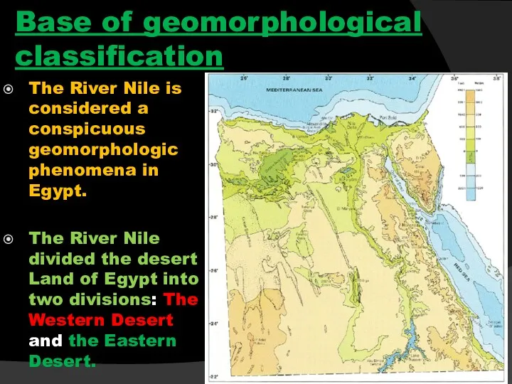
- 31. Base of geomorphological classification The River Nile is considered a conspicuous geomorphologic phenomena in Egypt. The
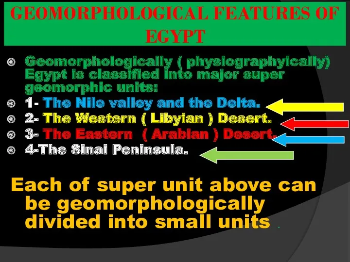
- 32. Geomorphologically ( physiographyically) Egypt is classified into major super geomorphic units: 1- The Nile valley and
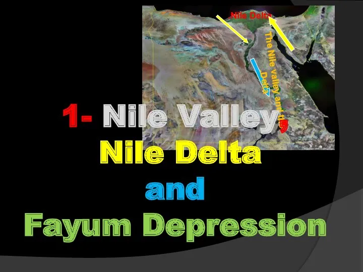
- 33. Nile Delta. The Nile valley and the Delta. 1- Nile Valley, Nile Delta and Fayum Depression
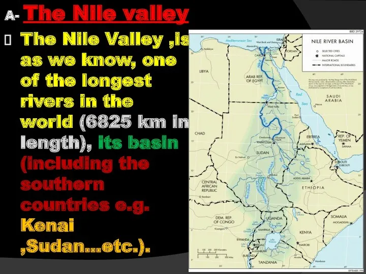
- 34. A- The Nile valley The Nile Valley ,is as we know, one of the longest rivers
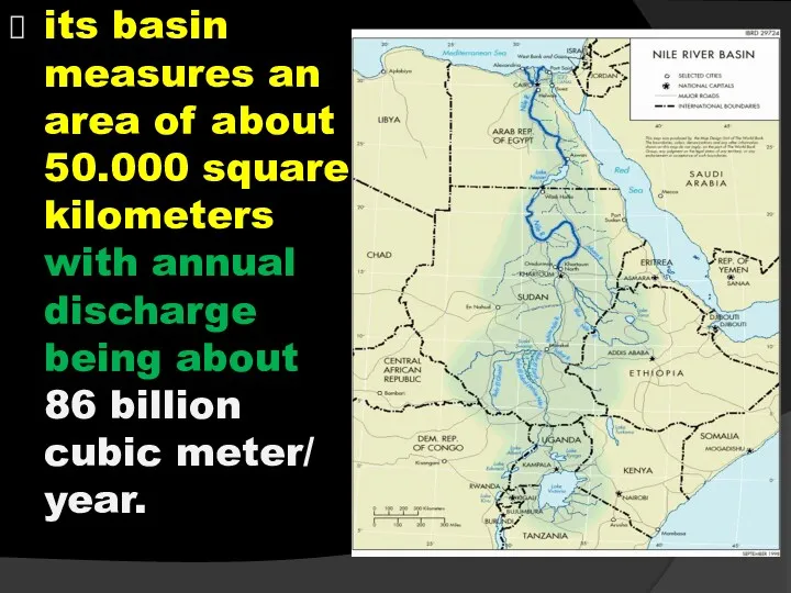
- 35. its basin measures an area of about 50.000 square kilometers with annual discharge being about 86
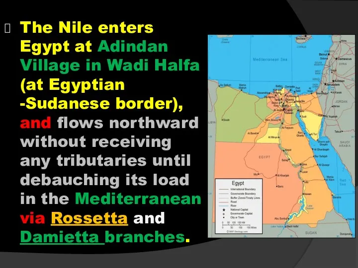
- 36. The Nile enters Egypt at Adindan Village in Wadi Halfa (at Egyptian -Sudanese border), and flows
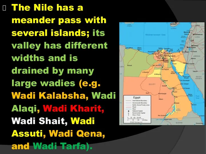
- 37. The Nile has a meander pass with several islands; its valley has different widths and is
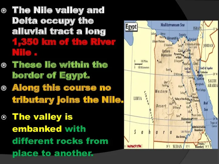
- 38. The Nile valley and Delta occupy the alluvial tract a long 1,350 km of the River
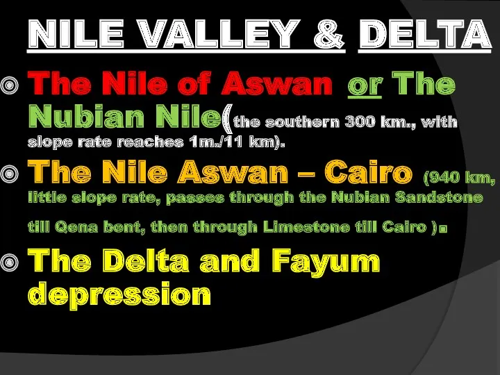
- 40. NILE VALLEY & DELTA The Nile of Aswan or The Nubian Nile(the southern 300 km., with
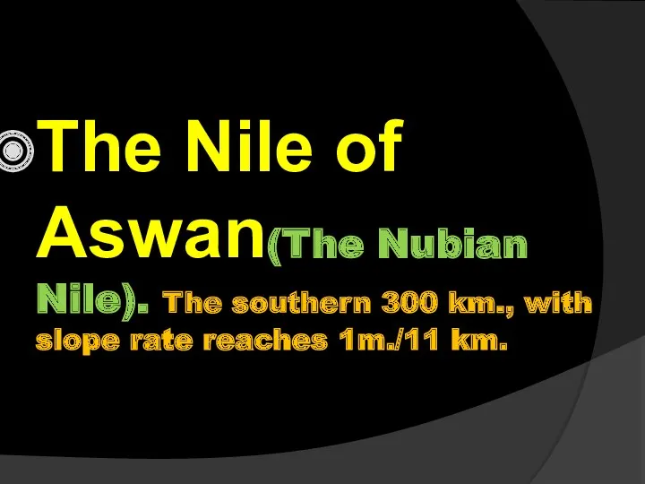
- 42. The Nile of Aswan(The Nubian Nile). The southern 300 km., with slope rate reaches 1m./11 km.
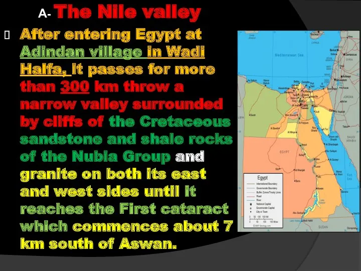
- 43. A- The Nile valley After entering Egypt at Adindan village in Wadi Halfa, it passes for
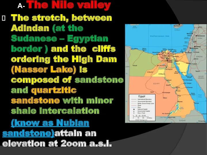
- 44. A- The Nile valley The stretch, between Adindan (at the Sudanese – Egyptian border ) and
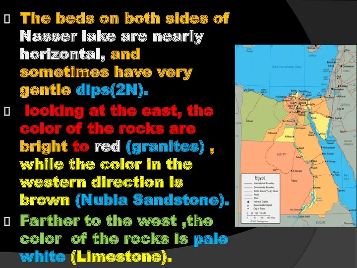
- 45. The beds on both sides of Nasser lake are nearly horizontal, and sometimes have very gentle
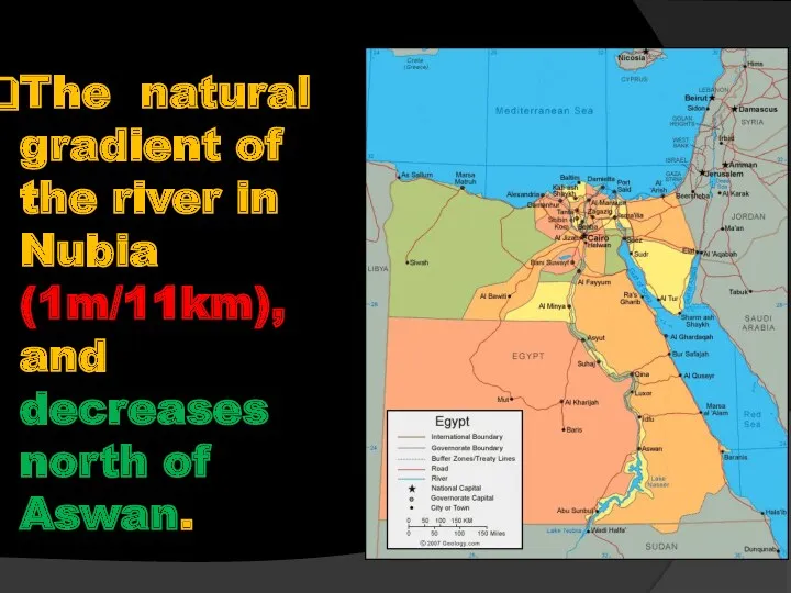
- 46. The natural gradient of the river in Nubia (1m/11km), and decreases north of Aswan.
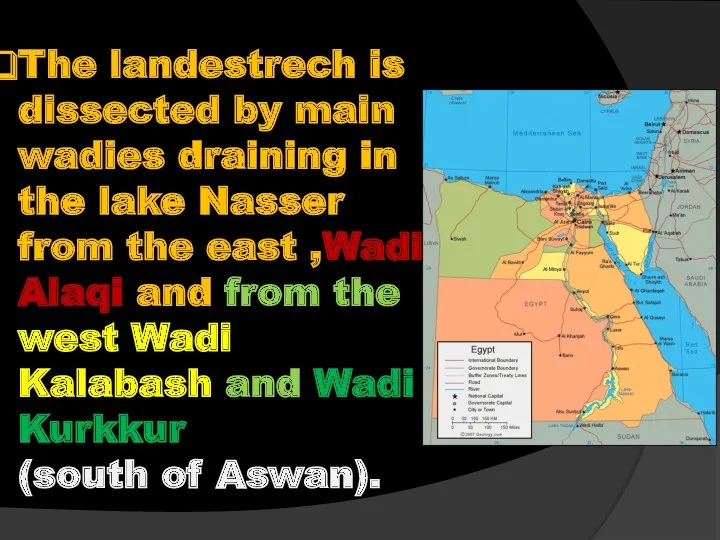
- 47. The landestrech is dissected by main wadies draining in the lake Nasser from the east ,Wadi
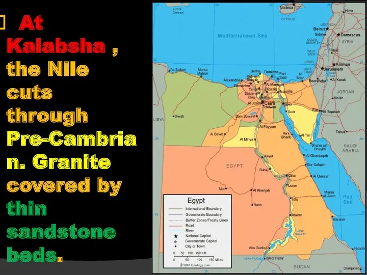
- 48. At Kalabsha , the Nile cuts through Pre-Cambrian. Granite covered by thin sandstone beds.
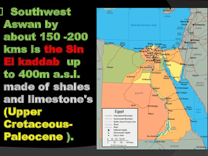
- 49. Southwest Aswan by about 150 -200 kms is the Sin El kaddab up to 400m a.s.l.
- 50. Review (The Nubian Nile) 300 km from Wadi Halfa to the 1st Cataract to the south
- 51. The Nile Aswan – Cairo
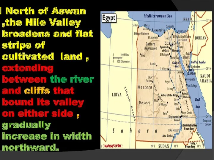
- 52. North of Aswan ,the Nile Valley broadens and flat strips of cultivated land , extending between
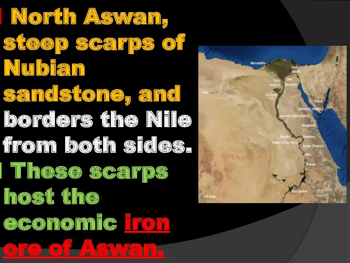
- 53. North Aswan, steep scarps of Nubian sandstone, and borders the Nile from both sides. These scarps
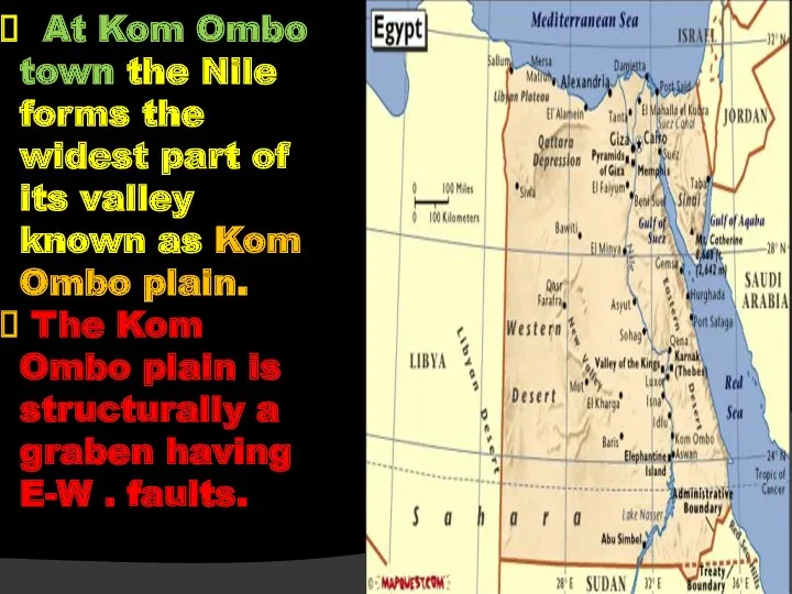
- 54. At Kom Ombo town the Nile forms the widest part of its valley known as Kom
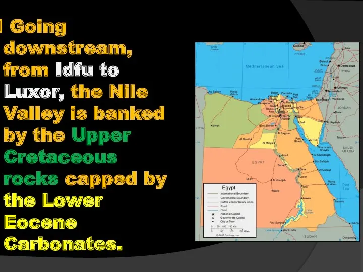
- 55. Going downstream, from Idfu to Luxor, the Nile Valley is banked by the Upper Cretaceous rocks
- 56. At that stretch is located the Phosphate deposits of the Nile Valley (at El Mahamid village
- 57. At Qena about 120 km north of Esna, the river makes a great bend bounded by
- 58. From Nag Hammadi to Assiut city the Eastern side of the Nile Valley is borderd by
- 59. – wards to Cairo for example the thick sequence of Helwane, Tura , and G.El Mokattam
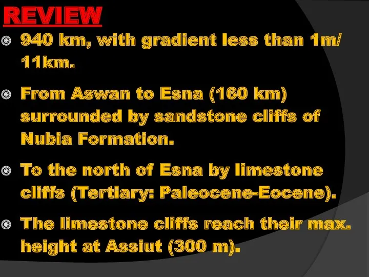
- 60. REVIEW 940 km, with gradient less than 1m/ 11km. From Aswan to Esna (160 km) surrounded
- 61. REVIEW The eastern cliff is always higher than the western one and the age of the
- 62. REVIEW Isolated blocks of granites obstruct the Nile course forming cataracts (e.g. Aswan cataract) North Aswan,
- 63. REVIEW From Idfu to Luxor, the Nile Valley is banked by the Upper Cretaceous rocks capped
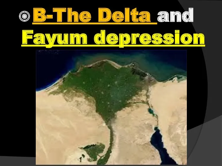
- 64. B-The Delta and Fayum depression
- 65. The Latitude and Longitude of CAIRO are 30 degree N and 31 degree E respectively.
- 66. B-The Nile Delta
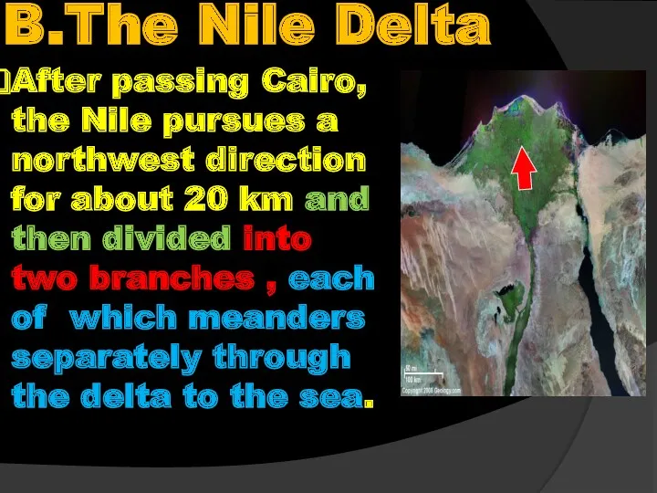
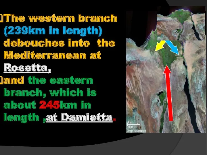
- 67. B.The Nile Delta After passing Cairo, the Nile pursues a northwest direction for about 20 km
- 68. The western branch (239km in length) debouches into the Mediterranean at Rosetta, and the eastern branch,
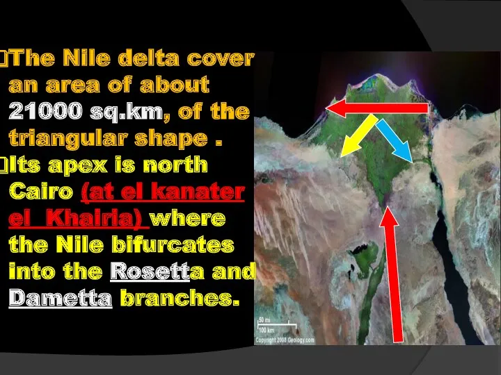
- 69. The Nile delta cover an area of about 21000 sq.km, of the triangular shape . Its
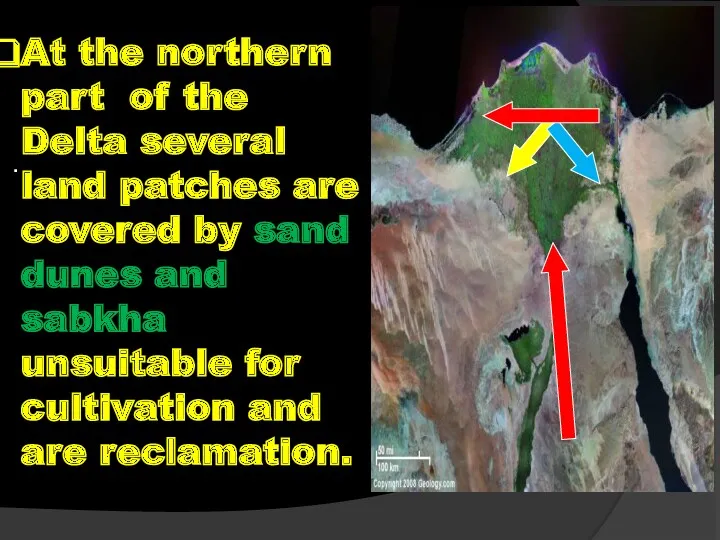
- 70. . At the northern part of the Delta several land patches are covered by sand dunes
- 71. REVIEW It begins 20 km to the north of Cairo. The Nile Delta covers a triangular
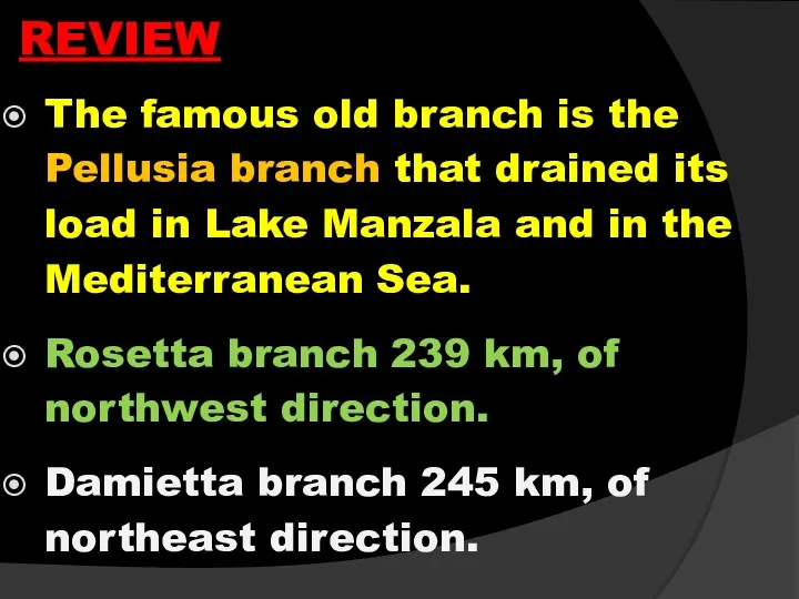
- 72. REVIEW The famous old branch is the Pellusia branch that drained its load in Lake Manzala
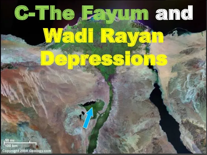
- 73. . C-The Fayum and Wadi Rayan Depressions
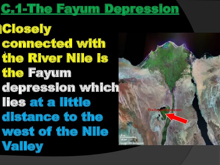
- 74. . C.1-The Fayum Depression Closely connected with the River Nile is the Fayum depression which lies
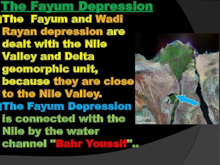
- 75. . The Fayum Depression The Fayum and Wadi Rayan depression are dealt with the Nile Valley
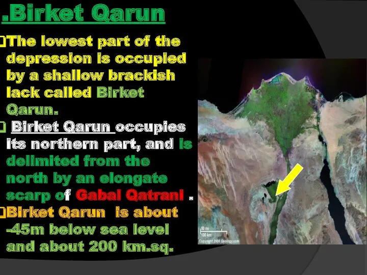
- 76. The lowest part of the depression is occupied by a shallow brackish lack called Birket Qarun.
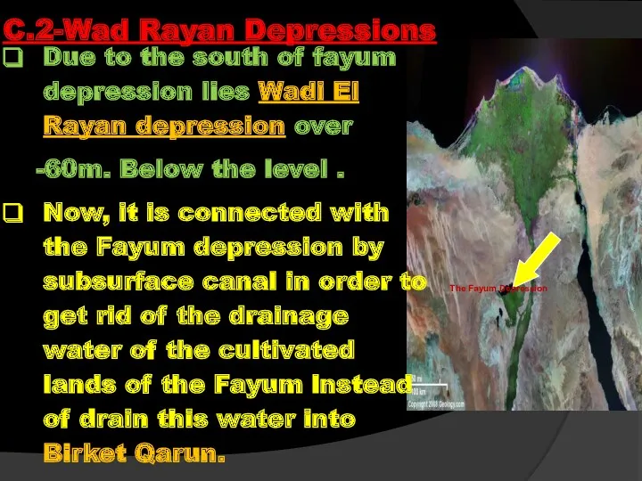
- 77. Due to the south of fayum depression lies Wadi El Rayan depression over -60m. Below the
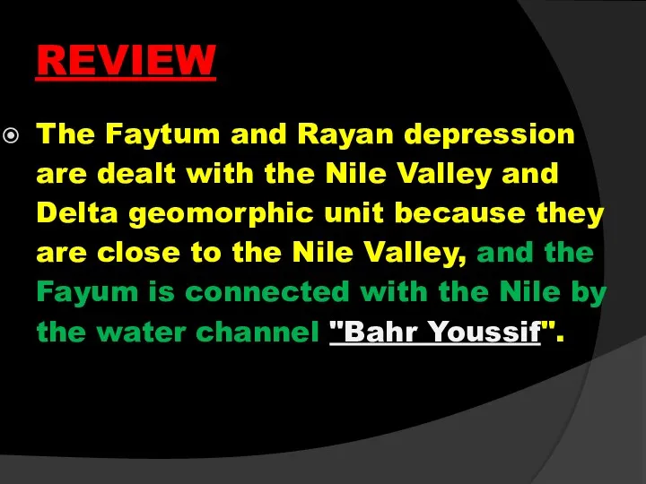
- 78. REVIEW The Faytum and Rayan depression are dealt with the Nile Valley and Delta geomorphic unit
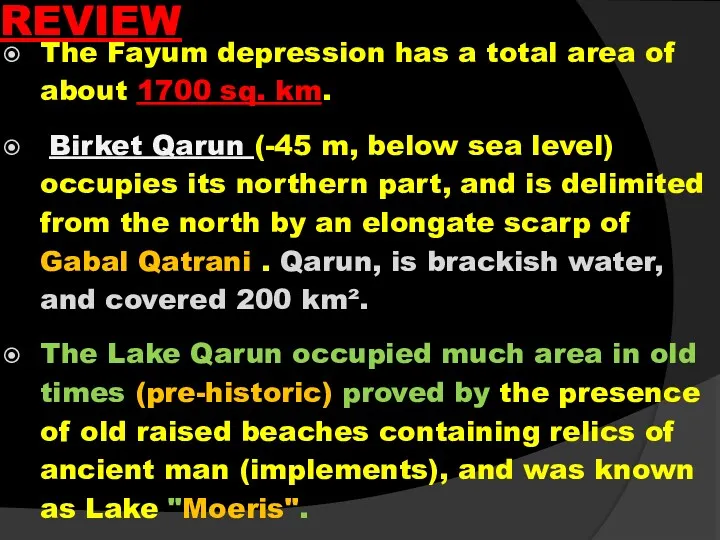
- 79. The Fayum depression has a total area of about 1700 sq. km. Birket Qarun (-45 m,
- 80. Due to the south of Fayum depression lies Wadi El Rayan depression being over -60 m
- 82. Скачать презентацию
THE Phanerzoic
OF EGYPT
G411
THE Phanerzoic
OF EGYPT
G411
THE
PHANEROZOIC OF EGYPT
Dr. Shehta Abou Fandoud Eweidhah
Zagazig Univ.
Faculty of science
Geology
THE
PHANEROZOIC OF EGYPT
Dr. Shehta Abou Fandoud Eweidhah
Zagazig Univ.
Faculty of science
Geology

10/1/2019
Course Grading
ACTIVITIES PERCENTAGES
Class Exercises 10 %
Lab exam 10 %
Midterm exam 10
10/1/2019
Course Grading
ACTIVITIES PERCENTAGES
Class Exercises 10 %
Lab exam 10 %
Midterm exam 10
Purpose: To introduce undergraduate students to Know geology of Egypt from
Purpose: To introduce undergraduate students to Know geology of Egypt from
10/1/2019
Example of text books
Said, R., 1962: The geology of Egypt.- Elseveir
10/1/2019
Example of text books
Said, R., 1962: The geology of Egypt.- Elseveir
http://www.cotf.edu/ete/modules/msese/earthsysflr/geotime.html
http://www.cotf.edu/ete/modules/msese/earthsysflr/geotime.html
Introduction
The present work presents the framework on the Phanerozoic of Egypt;
Introduction
The present work presents the framework on the Phanerozoic of Egypt;
GEOMORPHOLOGY OF EGYPT
G 411 Lecture Topics 1st semester 2019
Egypt in
G 411 Lecture Topics 1st semester 2019
Egypt in

Course Introduction
Course Introduction
Geographic Situation
Egypt forms the northeast corner of Africa and occupies nearly
Geographic Situation
Egypt forms the northeast corner of Africa and occupies nearly
Geographic Situation
Bounded by to the North by the Mediterranean Sea, to
Geographic Situation
Bounded by to the North by the Mediterranean Sea, to
It measures 1,073km in greatest length from north to south,1,226km in
It measures 1,073km in greatest length from north to south,1,226km in
Egypt lies for the most part in the temperate zone, with
Egypt lies for the most part in the temperate zone, with
Egypt lies in the arid belt (great desert belt or the
Egypt lies in the arid belt (great desert belt or the
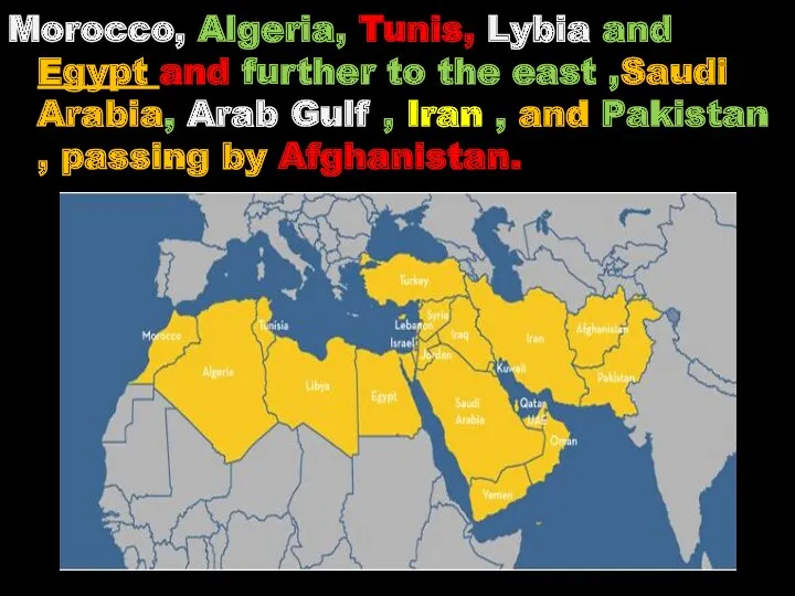
Morocco, Algeria, Tunis, Lybia and Egypt and further to the east
Morocco, Algeria, Tunis, Lybia and Egypt and further to the east
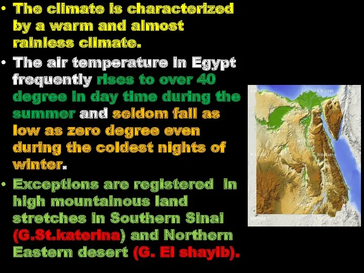
The climate is characterized by a warm and almost rainless climate.
The
The climate is characterized by a warm and almost rainless climate.
The
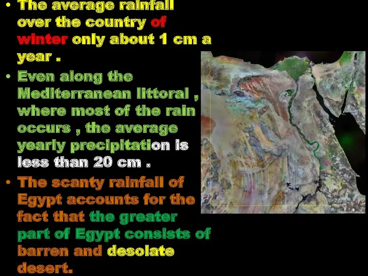
The average rainfall over the country of winter only about 1
The average rainfall over the country of winter only about 1
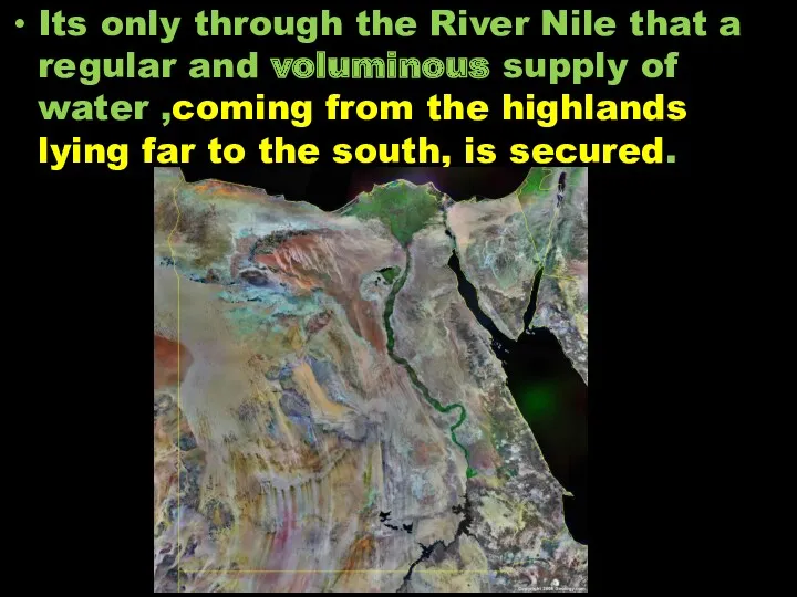
Its only through the River Nile that a regular and voluminous
Its only through the River Nile that a regular and voluminous
The average density of population in the habitable part of Egypt
The average density of population in the habitable part of Egypt
The River Nile has given Egypt a strip of fertile land
The River Nile has given Egypt a strip of fertile land
The statement “ The Nile is the gift of Egypt” is
The statement “ The Nile is the gift of Egypt” is
The River Nile is considered a conspicuous geomorphologic phenomena in Egypt.
The
The River Nile is considered a conspicuous geomorphologic phenomena in Egypt.
The
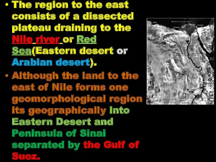
The region to the east consists of a dissected plateau draining
The region to the east consists of a dissected plateau draining
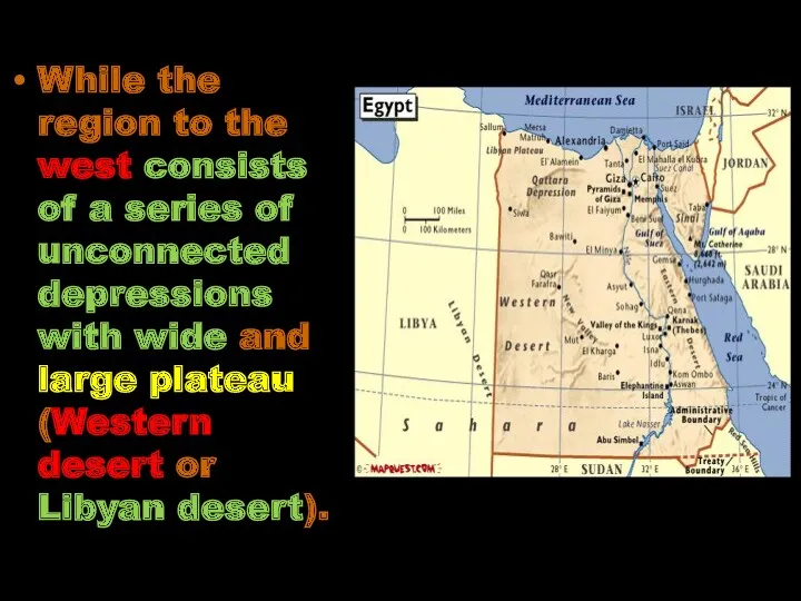
While the region to the west consists of a series of
While the region to the west consists of a series of
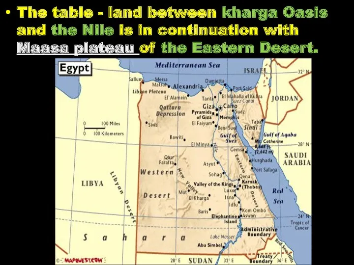
The table - land between kharga Oasis and the Nile is
The table - land between kharga Oasis and the Nile is
Review
Egypt forms the northeastern corner of Africa and occupies nearly 1/30th
Review
Egypt forms the northeastern corner of Africa and occupies nearly 1/30th
Review
Max. Summer temp. over 40ºC and min. Winter temp. 0ºC.
Average rainfall
Review
Max. Summer temp. over 40ºC and min. Winter temp. 0ºC.
Average rainfall
GEOMORPHOLOGICAL
FEATURES OF
EGYPT
GEOMORPHOLOGICAL
FEATURES OF
EGYPT
Objectives
Base of geomorphological classification
Main Geomorphological units
Objectives
Base of geomorphological classification
Main Geomorphological units
Base of geomorphological classification
The River Nile is considered a conspicuous geomorphologic
Base of geomorphological classification
The River Nile is considered a conspicuous geomorphologic
Geomorphologically ( physiographyically) Egypt is classified into major super geomorphic units:
1-
Geomorphologically ( physiographyically) Egypt is classified into major super geomorphic units:
1-
Nile Delta.
The Nile valley and the Delta.
1- Nile Valley,
Nile Delta
Nile Delta.
The Nile valley and the Delta.
1- Nile Valley,
Nile Delta
A- The Nile valley
The Nile Valley ,is as we know, one
A- The Nile valley
The Nile Valley ,is as we know, one
its basin measures an area of about 50.000 square kilometers with
its basin measures an area of about 50.000 square kilometers with
The Nile enters Egypt at Adindan Village in Wadi Halfa (at
The Nile enters Egypt at Adindan Village in Wadi Halfa (at
The Nile has a meander pass with several islands; its valley
The Nile has a meander pass with several islands; its valley
The Nile valley and Delta occupy the alluvial tract a long
NILE VALLEY & DELTA
The Nile of Aswan or The Nubian Nile(the
NILE VALLEY & DELTA
The Nile of Aswan or The Nubian Nile(the
The Nile of Aswan(The Nubian Nile). The southern 300 km., with
The Nile of Aswan(The Nubian Nile). The southern 300 km., with
A- The Nile valley
After entering Egypt at Adindan village in Wadi
A- The Nile valley
After entering Egypt at Adindan village in Wadi
A- The Nile valley
The stretch, between Adindan (at the Sudanese –
A- The Nile valley
The stretch, between Adindan (at the Sudanese –
The beds on both sides of Nasser lake are nearly horizontal,
The beds on both sides of Nasser lake are nearly horizontal,
The natural gradient of the river in Nubia (1m/11km), and decreases
The natural gradient of the river in Nubia (1m/11km), and decreases
The landestrech is dissected by main wadies draining in the lake
The landestrech is dissected by main wadies draining in the lake
At Kalabsha , the Nile cuts through Pre-Cambrian. Granite covered
At Kalabsha , the Nile cuts through Pre-Cambrian. Granite covered
Southwest Aswan by about 150 -200 kms is the Sin
Southwest Aswan by about 150 -200 kms is the Sin
Review (The Nubian Nile)
300 km from Wadi Halfa to the 1st
Review (The Nubian Nile)
300 km from Wadi Halfa to the 1st
The Nile Aswan – Cairo
The Nile Aswan – Cairo
North of Aswan ,the Nile Valley broadens and flat strips
North of Aswan ,the Nile Valley broadens and flat strips
North Aswan, steep scarps of Nubian sandstone, and borders the
North Aswan, steep scarps of Nubian sandstone, and borders the
At Kom Ombo town the Nile forms the widest part
At Kom Ombo town the Nile forms the widest part
Going downstream, from Idfu to Luxor, the Nile Valley is
Going downstream, from Idfu to Luxor, the Nile Valley is
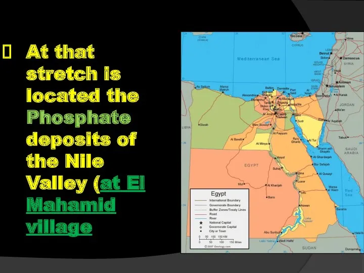
At that stretch is located the Phosphate deposits of the Nile
At that stretch is located the Phosphate deposits of the Nile
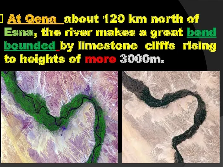
At Qena about 120 km north of Esna, the river
At Qena about 120 km north of Esna, the river
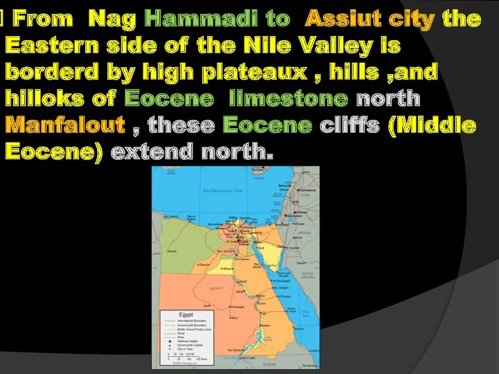
From Nag Hammadi to Assiut city the Eastern side of
From Nag Hammadi to Assiut city the Eastern side of
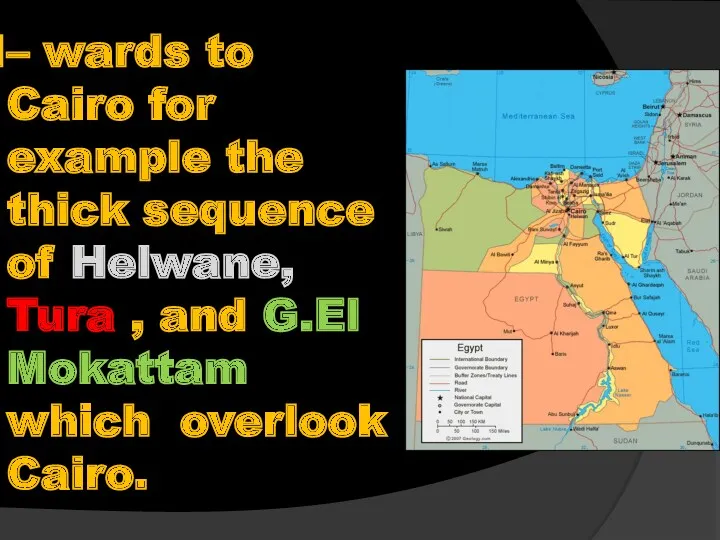
– wards to Cairo for example the thick sequence of Helwane,
– wards to Cairo for example the thick sequence of Helwane,
REVIEW
940 km, with gradient less than 1m/ 11km.
From Aswan to Esna
REVIEW
940 km, with gradient less than 1m/ 11km.
From Aswan to Esna
REVIEW
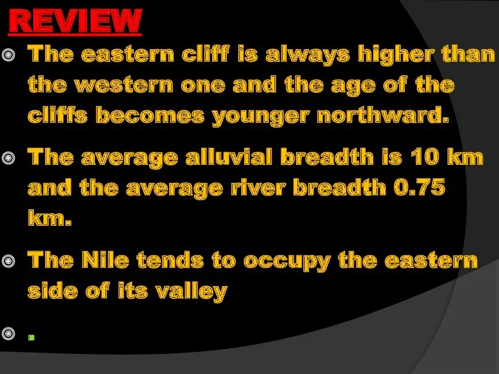
The eastern cliff is always higher than the western one and
REVIEW
The eastern cliff is always higher than the western one and
REVIEW
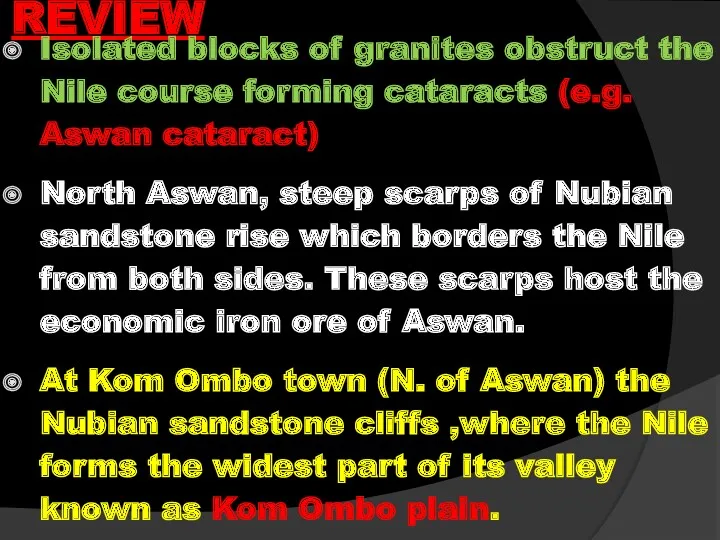
Isolated blocks of granites obstruct the Nile course forming cataracts (e.g.
REVIEW
Isolated blocks of granites obstruct the Nile course forming cataracts (e.g.
REVIEW
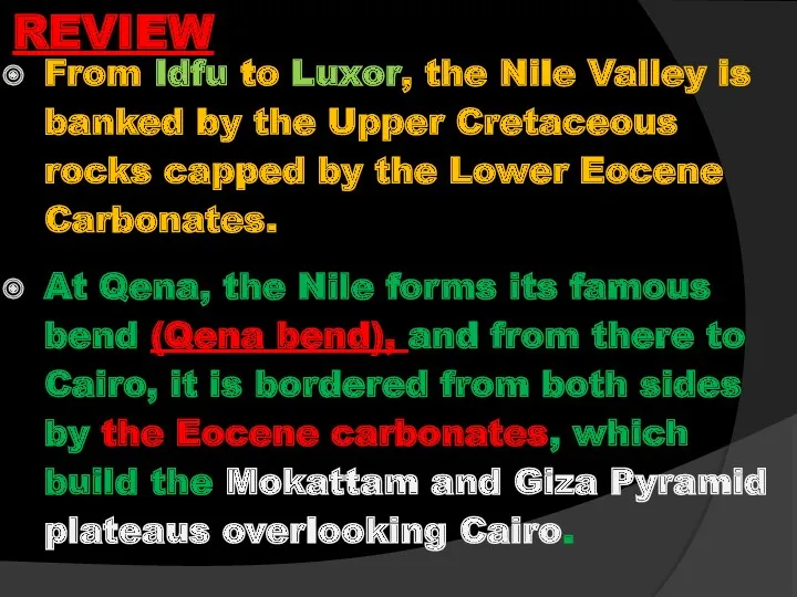
From Idfu to Luxor, the Nile Valley is banked by the
REVIEW
From Idfu to Luxor, the Nile Valley is banked by the
B-The Delta and Fayum depression
B-The Delta and Fayum depression
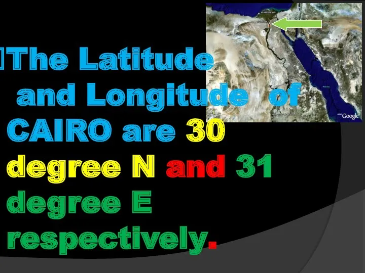
The Latitude
and Longitude of CAIRO are 30 degree N and
The Latitude
and Longitude of CAIRO are 30 degree N and
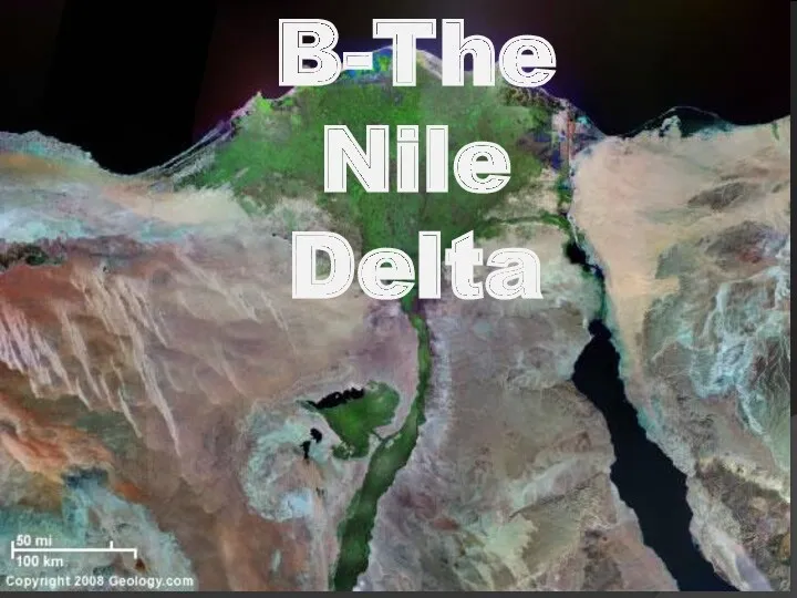
B-The Nile Delta
B-The Nile Delta
B.The Nile Delta
After passing Cairo, the Nile pursues a northwest direction
B.The Nile Delta
After passing Cairo, the Nile pursues a northwest direction
The western branch (239km in length) debouches into the Mediterranean at
The western branch (239km in length) debouches into the Mediterranean at
The Nile delta cover an area of about 21000 sq.km, of
The Nile delta cover an area of about 21000 sq.km, of
.
At the northern part of the Delta several land patches are
At the northern part of the Delta several land patches are
REVIEW
It begins 20 km to the north of Cairo.
The Nile Delta
REVIEW
It begins 20 km to the north of Cairo.
The Nile Delta
REVIEW
The famous old branch is the Pellusia branch that drained its
REVIEW
The famous old branch is the Pellusia branch that drained its
.
C-The Fayum and Wadi Rayan Depressions
C-The Fayum and Wadi Rayan Depressions
.
C.1-The Fayum Depression
Closely connected with the River Nile is the Fayum
C.1-The Fayum Depression
Closely connected with the River Nile is the Fayum
.
The Fayum Depression
The Fayum and Wadi Rayan depression are dealt with
The Fayum Depression
The Fayum and Wadi Rayan depression are dealt with
The lowest part of the depression is occupied by a shallow
The lowest part of the depression is occupied by a shallow
Due to the south of fayum depression lies Wadi El Rayan
Due to the south of fayum depression lies Wadi El Rayan
REVIEW
The Faytum and Rayan depression are dealt with the Nile Valley
REVIEW
The Faytum and Rayan depression are dealt with the Nile Valley
The Fayum depression has a total area of about 1700 sq.
The Fayum depression has a total area of about 1700 sq.
Due to the south of Fayum depression lies Wadi El Rayan
Due to the south of Fayum depression lies Wadi El Rayan
 Ориентирование на местности по внешним признакам
 Заповедный урок. Природный парк Зона покоя Укокв республике Алтай
 Презентация по географии Режим и питание рек
 Технология наземного лазерного сканирования (Демонстрация примеров IP-S2)
 Berlin
 Северная Америка: географическое положение, история исследования материка
 Практическая работа. Определение ГП реки, обозначение рек на контурной карте
 Машиностроение. Состав, уровень развития, география, центры
 Країни світу. Франція
 Управление состоянием массива при искусственных способах поддержания очистного пространства. Лекция 6
 Южные безлесные зоны пустыни, полупустыниэ 8 класс,
 Своеобразие природы Урала
 Природа Нижегородского края
 Численность населения
 Всемирный День Земли
 Калининградская область
 Танзания. Страна бесконечных саванн, удивительных животных и никогда не тающих снегов Килиманджаро
 Южная Америка. 7 Класс
 Топливная промышленность. 9 класс
 Мой город – моя гордость. Владикавказ
 Моє село - Острожок
 Природные зоны России. 8 класс
 Воды суши : реки и озёра
 Картография. Картографический метод
 Влажность воздуха. Способы определения влажности воздуха
 Місто Донецьк
 Географическая карта
 Полярні льодові моря