- Urban Planning Kazakhstan

Содержание
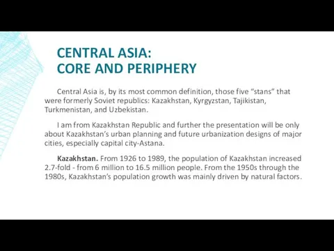
- 2. CENTRAL ASIA: CORE AND PERIPHERY Central Asia is, by its most common definition, those five “stans”
- 6. Kazakhstan is the world's largest landlocked country, and the ninth largest in the world, with an
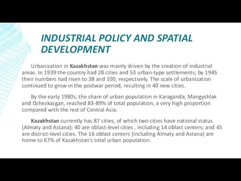
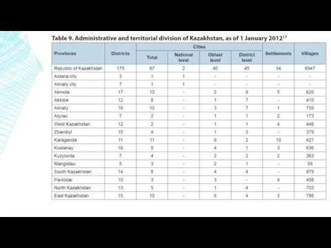
- 7. INDUSTRIAL POLICY AND SPATIAL DEVELOPMENT Urbanization in Kazakhstan was mainly driven by the creation of industrial
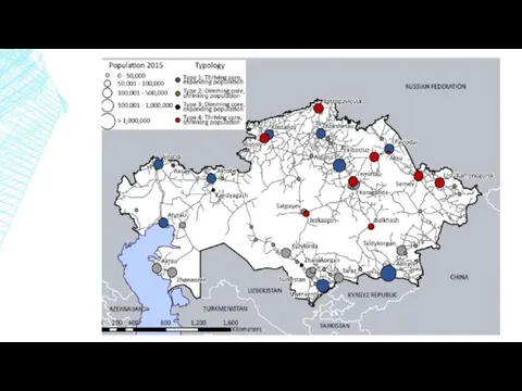
- 9. Urban development in Kazakhstan is characterized by the predominance of small towns (with a population up
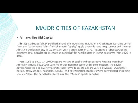
- 11. MAJOR CITIES OF KAZAKHSTAN Almaty: The Old Capital Almaty is a beautiful city perched among the
- 12. “Medeo” sport complex
- 13. The Medeu Dam, designed to protect the city of Almaty and the Medeo skating rink from
- 14. Current city plan of Almaty (On the map figured map of metro lines and future plans)
- 15. Alamaty urban plan view
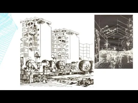
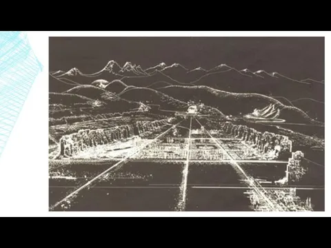
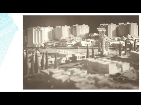
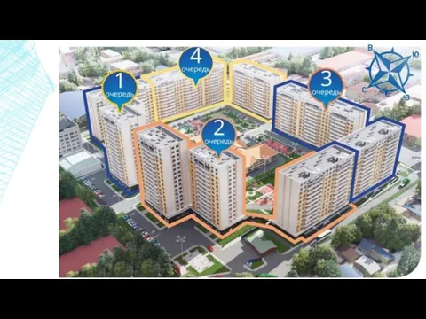
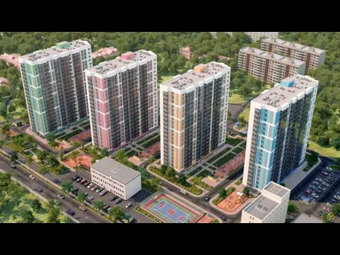
- 16. Alatau Urban Planning Development (First Prize, Republican Contest) Design: 1986
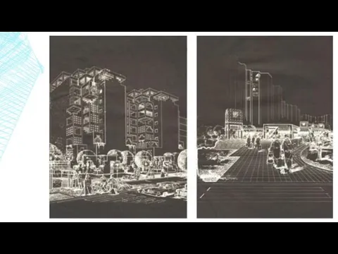
- 22. Information Technology Park Gold Medal of Republic of Kazakhstan Union of Architects, Republican Contest for the
- 25. Astana: The New Capital After Kazakhstan became independent in 1991, the city’s name was changed back
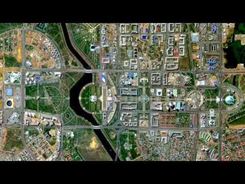
- 26. Topographic of the capital city, Astana. ASTANA Here you can see a photo from a height
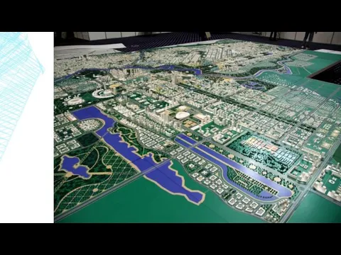
- 28. Digital map of Astana
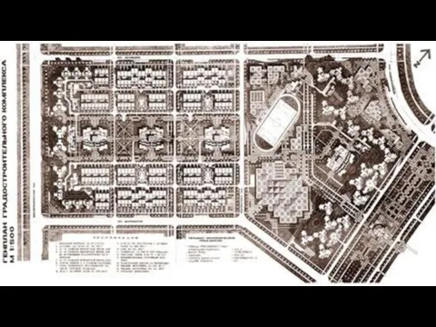
- 29. General plan of mikro-rigions, building boxes, of the city
- 32. New Astana city Centre development Master Plan. Sketch idea (for international bid) Design: 1998
- 34. Launch of Five Express Routes is planned in Astana On August 29, 2015, it is planned
- 35. CONCLUSION If we take a look back for 20 years, the process of urbanization and urban
- 37. Скачать презентацию
CENTRAL ASIA:
CORE AND PERIPHERY
Central Asia is, by its most common definition,
CENTRAL ASIA:
CORE AND PERIPHERY
Central Asia is, by its most common definition,
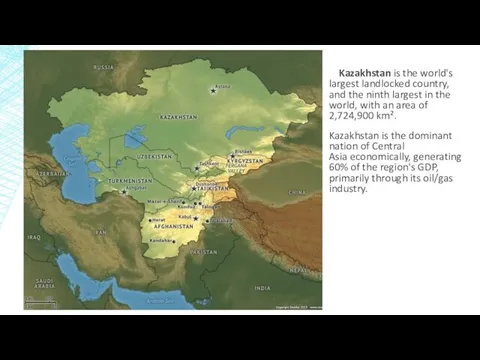
Kazakhstan is the world's largest landlocked country, and the ninth largest in the world,
Kazakhstan is the world's largest landlocked country, and the ninth largest in the world,
INDUSTRIAL POLICY AND SPATIAL DEVELOPMENT
Urbanization in Kazakhstan was mainly driven by
INDUSTRIAL POLICY AND SPATIAL DEVELOPMENT
Urbanization in Kazakhstan was mainly driven by
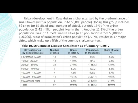
Urban development in Kazakhstan is characterized by the predominance of small
Urban development in Kazakhstan is characterized by the predominance of small
MAJOR CITIES OF KAZAKHSTAN
Almaty: The Old Capital
Almaty is a beautiful
MAJOR CITIES OF KAZAKHSTAN
Almaty: The Old Capital
Almaty is a beautiful
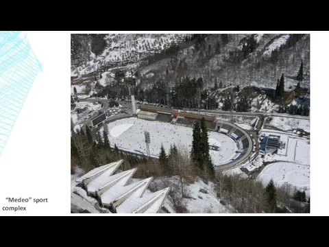
“Medeo” sport complex
“Medeo” sport complex
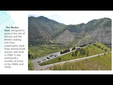
The Medeu Dam, designed to protect the city of Almaty and
The Medeu Dam, designed to protect the city of Almaty and
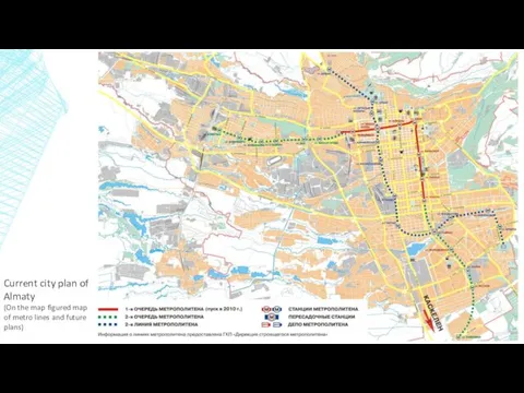
Current city plan of Almaty
(On the map figured map of metro
Current city plan of Almaty
(On the map figured map of metro
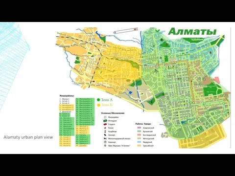
Alamaty urban plan view
Alamaty urban plan view
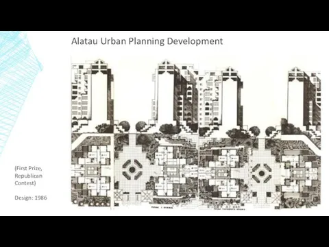
Alatau Urban Planning Development
(First Prize, Republican Contest)
Design: 1986
Alatau Urban Planning Development
(First Prize, Republican Contest)
Design: 1986
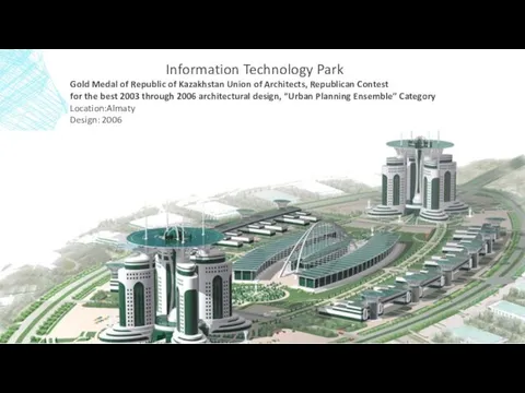
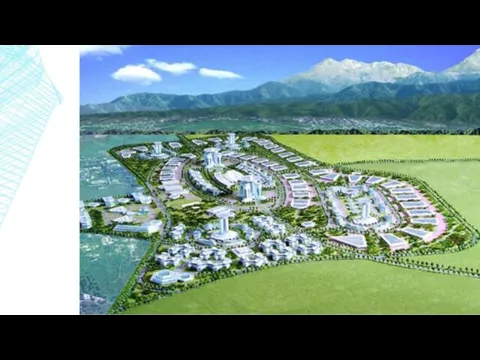
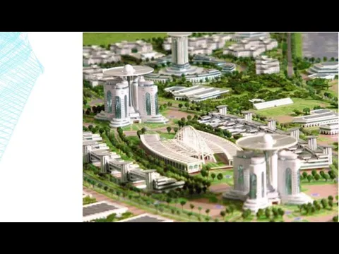
Information Technology Park
Gold Medal of Republic of Kazakhstan Union of Architects,
Information Technology Park
Gold Medal of Republic of Kazakhstan Union of Architects,
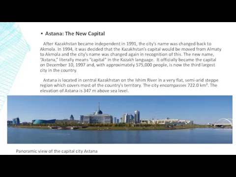
Astana: The New Capital
After Kazakhstan became independent in 1991, the
Astana: The New Capital
After Kazakhstan became independent in 1991, the
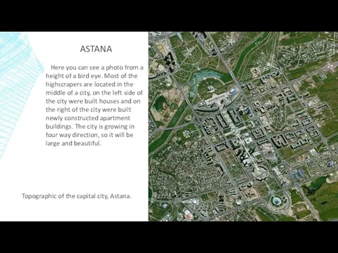
Topographic of the capital city, Astana.
ASTANA
Here you can see a
Topographic of the capital city, Astana.
ASTANA
Here you can see a
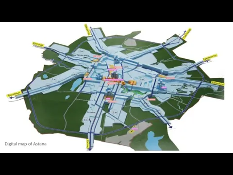
Digital map of Astana
Digital map of Astana
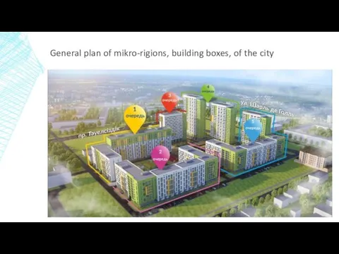
General plan of mikro-rigions, building boxes, of the city
General plan of mikro-rigions, building boxes, of the city
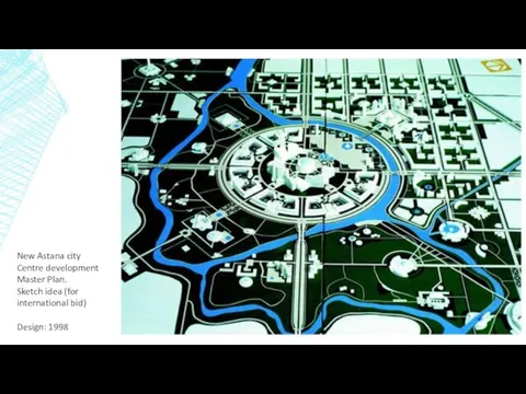
New Astana city Centre development Master Plan.
Sketch idea (for international bid)
Design:
New Astana city Centre development Master Plan.
Sketch idea (for international bid)
Design:
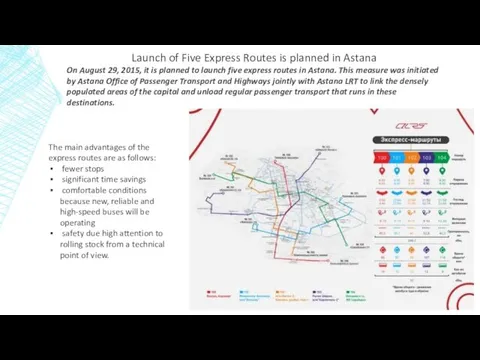
Launch of Five Express Routes is planned in Astana
On August 29,
Launch of Five Express Routes is planned in Astana
On August 29,
CONCLUSION
If we take a look back for 20 years, the
CONCLUSION
If we take a look back for 20 years, the
 Кафедра английской филологии. Абитуриенту 2017 года
 Вещество. Состояние вещества. Кристаллические решётки
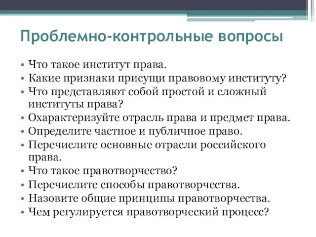 Что такое право
 Экономика и её роль в жизни общества
 Альбом квазиомонимов часть 3
 Металеві конструкції. Частина 1
 Безопасность детей в сети Интернет
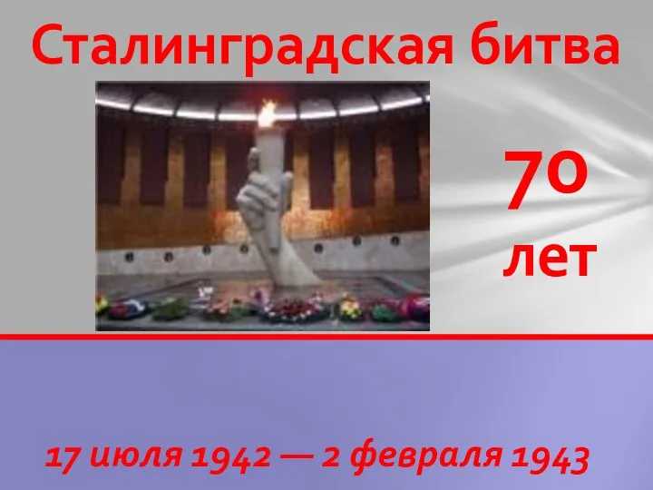 Конкурс А ну-ка, мальчики!, посвященный 70-летию Сталинградской битвы и 23 февраля
 Математическая теория катастроф
 Презентация по географии В мире географии географический турнир
 Взаимное расположение графиков линейных функций
 Систематические группы птиц
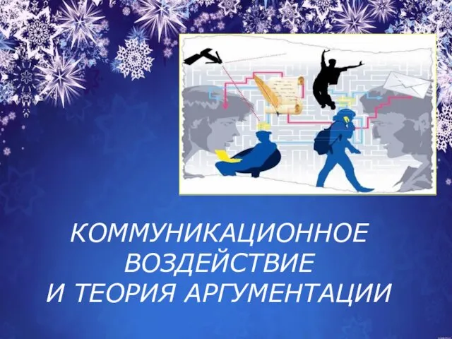 Коммуникационное воздействие и теория аргументации
 Архівування та розархівування даних
 Проект Мир театрав первой младшей группе
 Краеведческая викторина
 История села Белагино
 Мероприятия по раннему выявлению незаконного потребления наркотических средств и психотропных веществ
 интеллектуальный марафон
 Топография и ориентирование. Лекция 5
 Разработка познавательного шоппинг тура в Калининградскую область
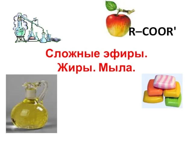 Сложные эфиры. Жиры. Мыла
 Укрепление грунтов оснований
 Сталинградцы
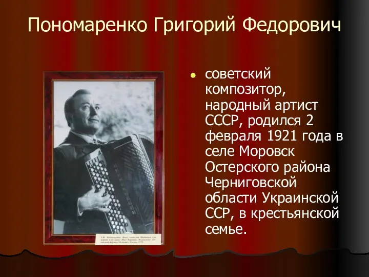 Григорий Пономаренко
 Сочинение по картине А.М. Герасимова После дождя
 Валютные системы, риски и кризисы
 Классный час Правила поведения на воде