- Canada. Geography

Содержание
- 2. Canada is located in the northern part of North America
- 3. Its ten provinces and three territories extend from the Atlantic to the Pacific and northward into
- 4. Moreover, Canada's border with the United States is the world's longest land border: 8,891 km, of
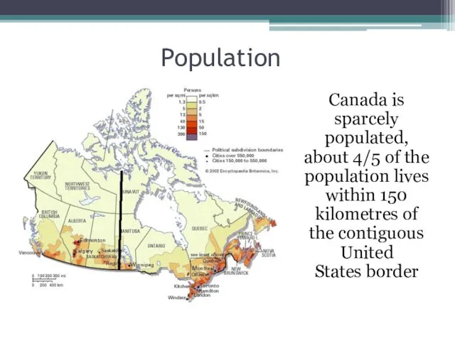
- 5. Population Canada is sparcely populated, about 4/5 of the population lives within 150 kilometres of the
- 6. Population Approximately 80% of Canadians live in urban areas concentrated in the Quebec City–Windsor Corridor, the
- 7. Geographical features Canada has a diverse climate. The climate varies from temperate on the west coast
- 9. Extreme northern Canada can have snow for most of the year with a Polar climate!
- 10. The Mackenzie River The Mackenzie River is the largest and longest river system in Canada, and
- 11. Great Bear Lake Great Bear Lake is the largest lake entirely in Canada (Lake Superior and
- 12. Mountains of Canada
- 13. Mount Logan Mount Logan is the highest mountain in Canada and the second-highest peak in North
- 14. Mount Logan Due to active tectonic uplifting, Mount Logan is still rising in height. Before 1992,
- 15. The Canadian Shield The Canadian Shield, also called the Laurentian Plateauis a large area of exposed
- 16. The Cordillera Mountains The North American Cordillera is the North American portion of the American Cordillera
- 17. Appalachian Mountains The Appalachian Mountains , often called the Appalachians, are a system of mountains in
- 18. The Rocky Mountains The Rocky Mountains stretch more than 3,000 miles (4,800 km) from the northernmost
- 20. Скачать презентацию
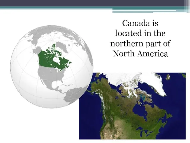
Canada is located in the northern part of North America
Canada is located in the northern part of North America
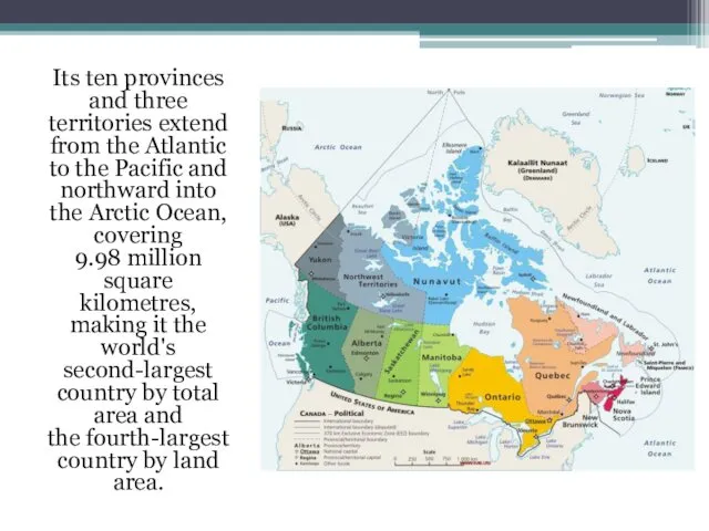
Its ten provinces and three territories extend from the Atlantic to the Pacific
Its ten provinces and three territories extend from the Atlantic to the Pacific
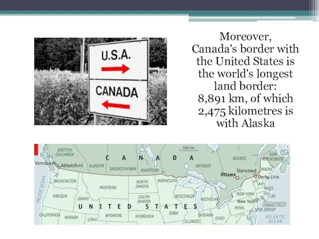
Moreover, Canada's border with the United States is the world's longest land border:
Moreover, Canada's border with the United States is the world's longest land border:
Population
Canada is sparcely populated, about 4/5 of the population lives within
Population
Canada is sparcely populated, about 4/5 of the population lives within
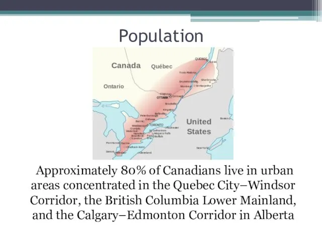
Population
Approximately 80% of Canadians live in urban areas concentrated in the Quebec
Population
Approximately 80% of Canadians live in urban areas concentrated in the Quebec
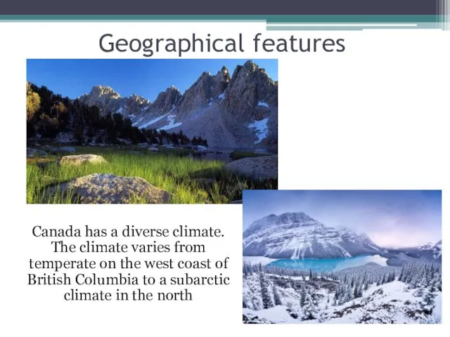
Geographical features
Canada has a diverse climate. The climate varies from temperate
Geographical features
Canada has a diverse climate. The climate varies from temperate
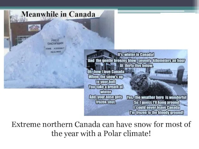
Extreme northern Canada can have snow for most of the year
Extreme northern Canada can have snow for most of the year
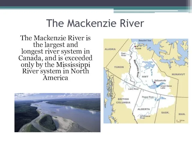
The Mackenzie River
The Mackenzie River is the largest and longest river system in
The Mackenzie River
The Mackenzie River is the largest and longest river system in
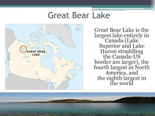
Great Bear Lake
Great Bear Lake is the largest lake entirely in Canada (Lake
Great Bear Lake
Great Bear Lake is the largest lake entirely in Canada (Lake
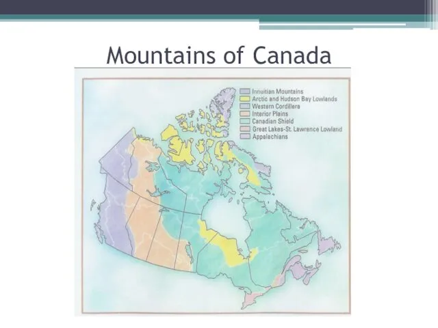
Mountains of Canada
Mountains of Canada
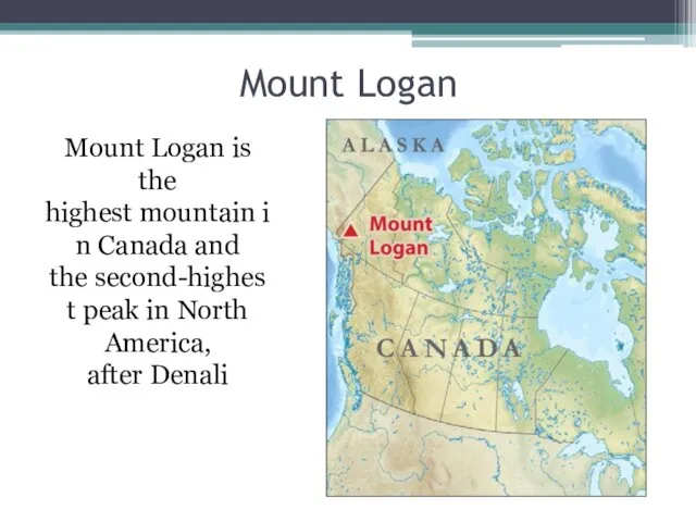
Mount Logan
Mount Logan is the highest mountain in Canada and the second-highest peak in North America, after Denali
Mount Logan
Mount Logan is the highest mountain in Canada and the second-highest peak in North America, after Denali
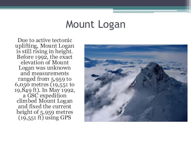
Mount Logan
Due to active tectonic uplifting, Mount Logan is still rising
Mount Logan
Due to active tectonic uplifting, Mount Logan is still rising
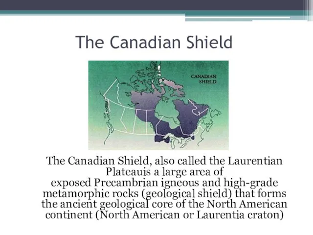
The Canadian Shield
The Canadian Shield, also called the Laurentian Plateauis a large area
The Canadian Shield
The Canadian Shield, also called the Laurentian Plateauis a large area
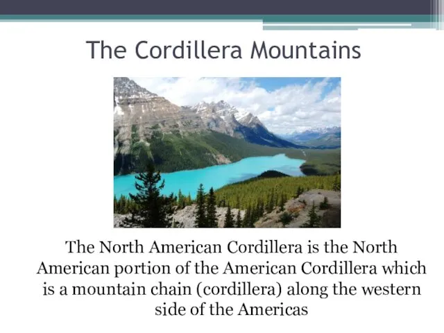
The Cordillera Mountains
The North American Cordillera is the North American portion of the American Cordillera which
The Cordillera Mountains
The North American Cordillera is the North American portion of the American Cordillera which
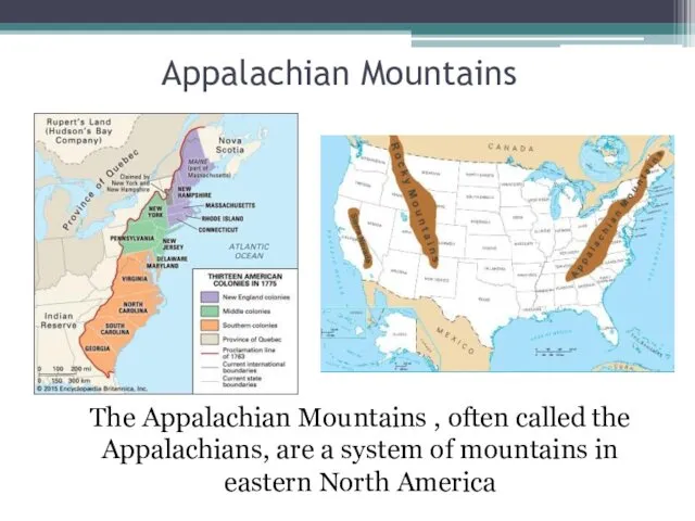
Appalachian Mountains
The Appalachian Mountains , often called the Appalachians, are a system of mountains in eastern North
Appalachian Mountains
The Appalachian Mountains , often called the Appalachians, are a system of mountains in eastern North
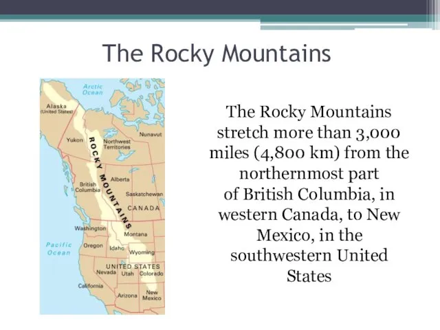
The Rocky Mountains
The Rocky Mountains stretch more than 3,000 miles (4,800 km)
The Rocky Mountains
The Rocky Mountains stretch more than 3,000 miles (4,800 km)
 Правила чтения букв английского алфавита
 Definition of terminological definition
 Work and tools
 Volkswagen PKW Russia
 The United Kingdom of Great Britain and Northern Ireland
 The noun a word expressing substance in the widest sense of the word
 Music in my life
 The theme of today’s lesson is Present Simple Tense
 Music in our life
 My idol - Pavel Datsyuk
 Types of companies in the UK. Important documents of company
 Feeling and emotions
 Superstitions in Britain
 Present Simple. Present Perfect
 Business plan. Online store
 Future meaning
 Terrorism
 Present Continuous Tense
 Game Travelling. Level A2 – B1
 Использование голосового помощника Маруся на уроках английского языка в начальной школе
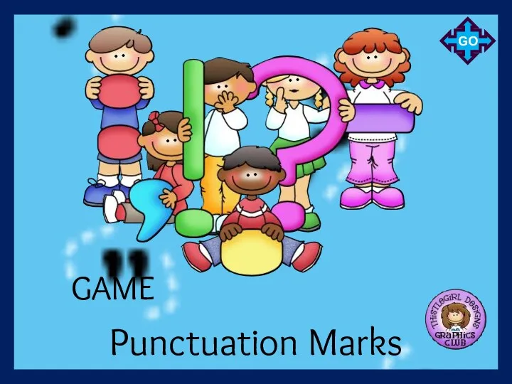 Punctuation marks
 The welfare state
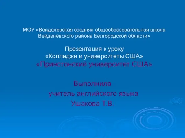 Princeton university
 Clothing and fashion
 Английский язык. Урок-повторение
 England is the largest and major part of the United Kingdom
 Can/can’t. Could/couldn’t
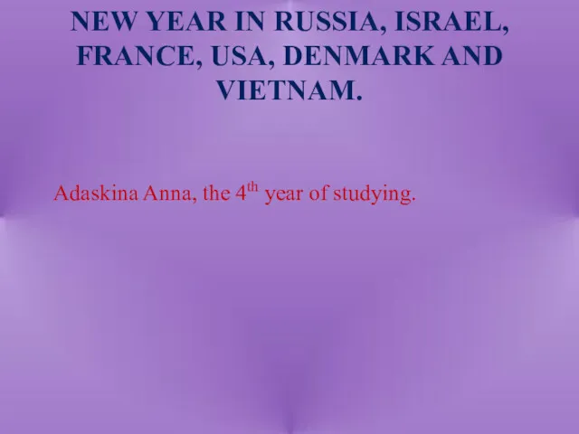 New Year in Russia, Israel, France, USA, Denmark and Vietnam