- Introduction To ArcCatalog

Содержание
- 2. ArcCatalog is a data-centric GUI tool used for managing spatial data
- 3. With ArcCatalog you can……. Inspect properties and attributes of data Preview and explore data contents Evaluate
- 4. ArcCatalog Gives You…. Direct access to all your data ‘live.’ Connections to any local or network
- 5. ArcCatalog Is Better Equipped to Allow GIS Analysts To… Manage the GIS data explosion Control consistency
- 6. ArcCatalog Is the Principal User Interface Used to Define and Manage the Geodatabase
- 7. What is a Geodatabase? A new type of geographic data format (GDF) for ArcInfo 8. Based
- 8. Geodatabase Framework
- 9. Geographic Feature Data Formats Formats are based on representations (models) of the real world that can
- 10. Geographic Feature Data Formats Shapefile – introduced with ArcView Also georelational data model – nontopological vector
- 11. Supported Data Types ArcInfo 8 supports four representations of geographic data. Vector data for representing features.
- 12. Three Ways to Create a Geodatabase Create from scratch. Use tools in ArcCatalog to create schema
- 13. Single-user Geodatabase Personal Geodatabase. Implemented as a Microsoft Access database (*.mdb file) by using MS jet
- 14. Multi-user (Enterprise) Geodatabase ArcSDE Geodatabase ArcSDE is the multi-user data access extension to ArcInfo (bundled w/software)
- 15. Geodatabase Elements Objects Object classes Features Feature classes Feature datasets Relationships Relationship classes Geometric networks Domains
- 16. Objects & Object Classes Geodatabases organize geographic data into a hierarchy of data objects. Objects are
- 17. Object Classes (tables) A row stores an Object
- 18. Features and Feature Classes Features are objects with required shape (Points, Multi-points, Lines & Polygons) that
- 19. Feature Classes A row stores feature Feature Class Table
- 20. Feature Datasets Containers for feature classes Shared spatial reference Analogous to a coverage less restrictive May
- 21. Relationships and Relationship Classes Relationships are an association between two or more objects in a geodatabase
- 22. Relationships Parcels (Spatial) Owners Non-Spatial
- 23. Relationship Behavior
- 24. Geometric Networks A topological relationship among a collection of feature classes in a feature dataset Used
- 25. Geometric Networks Network features classes must reside in a geometric network Directly support network analysis Types
- 26. Domains Describe the legal values of a field type Used to ensure attribute integrity Can be
- 27. Subtypes Feature class “subclasses” that allow you to further distinguish objects without creating new feature classes
- 28. Spatial References Describes the projection, spatial domain (X,Y,Z &M values), and precision for feature datasets or
- 29. For additional detail on the geodatabase see: geodatabase.ppt
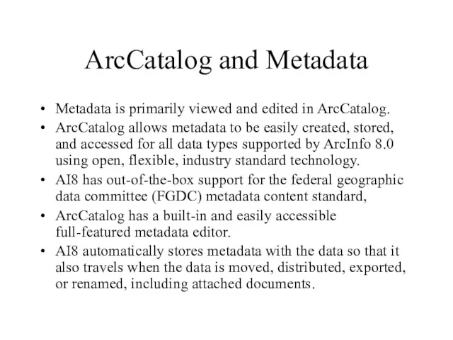
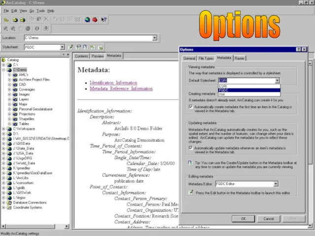
- 30. ArcCatalog and Metadata Metadata is primarily viewed and edited in ArcCatalog. ArcCatalog allows metadata to be
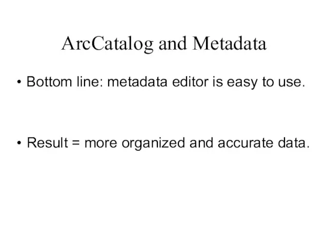
- 31. ArcCatalog and Metadata Bottom line: metadata editor is easy to use. Result = more organized and
- 32. Underlying Metadata Technology = XML XML=eXtensible Markup Language Document-oriented structured data Next step beyond HTML Separates
- 33. Where Is Metadata Stored? All data types and containers have metadata Coverages: XML file stored in
- 34. Creating and Editing Metadata Choose dataset and click the metadata tab… Metadata is automatically created if
- 35. ArcCatalog Metadata Editor
- 36. Extending and Customizing Metadata Metadata framework can be extended for various custom applications: Data inventory and
- 37. A Simple Right-click of the Mouse Yields Property Dialog Boxes for All Data Types
- 38. Working with Coverages In ArcCatalog you can……. Generate topology Define coordinate systems Modify coverage tics and
- 39. Generating Coverage Topology Right-click on coverage Go to properties Click the General tab See if topology
- 40. Define Coverage Coordinates Right-click and go to properties From file menu go to properties Can define
- 41. Modifying Coverage Tics and Extent Right-click on coverage Go to properties Click the Tics and Extent
- 42. Creating New Coverages Right click on ArcCatalog folder where you want to create a coverage and
- 43. Maintaining Coverage Attributes With attributes that reside in a feature attribute table or separate INFO table
- 44. From ArcCatalog you can add and edit the properties of fields in tables, shapefiles and feature
- 45. ArcCatalog Is Highly Customizable ArcCatalog is customizable at three levels Menu driven, drag and drop (requires
- 46. The ArcCatalog Window Detachable Catalog Tree ESRI Metadata Viewer
- 47. CAD Dataset (Blue) Coverages (Yellow) Raster Datasets (Grid) Layers (Bright Yellow) Folder Connections CAD Drawing File
- 48. Personal Geodatabase (Grey) ArcMap Document (.mxd) Projection (Globe) Shapefiles (Green) ArcView Dbase Table (Green) ArcInfo Info
- 49. TIN Dataset Preview Tab The ArcCatalog Window
- 50. Geodatabase Feature Dataset Relationship Class Feature Classes Annotation Class The ArcCatalog Window
- 51. Options Projection Files *.prj
- 52. Options
- 53. Options
- 54. Options
- 55. Options
- 56. Creating Thumbnails
- 57. Thumbnails
- 58. Customizing
- 59. Database Table (Blue) Remote Database Connection (Grey Cylinder w/network) Wizards for Creating Database Connections Database Connections
- 60. Add Coverage Attributes
- 61. Adding Fields
- 63. Скачать презентацию
ArcCatalog is a data-centric GUI tool used for managing spatial data
ArcCatalog is a data-centric GUI tool used for managing spatial data
With ArcCatalog you can…….
Inspect properties and attributes of data
Preview and explore
With ArcCatalog you can…….
Inspect properties and attributes of data
Preview and explore
ArcCatalog Gives You….
Direct access to all your data ‘live.’
Connections to any
ArcCatalog Gives You….
Direct access to all your data ‘live.’
Connections to any
ArcCatalog Is Better Equipped to Allow
GIS Analysts To…
Manage the GIS
ArcCatalog Is Better Equipped to Allow
GIS Analysts To…
Manage the GIS
ArcCatalog Is the Principal User Interface Used to Define
and Manage
ArcCatalog Is the Principal User Interface Used to Define and Manage
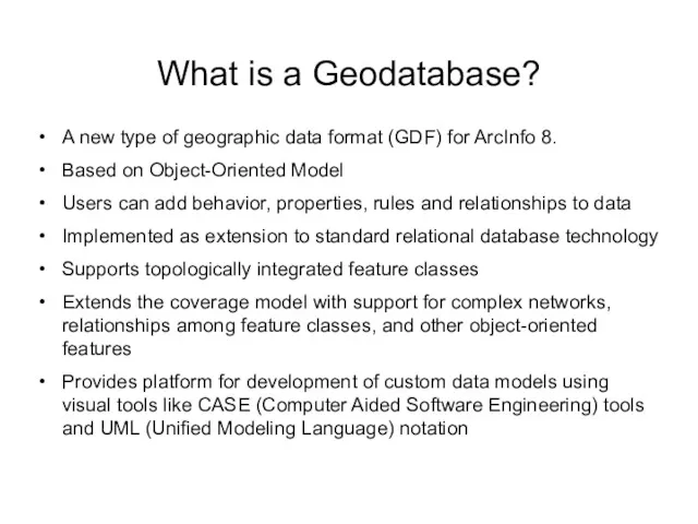
What is a Geodatabase?
A new type of geographic data format (GDF)
What is a Geodatabase?
A new type of geographic data format (GDF)
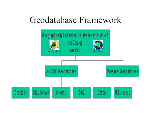
Geodatabase Framework
Geodatabase Framework
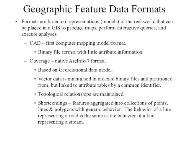
Geographic Feature Data Formats
Formats are based on representations (models) of the
Geographic Feature Data Formats
Formats are based on representations (models) of the
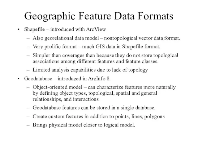
Geographic Feature Data Formats
Shapefile – introduced with ArcView
Also georelational data model
Geographic Feature Data Formats
Shapefile – introduced with ArcView
Also georelational data model
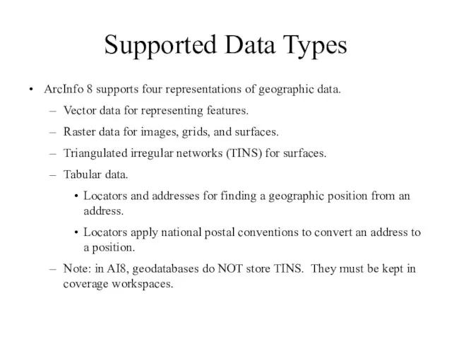
Supported Data Types
ArcInfo 8 supports four representations of geographic data.
Vector data
Supported Data Types
ArcInfo 8 supports four representations of geographic data.
Vector data
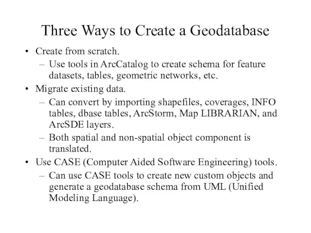
Three Ways to Create a Geodatabase
Create from scratch.
Use tools in ArcCatalog
Three Ways to Create a Geodatabase
Create from scratch.
Use tools in ArcCatalog
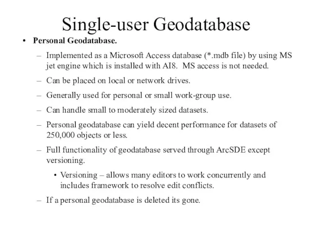
Single-user Geodatabase
Personal Geodatabase.
Implemented as a Microsoft Access database (*.mdb file) by
Single-user Geodatabase
Personal Geodatabase.
Implemented as a Microsoft Access database (*.mdb file) by
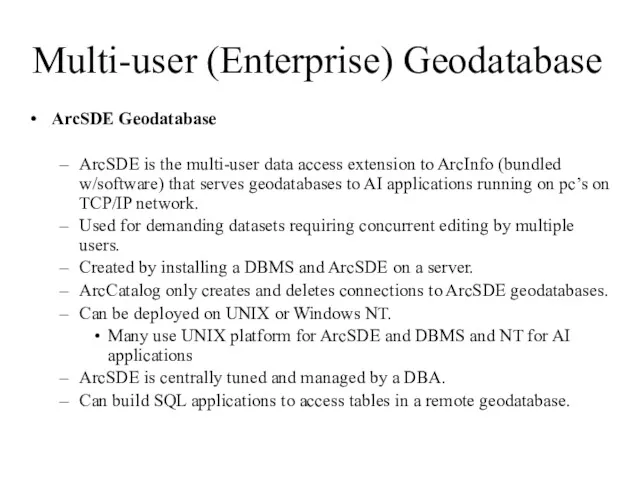
Multi-user (Enterprise) Geodatabase
ArcSDE Geodatabase
ArcSDE is the multi-user data access extension
Multi-user (Enterprise) Geodatabase
ArcSDE Geodatabase
ArcSDE is the multi-user data access extension
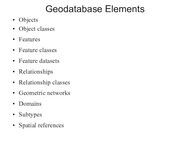
Geodatabase Elements
Objects
Object classes
Features
Feature classes
Feature datasets
Relationships
Relationship classes
Geometric networks
Domains
Subtypes
Spatial references
Geodatabase Elements
Objects
Object classes
Features
Feature classes
Feature datasets
Relationships
Relationship classes
Geometric networks
Domains
Subtypes
Spatial references
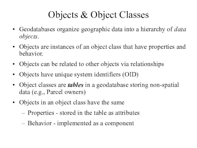
Objects & Object Classes
Geodatabases organize geographic data into a hierarchy of
Objects & Object Classes
Geodatabases organize geographic data into a hierarchy of
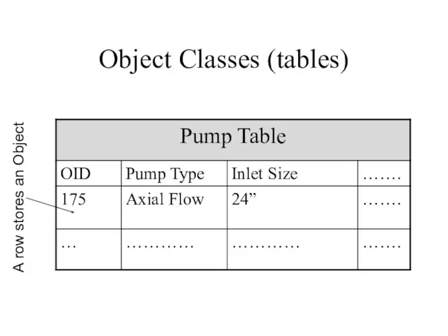
Object Classes (tables)
A row stores an Object
Object Classes (tables)
A row stores an Object
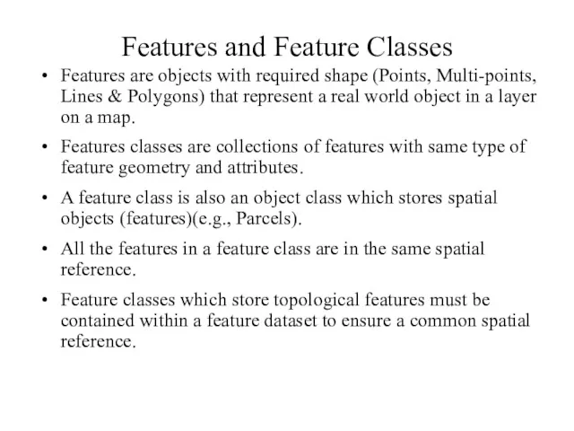
Features and Feature Classes
Features are objects with required shape (Points, Multi-points,
Features and Feature Classes
Features are objects with required shape (Points, Multi-points,
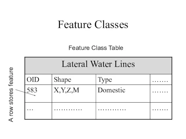
Feature Classes
A row stores feature
Feature Class Table
Feature Classes
A row stores feature
Feature Class Table
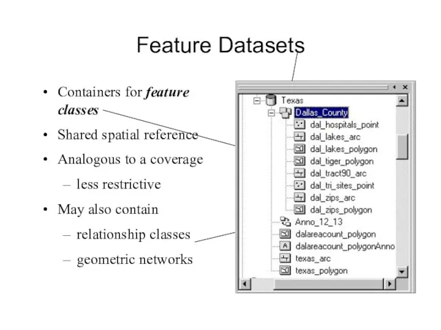
Feature Datasets
Containers for feature classes
Shared spatial reference
Analogous to a coverage
less restrictive
May
Feature Datasets
Containers for feature classes
Shared spatial reference
Analogous to a coverage
less restrictive
May
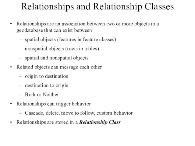
Relationships and Relationship Classes
Relationships are an association between two or more
Relationships and Relationship Classes
Relationships are an association between two or more
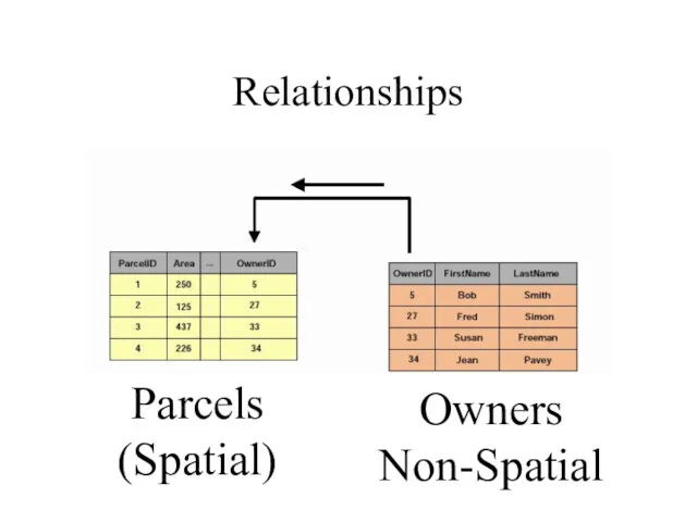
Relationships
Parcels
(Spatial)
Owners
Non-Spatial
Relationships
Parcels
(Spatial)
Owners
Non-Spatial
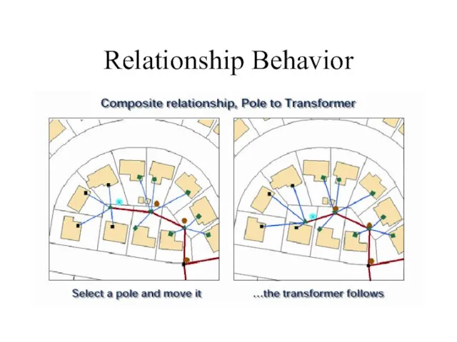
Relationship Behavior
Relationship Behavior
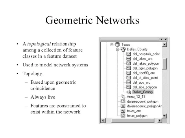
Geometric Networks
A topological relationship among a collection of feature classes in
Geometric Networks
A topological relationship among a collection of feature classes in
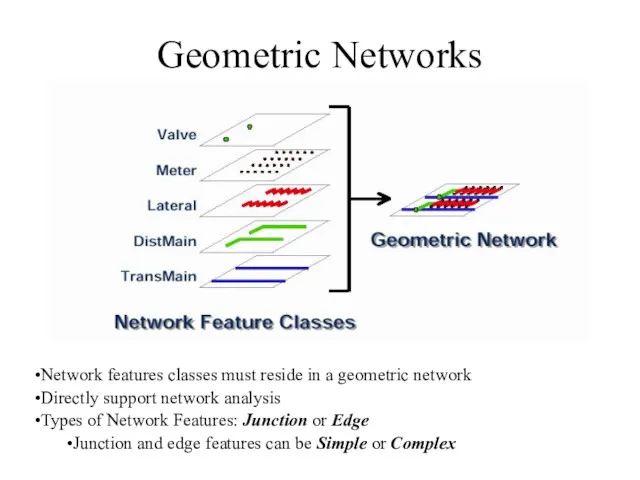
Geometric Networks
Network features classes must reside in a geometric network
Directly support
Geometric Networks
Network features classes must reside in a geometric network
Directly support
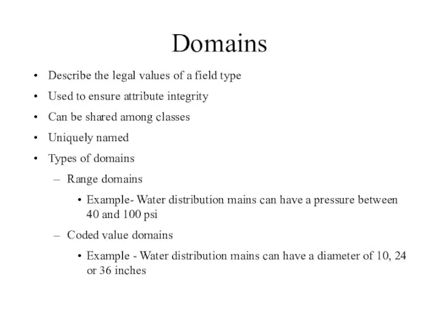
Domains
Describe the legal values of a field type
Used to ensure attribute
Domains
Describe the legal values of a field type
Used to ensure attribute
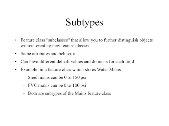
Subtypes
Feature class “subclasses” that allow you to further distinguish objects without
Subtypes
Feature class “subclasses” that allow you to further distinguish objects without
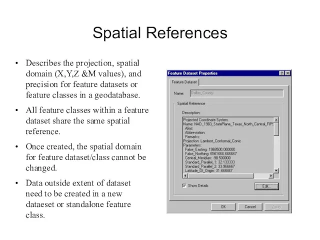
Spatial References
Describes the projection, spatial domain (X,Y,Z &M values), and precision
Spatial References
Describes the projection, spatial domain (X,Y,Z &M values), and precision
For additional detail on the geodatabase see:
geodatabase.ppt
For additional detail on the geodatabase see:
geodatabase.ppt
ArcCatalog and Metadata
Metadata is primarily viewed and edited in ArcCatalog.
ArcCatalog
ArcCatalog and Metadata
Metadata is primarily viewed and edited in ArcCatalog.
ArcCatalog
ArcCatalog and Metadata
Bottom line: metadata editor is easy to use.
Result
ArcCatalog and Metadata
Bottom line: metadata editor is easy to use.
Result
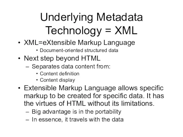
Underlying Metadata Technology = XML
XML=eXtensible Markup Language
Document-oriented structured data
Next step beyond
Underlying Metadata Technology = XML
XML=eXtensible Markup Language
Document-oriented structured data
Next step beyond
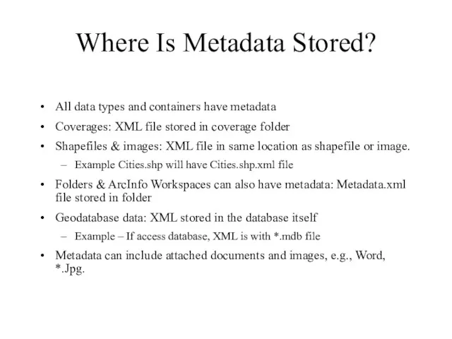
Where Is Metadata Stored?
All data types and containers have metadata
Coverages: XML
Where Is Metadata Stored?
All data types and containers have metadata
Coverages: XML
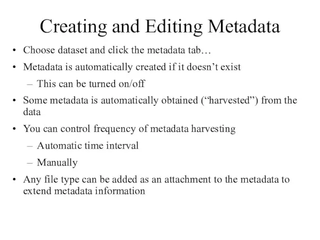
Creating and Editing Metadata
Choose dataset and click the metadata tab…
Metadata is
Creating and Editing Metadata
Choose dataset and click the metadata tab…
Metadata is
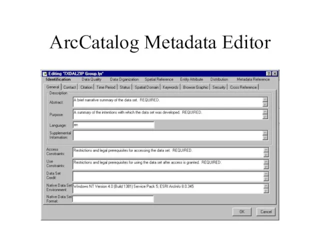
ArcCatalog Metadata Editor
ArcCatalog Metadata Editor
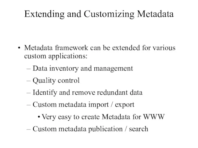
Extending and Customizing Metadata
Metadata framework can be extended for various custom
Extending and Customizing Metadata
Metadata framework can be extended for various custom
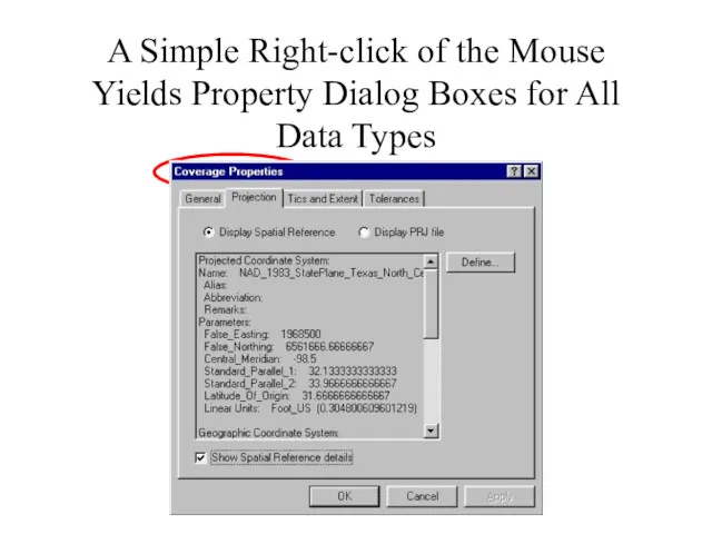
A Simple Right-click of the Mouse Yields Property Dialog Boxes for
A Simple Right-click of the Mouse Yields Property Dialog Boxes for
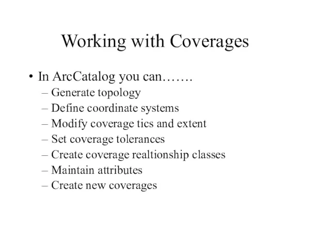
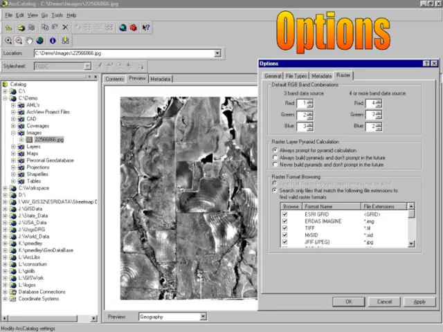
Working with Coverages
In ArcCatalog you can…….
Generate topology
Define coordinate systems
Modify coverage tics
Working with Coverages
In ArcCatalog you can…….
Generate topology
Define coordinate systems
Modify coverage tics
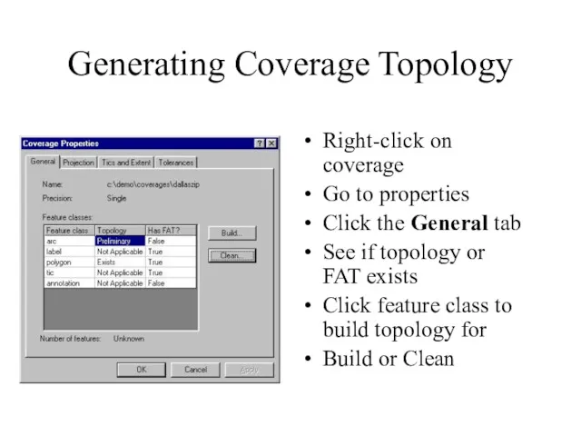
Generating Coverage Topology
Right-click on coverage
Go to properties
Click the General tab
See
Generating Coverage Topology
Right-click on coverage
Go to properties
Click the General tab
See
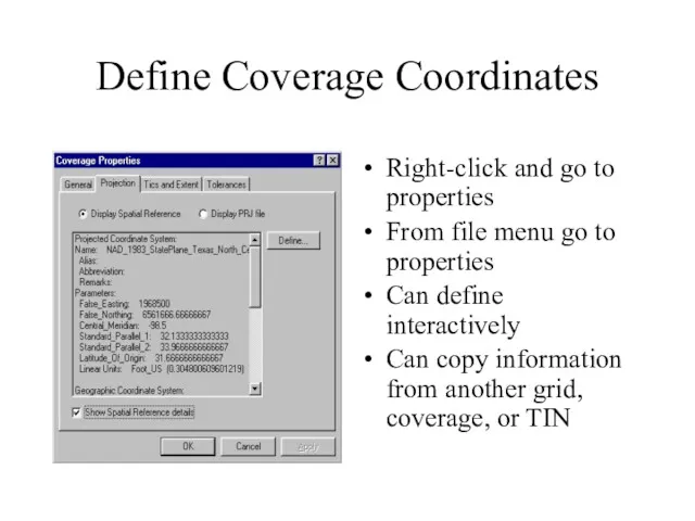
Define Coverage Coordinates
Right-click and go to properties
From file menu go to
Define Coverage Coordinates
Right-click and go to properties
From file menu go to
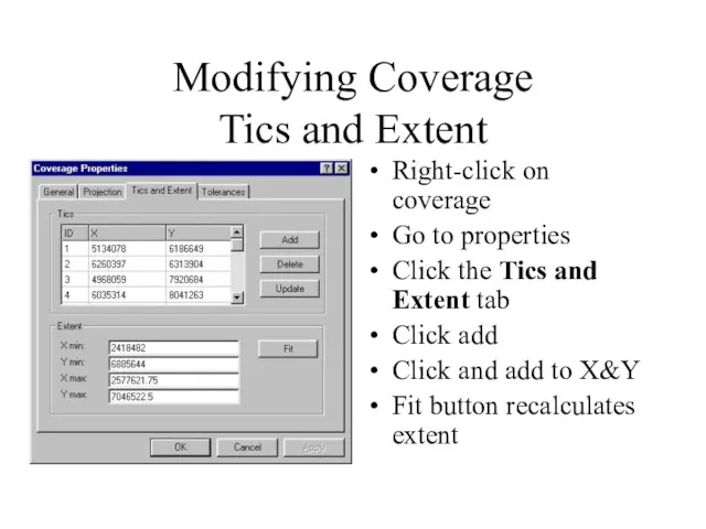
Modifying Coverage
Tics and Extent
Right-click on coverage
Go to properties
Click the
Modifying Coverage
Tics and Extent
Right-click on coverage
Go to properties
Click the
Creating New Coverages
Right click on ArcCatalog folder where you want to
Creating New Coverages
Right click on ArcCatalog folder where you want to
Maintaining Coverage Attributes
With attributes that reside in a feature attribute table
Maintaining Coverage Attributes
With attributes that reside in a feature attribute table
From ArcCatalog you can add and edit the properties of fields
From ArcCatalog you can add and edit the properties of fields
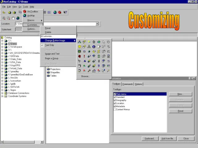
ArcCatalog Is Highly Customizable
ArcCatalog is customizable at three levels
Menu driven, drag
ArcCatalog Is Highly Customizable
ArcCatalog is customizable at three levels
Menu driven, drag
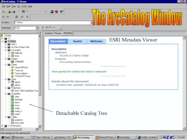
The ArcCatalog Window
Detachable Catalog Tree
ESRI Metadata Viewer
The ArcCatalog Window
Detachable Catalog Tree
ESRI Metadata Viewer
CAD Dataset (Blue)
Coverages
(Yellow)
Raster Datasets
(Grid)
Layers
(Bright Yellow)
Folder Connections
CAD Drawing File
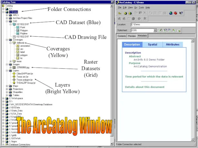
The ArcCatalog Window
CAD Dataset (Blue)
Coverages
(Yellow)
Raster Datasets
(Grid)
Layers
(Bright Yellow)
Folder Connections
CAD Drawing File
The ArcCatalog Window
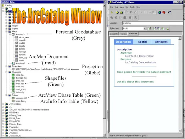
Personal Geodatabase
(Grey)
ArcMap Document
(.mxd)
Projection
(Globe)
Shapefiles
(Green)
ArcView Dbase Table (Green)
ArcInfo Info Table (Yellow)
The ArcCatalog Window
Personal Geodatabase
(Grey)
ArcMap Document
(.mxd)
Projection
(Globe)
Shapefiles
(Green)
ArcView Dbase Table (Green)
ArcInfo Info Table (Yellow)
The ArcCatalog Window
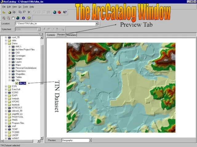
TIN Dataset
Preview Tab
The ArcCatalog Window
TIN Dataset
Preview Tab
The ArcCatalog Window
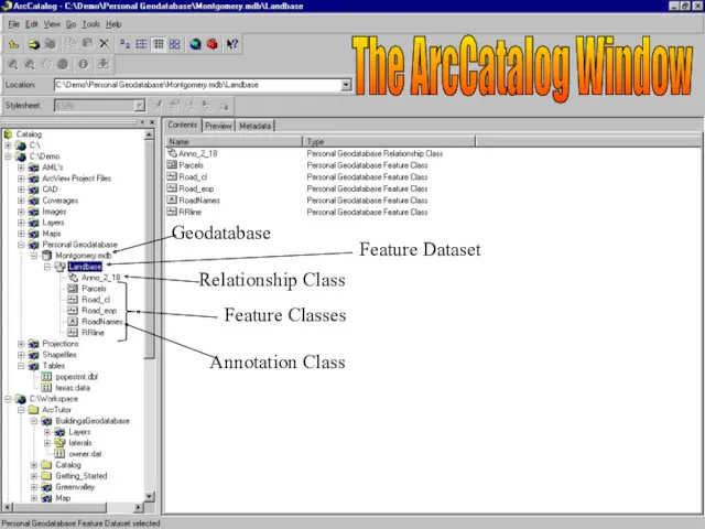
Geodatabase
Feature Dataset
Relationship Class
Feature Classes
Annotation Class
The ArcCatalog Window
Geodatabase
Feature Dataset
Relationship Class
Feature Classes
Annotation Class
The ArcCatalog Window
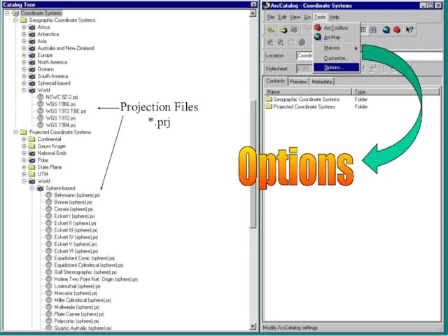
Options
Projection Files
*.prj
Options
Projection Files
*.prj
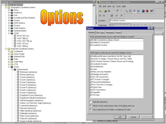
Options
Options
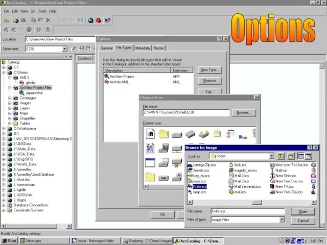
Options
Options
Options
Options
Options
Options
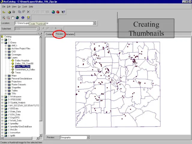
Creating Thumbnails
Creating Thumbnails
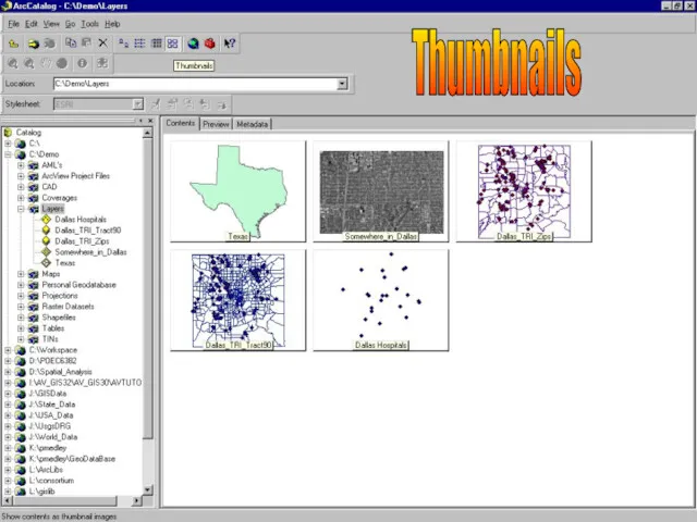
Thumbnails
Thumbnails
Customizing
Customizing
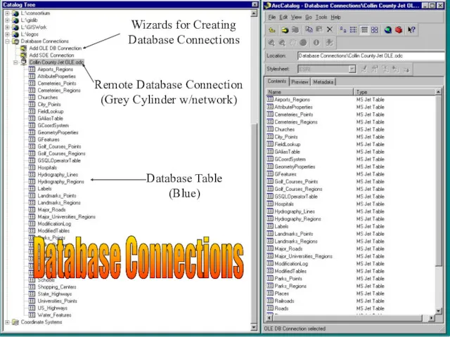
Database Table
(Blue)
Remote Database Connection
(Grey Cylinder w/network)
Wizards for Creating
Database Connections
Database Connections
Database Table
(Blue)
Remote Database Connection
(Grey Cylinder w/network)
Wizards for Creating
Database Connections
Database Connections
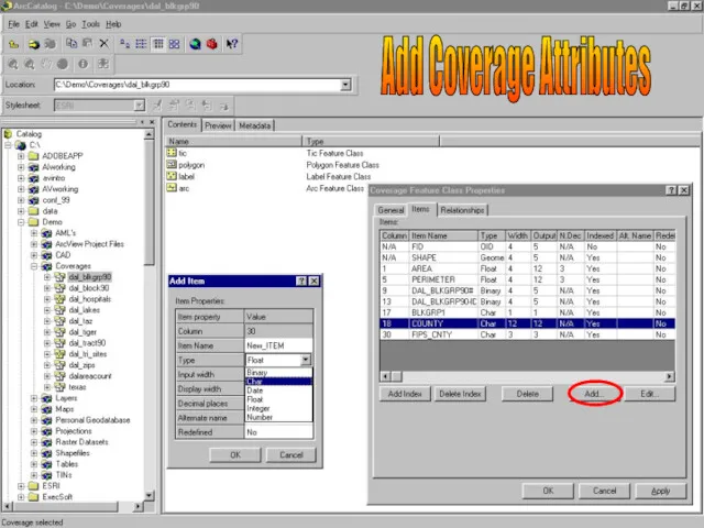
Add Coverage Attributes
Add Coverage Attributes
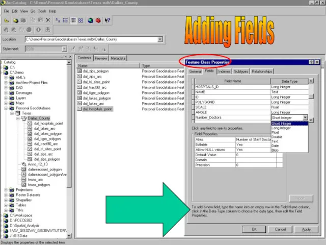
Adding Fields
Adding Fields
 Online-курс Женское счастье
 Нахождение оптимального маршрута с пересадками на железной дороге
 Представление чисел в компьютере. Прямой, обратный и дополнительный код
 Work with computer
 Геоинформационные системы
 Доступ граждан к правовой информации
 Маршрутизация и транспортировка данных по компьютерным сетям
 Средства рекламы
 Первичный ключ к базе данных
 Хранение информации
 Мастер-класс по написанию литературного обзора
 Язык программирования Java. Многопоточное программирование
 Логические элементы
 Электронная почта. (5 класс)
 Измерение информации (алфавитный подход). Единицы измерения информации
 Обработка информации и алгоритмы
 3D принтеры
 Нейронные сети
 Рисунки в режиме символьной печати
 Обзор функциональных возможностей ERP–решения фирмы 1С
 The Mass Media and its influence on youth
 Журналистика в современном социокультурном пространстве
 Динамические данные разветвленной структуры
 우분투 리눅스를 vmware에 설치 하시오
 Наследование в C#
 Задачи на ветвление
 Условный оператор на языке Pascal
 Application layer. Computer networking. (Chapter 2)