- International and national spatial data infrastructures (SDI)

Содержание
- 2. Theme 1. INTRODUCTION TO THE DISCIPLINE 2
- 3. The goal of the academic discipline is to form students' requisite knowledge, skills and expertise on
- 4. As a result of academic discipline study, students are obliged: 1) To know: a) General principles
- 5. 2) To be able to: a) Define the factors for an effective SDI organization; b) Set
- 6. 1.1. SDI development preconditions 1. At the United Nations Conference on Environment and Development in Rio
- 7. 3. The importance of geographic information to support decision-making and management of these growing national, regional,
- 8. Notes. 1. Geographic information – facts that are obtained and/or can be obtained as a result
- 9. 3. Spatial features – spatial components of real world, which are presented in computerized (digital) form
- 10. 5. Geographic information is vital to making sound decisions at the local, regional, and global levels.
- 11. 7. However: 1) Information is an expensive resource; 2) For this reason appropriate information and the
- 12. 9. This is true of many initiatives even if they are not actually labeled as “SDI
- 13. Note. Interoperability: 1) (in the informatization scope) a capability to communicate, execute programs, or transfer data
- 14. 11. However: 1) Even in the new era of networked computers, the social habits of the
- 15. 12. There is a clear need, at all scales, to be able to access, integrate and
- 16. 15. The use of common conventions and technical agreements also makes sound economic sense by: –
- 17. 1.2. The term 'Spatial Data Infrastructure' (SDI): 1) Is often used to denote the relevant base
- 18. 1.3. Requirements to SDI: 1) SDI must be more than a single data set or database;
- 19. 1.4. SDI levels 1. As to spatial data domain, we can distinguish in general: 1) Global
- 20. 1.5. The ultimate goal of SDI is to create a situation where spatial data is available
- 21. 1.6. Lead agency of SDI development: 1) Is the prime mover of SDI: a) Facilitates administrative
- 22. 1.7. Factors for an effective SDI organization: 1) Open data policy, accessible to users, few restrictions;
- 23. 1.8. Generalized SDI implementation stages: 1) Creating an awareness of need for SDI; 2) Identifying system,
- 24. Fig.1.1 – SDI institutional framework (1.9) 24
- 25. 1.10. Advantages of SDI development: 1) Spatial data are standardized and better maintained: a) Revision and
- 26. 1.10. Advantages of SDI development: 2) Spatial data operations are faster: a) Faster data acquisition and
- 27. 1.11. SDI possible benefits for the society: 1) Social infrastructure...better society; 2) Environmental infrastructure....better management; 3)
- 28. 1.12. SDI funding: 1) Funding for SDI development is derived from public sources (e.g. taxes or
- 29. 1.13. Recovery of costs on SDI development: 1) Cost recovery models are based on the financial
- 30. 1.14. SDI tax funding: 1) Benefits provide the justification for tax support for SDI development; 2)
- 31. 1.15. Examples of SDI economic benefits: 1) Great Britain: a) £79-136 billion created by SDI activities
- 32. 1.16. Types of SDI legislation assistance: 1) Pre-existing laws covering information access, including copyright and patent
- 33. 1.17. SDI peculiarities 1. SDI provides the ideal environment to connect applications to data: – Influencing
- 34. 4. In reality, many initiatives are working in isolation, not necessarily developing in harmony with others
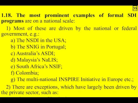
- 35. 1.18. The most prominent examples of formal SDI programs are on a national scale: 1) Most
- 37. Скачать презентацию

Theme 1. INTRODUCTION TO THE DISCIPLINE
2
2

The goal of the academic discipline is to form students' requisite
As a result of academic discipline study, students are obliged:
1) To
1) To
2) To be able to:
a) Define the factors for an effective
a) Define the factors for an effective
1.1. SDI development preconditions
1. At the United Nations Conference on Environment
1. At the United Nations Conference on Environment

3. The importance of geographic information to support decision-making and management

Notes.
1. Geographic information – facts that are obtained and/or can be
1. Geographic information – facts that are obtained and/or can be
3. Spatial features – spatial components of real world, which are

5. Geographic information is vital to making sound decisions at the
7. However:
1) Information is an expensive resource;
2) For this reason appropriate
1) Information is an expensive resource;
2) For this reason appropriate
9. This is true of many initiatives even if they are
Note. Interoperability:
1) (in the informatization scope) a capability to communicate,
1) (in the informatization scope) a capability to communicate,
11. However:
1) Even in the new era of networked computers, the
1) Even in the new era of networked computers, the
12. There is a clear need, at all scales, to be
15. The use of common conventions and technical agreements also makes
1.2. The term 'Spatial Data Infrastructure' (SDI):
1) Is often used to
1) Is often used to
1.3. Requirements to SDI:
1) SDI must be more than a single
1) SDI must be more than a single
1.4. SDI levels
1. As to spatial data domain, we can distinguish
1. As to spatial data domain, we can distinguish
1.5. The ultimate goal of SDI is to create a situation
1.6. Lead agency of SDI development:
1) Is the prime mover of
1) Is the prime mover of
1.7. Factors for an effective SDI organization:
1) Open data policy, accessible
1) Open data policy, accessible
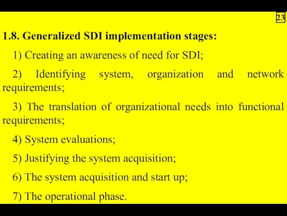
1.8. Generalized SDI implementation stages:
1) Creating an awareness of need for
1) Creating an awareness of need for
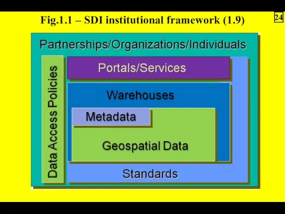
Fig.1.1 – SDI institutional framework (1.9)
24
Fig.1.1 – SDI institutional framework (1.9)
24
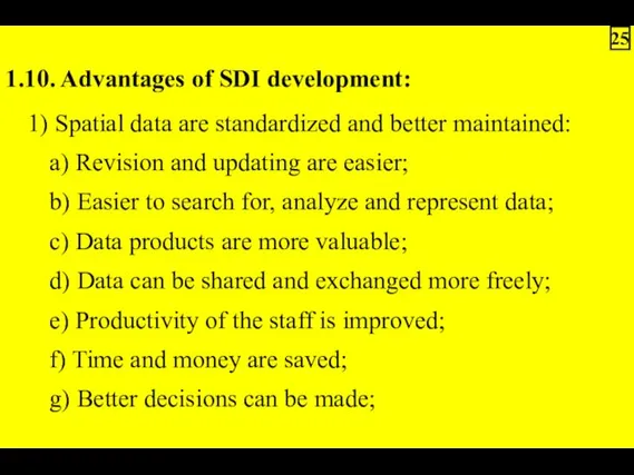
1.10. Advantages of SDI development:
1) Spatial data are standardized and better
1) Spatial data are standardized and better
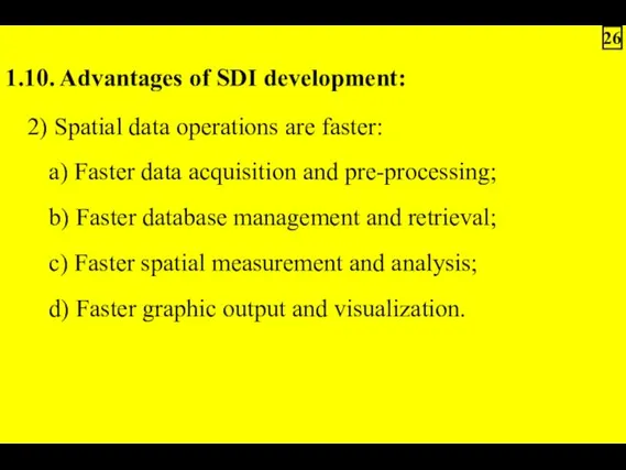
1.10. Advantages of SDI development:
2) Spatial data operations are faster:
a) Faster
2) Spatial data operations are faster:
a) Faster
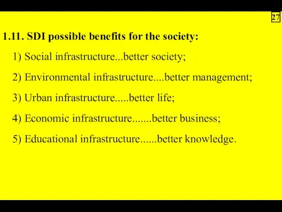
1.11. SDI possible benefits for the society:
1) Social infrastructure...better society;
2) Environmental
1) Social infrastructure...better society;
2) Environmental
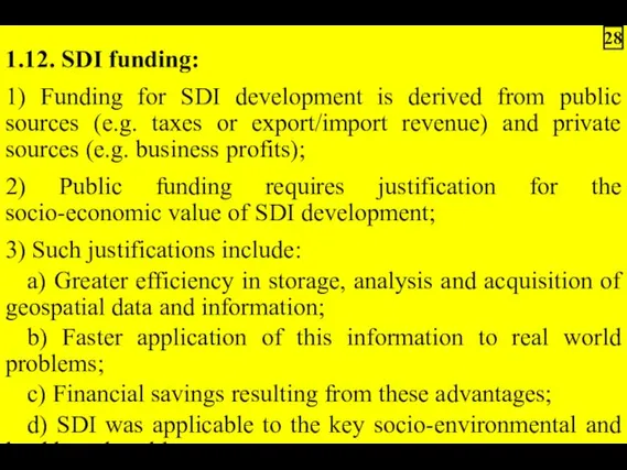
1.12. SDI funding:
1) Funding for SDI development is derived from public
1) Funding for SDI development is derived from public
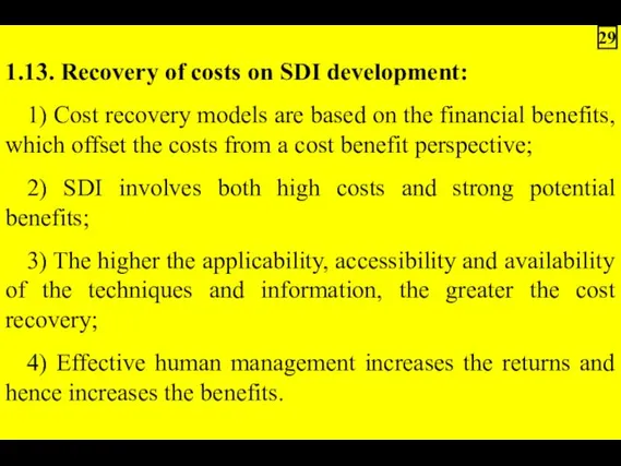
1.13. Recovery of costs on SDI development:
1) Cost recovery models are
1) Cost recovery models are
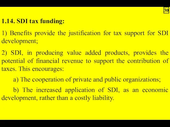
1.14. SDI tax funding:
1) Benefits provide the justification for tax support
1) Benefits provide the justification for tax support
1.15. Examples of SDI economic benefits:
1) Great Britain:
a) £79-136 billion created
1) Great Britain:
a) £79-136 billion created
1.16. Types of SDI legislation assistance:
1) Pre-existing laws covering information access,
1) Pre-existing laws covering information access,
1.17. SDI peculiarities
1. SDI provides the ideal environment to connect applications
1. SDI provides the ideal environment to connect applications
 SDLC and Waterfall
 Безопасность детей в интернете
 Лабораторный практикум
 Элементы математической логики
 Программа 1С программист
 Задачи к главе 1
 Блиц-опрос
 Социальные группы, их классификация
 Использование функций в табличном процессоре MS EXCEL
 Dasturiy ta’minot sifatini taminlash faniga kirish
 Реализация коррекционно-образовательного процесса в учреждении для детей с нарушениями развития с использованием ИКТ
 Инструкция размещения проекта на сайте Simex
 Введение в искусственный интеллект. Тема 1
 Системы счисления. Виды систем счисления
 Проектирование автоматизированной системы управления технологическим процессом осушки газа
 Урок по теме Математическое моделирование с презентацией и использованием ЭОР
 Система электронных дневников и журналов
 История развития компьютерной техники
 HTML+CSS course
 Естественный отбор
 Установка Агента
 Презентация к уроку информатики в 9 классе Сортировка записей в БД
 Кодирование звуковой информации
 Тип переменной и ее адрес. Циклы и ветвления
 Основные элементы текста. Оформление текста
 Моделирование как метод познания. Моделирование и формализация. Информатика. 9 класс
 Файлы и файловые структуры. Компьютер как универсальное устройство для работы с информацией. Информатика. 7 класс
 Докинг. Hadoop