- Introduction of the Navigation and ILS, VOR/DME

Содержание
- 2. Main ideas What is navigation? What is navigation used for? ILS ; VOR/DME
- 3. What is navigation? The process or activity of accurately ascertaining one's position and planning and following
- 4. What is navigation used for? Navigation is the art and science of determining the position of
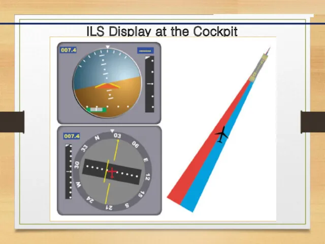
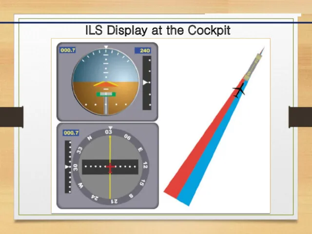
- 5. ILS Display at the Cockpit In aviation, the instrument landing system (ILS) is a radio navigation
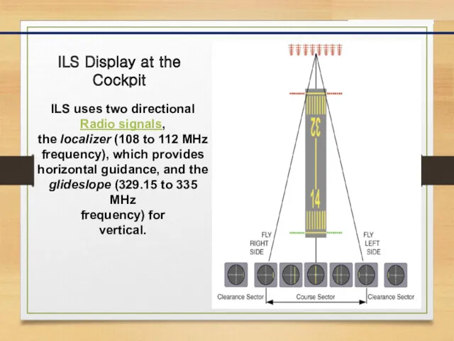
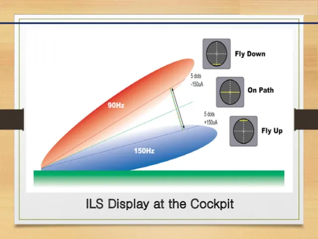
- 6. ILS Display at the Cockpit ILS uses two directional Radio signals, the localizer (108 to 112
- 7. ILS Display at the Cockpit
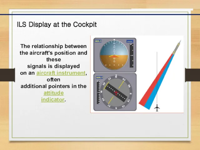
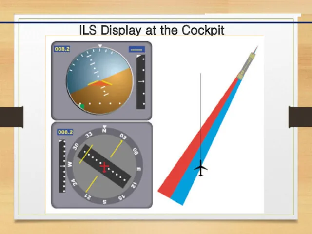
- 8. ILS Display at the Cockpit The relationship between the aircraft's position and these signals is displayed
- 9. ILS Display at the Cockpit
- 10. ILS Display at the Cockpit
- 11. ILS Display at the Cockpit
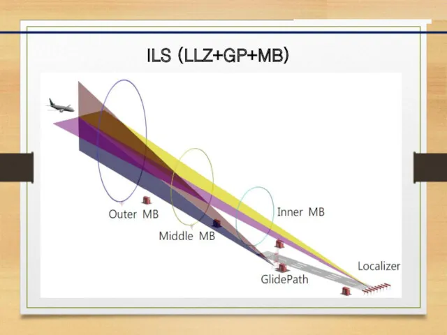
- 12. ILS (LLZ+GP+MB)
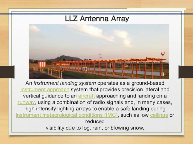
- 13. LLZ Antenna Array An instrument landing system operates as a ground-based instrument approach system that provides
- 14. LLZ Coverage Coverage - 25NM : 46.3 km within 10° from course line - 17NM :
- 15. DVOR/DME In radio navigation, a VOR/DME is a radio beacon that combines a VHF omnidirectional range
- 16. VOR Display at the Cockpit
- 17. DVOR/DME The VOR system was first introduced in the 1930s, but didn't enter significant commercial use
- 18. Phase Difference of each position
- 19. Distance Calculation The Aircraft Interrogator transmits an omnidrectional interrogation. The Interrogation travels At the speed of
- 21. Скачать презентацию
Main ideas
What is navigation?
What is navigation used for?
ILS ; VOR/DME
Main ideas
What is navigation?
What is navigation used for?
ILS ; VOR/DME
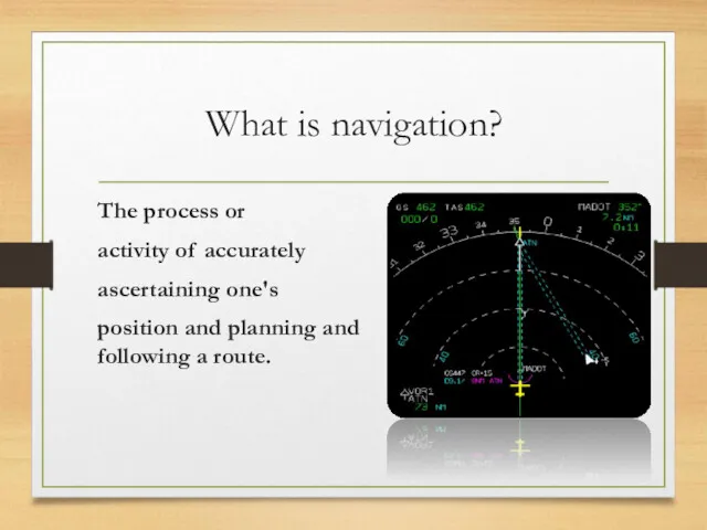
What is navigation?
The process or
activity of accurately
ascertaining one's
position and
What is navigation?
The process or
activity of accurately
ascertaining one's
position and
What is navigation used for?
Navigation is the art and science of
determining
What is navigation used for?
Navigation is the art and science of
determining
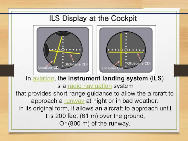
ILS Display at the Cockpit
In aviation, the instrument landing system (ILS)
is a radio navigation system
ILS Display at the Cockpit
In aviation, the instrument landing system (ILS)
is a radio navigation system
ILS Display at the Cockpit
ILS uses two directional
Radio signals,
the localizer (108 to
ILS Display at the Cockpit
ILS uses two directional
Radio signals,
the localizer (108 to
ILS Display at the Cockpit
ILS Display at the Cockpit
ILS Display at the Cockpit
The relationship between the aircraft's position and
ILS Display at the Cockpit
The relationship between the aircraft's position and
ILS Display at the Cockpit
ILS Display at the Cockpit
ILS Display at the Cockpit
ILS Display at the Cockpit
ILS Display at the Cockpit
ILS Display at the Cockpit
ILS (LLZ+GP+MB)
ILS (LLZ+GP+MB)
LLZ Antenna Array
An instrument landing system operates as a ground-based
instrument approach system that provides
LLZ Antenna Array
An instrument landing system operates as a ground-based
instrument approach system that provides
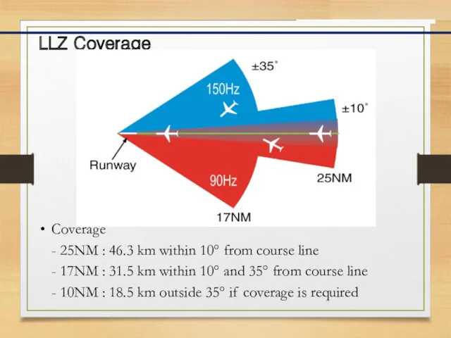
LLZ Coverage
Coverage
- 25NM : 46.3 km within 10° from course line
-
LLZ Coverage
Coverage
- 25NM : 46.3 km within 10° from course line
-
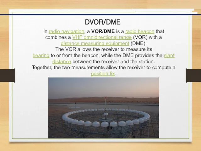
DVOR/DME
In radio navigation, a VOR/DME is a radio beacon that
combines a VHF omnidirectional range (VOR) with
DVOR/DME
In radio navigation, a VOR/DME is a radio beacon that
combines a VHF omnidirectional range (VOR) with
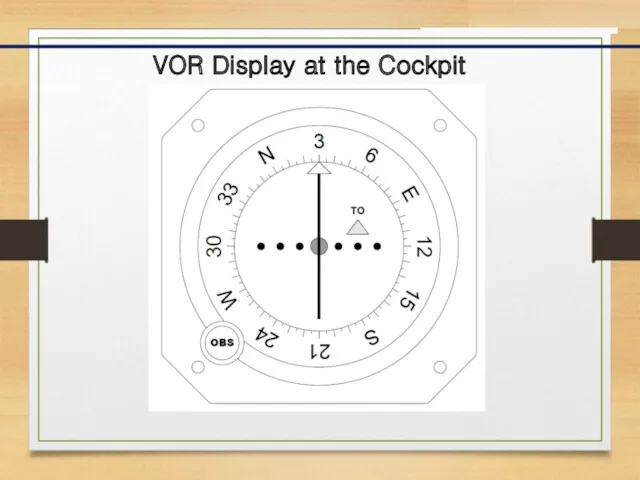
VOR Display at the Cockpit
VOR Display at the Cockpit
DVOR/DME
The VOR system was first introduced in the 1930s,
but didn't
DVOR/DME
The VOR system was first introduced in the 1930s,
but didn't
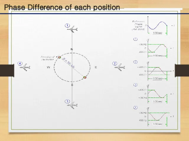
Phase Difference of each position
Phase Difference of each position
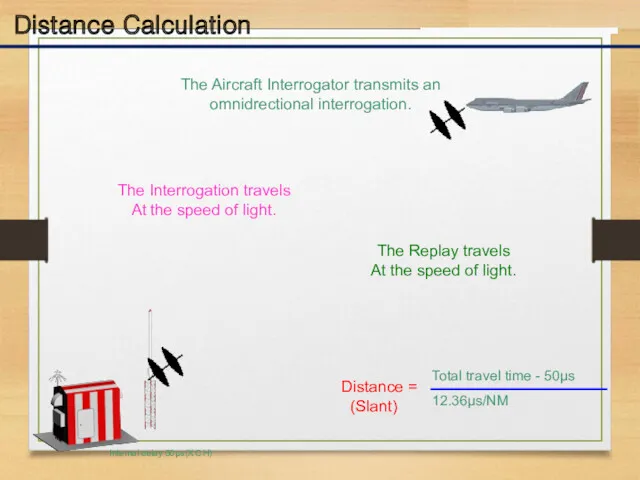
Distance Calculation
The Aircraft Interrogator transmits an omnidrectional interrogation.
The Interrogation travels
At the
Distance Calculation
The Aircraft Interrogator transmits an omnidrectional interrogation.
The Interrogation travels
At the
 Welcome To ZyXEL Router Customer Care Center. How to Install a ZyXEL Router
 Доступы: гостевой и представительский доступ, настройка и управление
 NFT \ Non Fungible Token
 Компьютерные игры как современный вид хобби
 Как найти пользователей ВКонтакте, которые действительно покупают товары?
 Характерные черты информационного общества
 Опасности в Интернете. Перечень опасностей
 Описательная статистика. Группировка данных. Лекция 2
 History of Cologne Digital Lexicons
 Разработка сайта
 Компьютер – универсальная машина для работы с информацией
 Lersus. Основные задачи и возможности
 Организация вычислений в электронных таблицах. Обработка числовой информации в электронных таблицах. Информатика. 9 класс
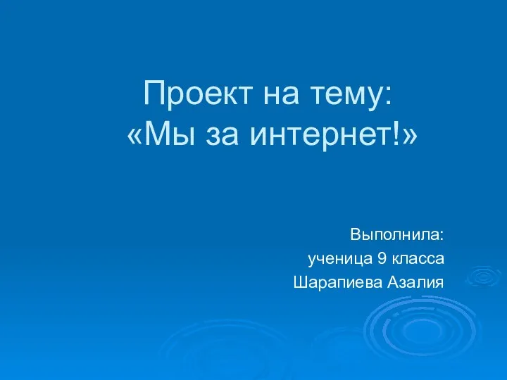 Мы за интернет!
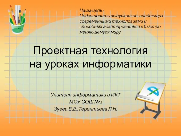 Проектная технология на уроках информатики
 Основные виды опасного и запрещённого контента в Интернете и его признаки, приёмы распознавания опасностей в Интернете
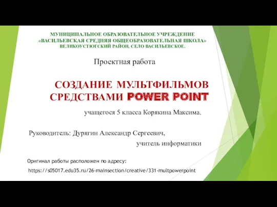 Создание мультфильмов средствами power point
 Язык программирования Pascal. Линейные алгоритмы
 Монтаж видеороликов в Windows Movie Maker
 Бейне жобаны әзірлеу және қорғау
 1С:Управление автотранспортом
 Поколения ЭВМ
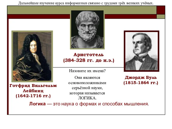 Логика — это наука о формах и способах мышления
 Компонентно-орієнтоване проектування. Основи розробки веб-застосувань за допомогою АSР.NЕТ. Керування станом у ASP.NET
 Использование массивов и табличных формул. Операции с матрицами. Решение систем линейных уравнений. (Лекция 8)
 Современные возможности ES-2015
 Компьютерные технологии. Версия Matlab R2013b
 Моделирование, как метод познания